

Freeride Added To 2030 Olympic Winter Games
The IOC has today announced a swathe of decisions ahead of the Alpes 2030 Winter Olympics and Paralympics in the French Alps.

Next 3 days weather summary:Mostly dry. Warm (max 27°C on Thu afternoon, min 17°C on Tue night). Wind will be generally light. | Days 4-6 weather summary:Mostly dry. Warm (max 26°C on Fri afternoon, min 17°C on Sun night). Wind will be generally light. | |||||||||||||||||
Tuesday 7 | Wednesday 8 | Thursday 9 | Friday 10 | Saturday 11 | Sunday 12 | |||||||||||||
AM | PM | night | AM | PM | night | AM | PM | night | AM | PM | night | AM | PM | night | AM | PM | night | |
clear | clear | clear | clear | clear | clear | clear | clear | clear | clear | clear | clear | clear | clear | some clouds | cloudy | some clouds | some clouds | |
km/h | ||||||||||||||||||
Snow map | 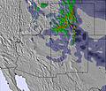 | 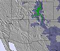 | 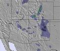 | 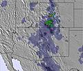 | 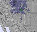 |  | ||||||||||||
— | — | — | — | — | — | — | — | — | — | — | — | — | — | — | — | — | — | |
mm | — | — | — | — | — | — | — | — | — | — | — | — | — | — | — | — | — | — |
max °C | 22 | 24 | 19 | 25 | 26 | 20 | 26 | 27 | 20 | 25 | 26 | 20 | 25 | 25 | 19 | 22 | 22 | 18 |
min °C | 20 | 23 | 17 | 22 | 26 | 19 | 23 | 26 | 18 | 23 | 25 | 18 | 22 | 24 | 18 | 21 | 21 | 17 |
chill °C | 20 | 23 | 17 | 22 | 26 | 19 | 23 | 26 | 18 | 23 | 25 | 18 | 22 | 24 | 18 | 21 | 21 | 17 |
Humid % | 23 | 18 | 17 | 11 | 11 | 10 | 13 | 14 | 10 | 10 | 13 | 15 | 12 | 19 | 24 | 32 | 38 | 36 |
Freeze m | 5050 | 5200 | 5200 | 5250 | 5350 | 5400 | 5350 | 5400 | 5450 | 5350 | 5350 | 5300 | 5250 | 5350 | 5200 | 5150 | 5200 | 5100 |
5:41 | — | — | 5:41 | — | — | 5:43 | — | — | 5:43 | — | — | 5:43 | — | — | 5:43 | — | — | |
— | — | 8:01 | — | — | 8:01 | — | — | 8:01 | — | — | 8:00 | — | — | 8:00 | — | — | 8:00 | |
Go pro and carve into:
Avalanche information: National Avalanche Center
Latest snow reports near Snow Summit:
| Top snow depth: | — |
|---|---|
| Bottom snow depth: | — |
| Fresh snowfall depth: | — |
| Last snowfall: | 25 Apr 2026 |
| Snow Alerts | Create Alert |
0.0 | Bluebird Powder days Fresh snow, mostly sunny, light wind. |
|---|---|
0.0 | Powder days Fresh snow, limited sun, any wind. |
0.0 | Bluebird days Average snow, mostly sunny, light wind. |
The above table gives the weather forecast for Snow Summit at the specific elevation of 2133 m. Our sophisticated weather models allow us to provide snow forecasts for the top, middle and bottom ski stations of Snow Summit. To access the weather forecasts for the other elevations, use the tab navigation above the table. For a wider view of the weather, check out the Weather Map of United States.
Click here to read further information on freezing levels and how we forecast our temperatures.
This is a great ski resort with a lot of things to do. It is 1.5 hr driving distance from LA. The runs are well groomed. It has a nice village and good restaurants. The lift are busy on the lower runs, but not at the top. I highly recommend this resort.
John Ashton from United States writes:
This is a great ski resort with a lot of things to do. It is 1.5 hr driving distance from LA. The runs are well groomed. It has a nice village and good restaurants. The lift are busy on the lower runs, but not at the top. I highly recommend this resort.


 Nearest