Weather Forecast for Ski Plattekill at859m altitude
Issued: 1 am 01 Aug 2026 (local time)
Forecast update in hr min
View forecast
Ski Plattekillat 859 m altitude
Issued by Snow-Forecast.com at:1 am (local time) / 01 Aug 2026
Last 6 daysScroll left for last 6 daysNow
Next 3 days weather summary:
Moderate rain (total 15.0mm), heaviest on Mon morning. Warm (max 23°C on Sat afternoon, min 16°C on Mon night). Winds decreasing (fresh winds from the S on Sun afternoon, light winds from the WNW by Mon afternoon).
Days 4-6 weather summary:
Heavy rain (total 29.0mm), heaviest during Wed afternoon. Warm (max 24°C on Thu afternoon, min 17°C on Tue morning). Wind will be generally light.
The above table gives the weather forecast for Ski Plattekill at the specific elevation of 859 m. Our sophisticated weather models allow us to provide snow forecasts for the top, middle and bottom ski stations of Ski Plattekill. To access the weather forecasts for the other elevations, use the tab navigation above the table. For a wider view of the weather, check out the Weather Map of United States.
Click here to read further information on freezing levels and how we forecast our temperatures.
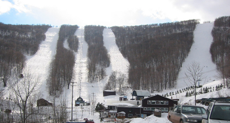
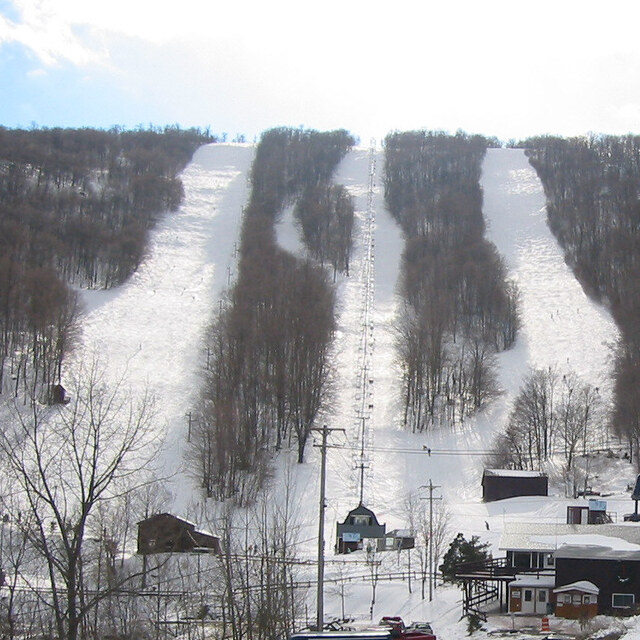
Plattekill (Ski Plattekill) is a family mountain that is all about having fun. It is not fancy, but Plattekill has everything it takes to have a memorable ski experience. The terrain varies from the long, easy Powder Puff, a top to bottom green, to double diamond Blockbuster, a steep, challenging mogul run. The fall line black diamond runs: North Face, Plunge, GS, Freefall and the Face are steep, straight and narrow. While the blues: Ridge, Twist,and The S snake their their way down the bowl shaped mountain. Tree skiing abounds and the locals all have their secret stash. Plattekill gets the most natural snow in the Catskills and due to the smaller crowds and fixed grip lifts, the powder stays for days after a storm. Plattekill may not have status but it sure has soul. If you love to ski you will love to ski Plattekill.
Plattekill (Ski Plattekill) is a family mountain that is all about having fun. It is not fancy, but Plattekill has everything it takes to have a memorable ski experience. The terrain varies from the long, easy Powder Puff, a top to bottom green, to double diamond Blockbuster, a steep, challenging mogul run. The fall line black diamond runs: North Face, Plunge, GS, Freefall and the Face are steep, straight and narrow. While the blues: Ridge, Twist,and The S snake their their way down the bowl shaped mountain. Tree skiing abounds and the locals all have their secret stash. Plattekill gets the most natural snow in the Catskills and due to the smaller crowds and fixed grip lifts, the powder stays for days after a storm. Plattekill may not have status but it sure has soul. If you love to ski you will love to ski Plattekill.
Free Snow-Forecast.com weather widget for your website
Embed the Ski Plattekill weather widget on your site for free. It provides a weekly snapshot of snow and rain conditions across all elevations. Follow the two quick steps to grab your custom code and paste it into your site. Choose between metric or imperial units. Click here to get the code.


 Nearest