


A New Largest Ski Area in New Zealand?
The Remarkables is hoping to overtake Cardrona as New Zealand’s largest ski area under a major NZD 150 million‑plus expansion proposal lodged by owner NZSki.

Next 3 days weather summary:Heavy rain (total 31.0mm), heaviest during Thu night. Very mild (max 16°C on Wed afternoon, min 12°C on Wed night). Wind will be generally light. | Days 4-6 weather summary:Light rain (total 4.0mm), mostly falling on Sun afternoon. Very mild (max 19°C on Tue morning, min 12°C on Sat night). Wind will be generally light. | ||||||||||||||||
Wed 24 | Thursday 25 | Friday 26 | Saturday 27 | Sunday 28 | Monday 29 | ||||||||||||
PM | night | AM | PM | night | AM | PM | night | AM | PM | night | AM | PM | night | AM | PM | night | |
light rain | light rain | light rain | light rain | heavy rain | mod. rain | light rain | light rain | rain shwrs | some clouds | some clouds | cloudy | light rain | rain shwrs | clear | some clouds | clear | |
km/h | |||||||||||||||||
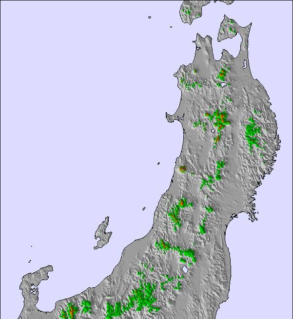
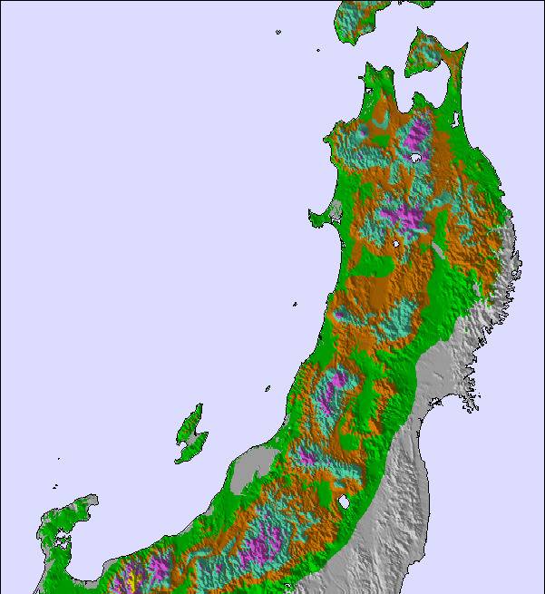
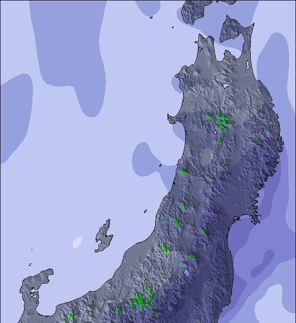
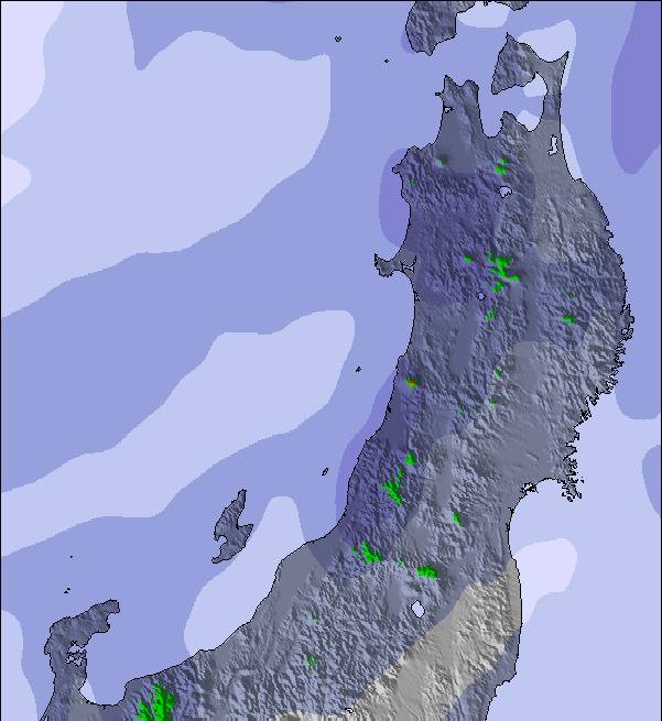
Snow map | 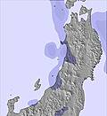 | 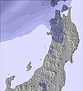 | 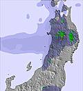 | 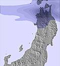 | 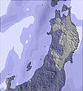 | 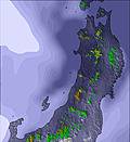 | |||||||||||
— | — | — | — | — | — | — | — | — | — | — | — | — | — | — | — | — | |
mm | 2 | 2 | 2 | 1 | 11 | 9 | 2 | 1 | 1 | — | — | — | 2 | 1 | — | — | — |
max °C | 16 | 13 | 13 | 13 | 13 | 15 | 15 | 14 | 16 | 16 | 14 | 17 | 16 | 14 | 18 | 18 | 14 |
min °C | 14 | 12 | 13 | 12 | 12 | 14 | 15 | 13 | 14 | 15 | 12 | 16 | 14 | 12 | 16 | 16 | 14 |
chill °C | 14 | 11 | 12 | 11 | 11 | 13 | 14 | 13 | 14 | 15 | 12 | 16 | 14 | 12 | 16 | 16 | 14 |
Humid % | 66 | 88 | 95 | 91 | 91 | 91 | 86 | 88 | 94 | 84 | 91 | 73 | 83 | 78 | 52 | 54 | 85 |
Freeze m | 3800 | 3950 | 4200 | 4450 | 4400 | 4650 | 4550 | 4350 | 4700 | 4750 | 5050 | 4650 | 4450 | 4100 | 4150 | 4000 | 4300 |
— | — | 4:28 | — | — | 4:28 | — | — | 4:28 | — | — | 4:28 | — | — | 4:28 | — | — | |
7:07 | — | — | 7:07 | — | — | 7:07 | — | — | 7:07 | — | — | 7:07 | — | — | 7:07 | — | |
Go pro and carve into:
Avalanche information: Japan Avalanche Network
Latest snow reports near Shiga Kogen-Sun Valley:
| Top snow depth: | — |
|---|---|
| Bottom snow depth: | — |
| Fresh snowfall depth: | — |
| Last snowfall: | 9 May 2026 |
| Snow Alerts | Create Alert |
0.0 | Bluebird Powder days Fresh snow, mostly sunny, light wind. |
|---|---|
0.0 | Powder days Fresh snow, limited sun, any wind. |
0.0 | Bluebird days Average snow, mostly sunny, light wind. |
The above table gives the weather forecast for Shiga Kogen-Sun Valley at the specific elevation of 1475 m. Our sophisticated weather models allow us to provide snow forecasts for the top, middle and bottom ski stations of Shiga Kogen-Sun Valley. To access the weather forecasts for the other elevations, use the tab navigation above the table. For a wider view of the weather, check out the Weather Map of Japan.
Click here to read further information on freezing levels and how we forecast our temperatures.
Resort name is also written as Shiga Kogen Sun Valley.
Also stayed at Villa Alpen at Sun Valley (Shiga Kogen Sun Valley) in 2010 and going back in 2011. I can add a few things:- Distance to ticket office :- 20m Distance to lift 30m Excellent food at Villa Alpen. Captain and his family will ensure you have a great stay. Onsen in lodge great for relaxing in. You can either ski your way over to the other resorts or, if you're in a rush, you can take the free bus up to the other ski-areas.
Chris Ivin from Australia writes:
Also stayed at Villa Alpen at Sun Valley (Shiga Kogen Sun Valley) in 2010 and going back in 2011. I can add a few things:-
Distance to ticket office :- 20m
Distance to lift 30m
Excellent food at Villa Alpen. Captain and his family will ensure you have a great stay.
Onsen in lodge great for relaxing in.
You can either ski your way over to the other resorts or, if you're in a rush, you can take the free bus up to the other ski-areas.
Read 1 more reviews of Shiga Kogen-Sun Valley or submit your own

 Nearest