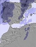
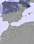
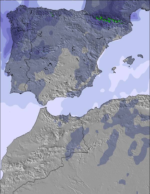
The above table gives the weather forecast for Serra da Estrela at the specific elevation of 1916 m. Our sophisticated weather models allow us to provide snow forecasts for the top, middle and bottom ski stations of Serra da Estrela. To access the weather forecasts for the other elevations, use the tab navigation above the table. For a wider view of the weather, check out the Weather Map of Portugal.
Click here to read further information on freezing levels and how we forecast our temperatures.
(Classificação geral de 1 a 5: Nº Pistas=3;Quantidade de neve=4;Qualidade da neve=1;Material=2;Staff=1;OffPiste=3;SnowPark=2;Estacionamento de carros=2.)
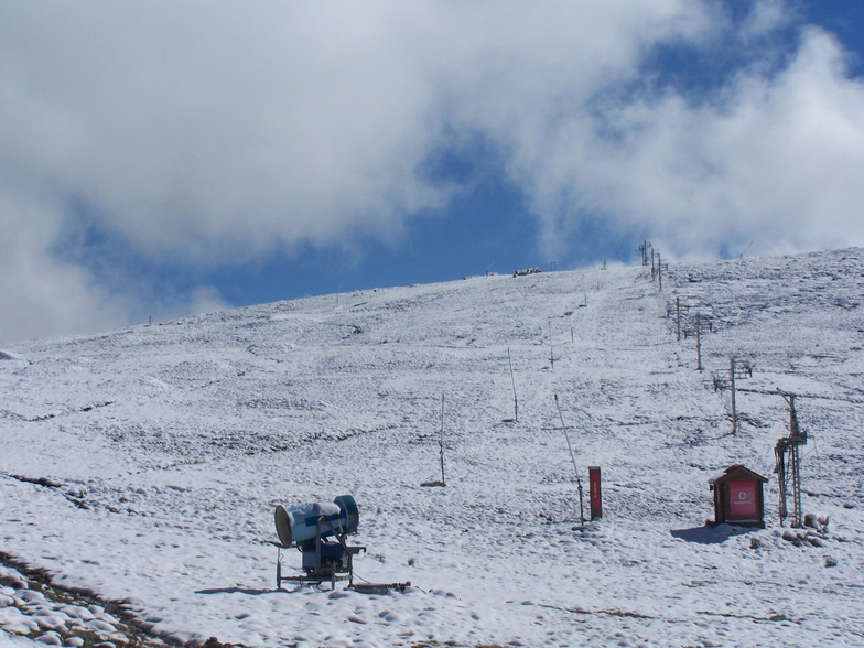
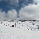
Estive no Sábado na estância da Serra da Estrela no que foi considerado o melhor nevão dos 6 anos. Realmente havia bastante neve com alturas superiores a 1 metro em alguns sítios da estância e Torre (3 a 4 metros). A qualidade da neve estava muito má por duas razões:
- 1ª por razões naturais devido ao calor elevado que se fez sentir nos 3 dias anteriores , chuviscos e extrema humidade deixando a neve em papa.
- 2ª Não houve manutenção da neve e alisamento das pistas do dia anterior e manteve-se assim pelo fim de semana fora, abrindo na segunda-feira nas mesmas condições. A neve além de papa, estava toda com buracos e severamente irregular!
Portanto, além de ser difícil deslizar, tinhas solavancos e buracos, terrível para quando em alguns sítios têm pouquíssima ou nenhuma inclinação, que não permite em snowboard descer a montanha sem parar e andar a pé!
As pistas além de estar mal sinalizadas e serem confusas, não estavam balizadas!
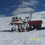
As telecadeiras estão bastante velhas, mas funcionam! Nós portugueses queremos é aproveitar a neve que temos nem ligamos a estas coisas desde que esteja a andar e a funcionar!
Quanto à organização e staff, claramente não estavam preparados para tanta afluência de gente, filas gigantes de 2-3 horas para mostrar um QR code de forfait comprado online (recebendo uma pulseira) e adquirir material mau, velho e limitado! Para quem tinha o seu próprio material, comprar online o Forfait não significa que passará à frente da fila, teria que estar à mesma na fila nem podendo sair/entrar e ir ao WC (uma vergonha quando tem crianças, mulheres, inclusive grávidas). Além disso, ouvi por testemunho que clientes compraram aulas e as viram desmarcadas ou marcadas por outras pessoas que não eram as escolhidas para o assunto.
Contudo, consegui passar um bom tempo, e que com todas as pessoas que falei, todos concordávamos que a estância estava péssima pelas razões acima referidas, infelizmente não acreditando que possa melhorar, pois devido à escassez de neve geral, possivelmente não permite melhor investimento por parte da gestão! Deixando pouco margem para melhorar e estar ao nível internacional ou da vizinha Espanha!
(Classificação geral de 1 a 5: Nº Pistas=3;Quantidade de neve=4;Qualidade da neve=1;Material=2;Staff=1;OffPiste=3;SnowPark=2;Estacionamento de carros=2.)
Estive no Sábado na estância da Serra da Estrela no que foi considerado o melhor nevão dos 6 anos. Realmente havia bastante neve com alturas superiores a 1 metro em alguns sítios da estância e Torre (3 a 4 metros). A qualidade da neve estava muito má por duas razões:
- 1ª por razões naturais devido ao calor elevado que se fez sentir nos 3 dias anteriores , chuviscos e extrema humidade deixando a neve em papa.
- 2ª Não houve manutenção da neve e alisamento das pistas do dia anterior e manteve-se assim pelo fim de semana fora, abrindo na segunda-feira nas mesmas condições. A neve além de papa, estava toda com buracos e severamente irregular!
Portanto, além de ser difícil deslizar, tinhas solavancos e buracos, terrível para quando em alguns sítios têm pouquíssima ou nenhuma inclinação, que não permite em snowboard descer a montanha sem parar e andar a pé!
As pistas além de estar mal sinalizadas e serem confusas, não estavam balizadas!
As telecadeiras estão bastante velhas, mas funcionam! Nós portugueses queremos é aproveitar a neve que temos nem ligamos a estas coisas desde que esteja a andar e a funcionar!
Quanto à organização e staff, claramente não estavam preparados para tanta afluência de gente, filas gigantes de 2-3 horas para mostrar um QR code de forfait comprado online (recebendo uma pulseira) e adquirir material mau, velho e limitado! Para quem tinha o seu próprio material, comprar online o Forfait não significa que passará à frente da fila, teria que estar à mesma na fila nem podendo sair/entrar e ir ao WC (uma vergonha quando tem crianças, mulheres, inclusive grávidas). Além disso, ouvi por testemunho que clientes compraram aulas e as viram desmarcadas ou marcadas por outras pessoas que não eram as escolhidas para o assunto.
Contudo, consegui passar um bom tempo, e que com todas as pessoas que falei, todos concordávamos que a estância estava péssima pelas razões acima referidas, infelizmente não acreditando que possa melhorar, pois devido à escassez de neve geral, possivelmente não permite melhor investimento por parte da gestão! Deixando pouco margem para melhorar e estar ao nível internacional ou da vizinha Espanha!
Free Snow-Forecast.com weather widget for your website
Embed the Serra da Estrela weather widget on your site for free. It provides a weekly snapshot of snow and rain conditions across all elevations. Follow the two quick steps to grab your custom code and paste it into your site. Choose between metric or imperial units. Click here to get the code.


 Nearest