

Portillo Storm Snowfall Total Passes 5m / 17 Feet
A snow storm that has now continued for nine days has taken Chilean ski resort Portillo to a snowfall total of 5.2 metres (17 feet) so far, with more snow forecast.

Next 3 days weather summary:Light rain (total 6.0mm), mostly falling on Sun afternoon. Very mild (max 19°C on Tue afternoon, min 9°C on Sun afternoon). Wind will be generally light. | Days 4-6 weather summary:Mostly dry. Warm (max 25°C on Fri afternoon, min 18°C on Wed night). Wind will be generally light. | ||||||||||||||||
Sun 26 | Monday 27 | Tuesday 28 | Wednesday 29 | Thursday 30 | Friday 31 | ||||||||||||
PM | night | AM | PM | night | AM | PM | night | AM | PM | night | AM | PM | night | AM | PM | night | |
rain shwrs | rain shwrs | clear | clear | clear | clear | clear | t-storm risk | clear | clear | clear | clear | clear | clear | clear | clear | some clouds | |
km/h | |||||||||||||||||
Snow map |  |  |  |  |  |  | |||||||||||
— | — | — | — | — | — | — | — | — | — | — | — | — | — | — | — | — | |
mm | 4 | 1 | — | — | — | — | — | 1 | — | — | — | — | — | — | — | — | — |
max °C | 10 | 10 | 12 | 15 | 15 | 16 | 19 | 17 | 18 | 21 | 20 | 21 | 23 | 22 | 22 | 25 | 22 |
min °C | 9 | 9 | 10 | 14 | 13 | 14 | 18 | 15 | 15 | 19 | 18 | 18 | 22 | 19 | 19 | 24 | 18 |
chill °C | 8 | 8 | 10 | 14 | 13 | 14 | 18 | 15 | 15 | 19 | 18 | 18 | 22 | 19 | 19 | 24 | 18 |
Humid % | 82 | 79 | 56 | 46 | 56 | 51 | 58 | 73 | 48 | 39 | 38 | 31 | 29 | 45 | 30 | 23 | 45 |
Freeze m | 3600 | 3600 | 4450 | 4700 | 4850 | 4650 | 4700 | 4500 | 4500 | 4700 | 4750 | 4700 | 4850 | 4750 | 4850 | 5000 | 4800 |
— | — | 6:11 | — | — | 6:13 | — | — | 6:13 | — | — | 6:15 | — | — | 6:16 | — | — | |
— | 9:09 | — | — | 9:08 | — | — | 9:07 | — | — | 9:06 | — | — | 9:05 | — | — | 9:04 | |
Go pro and carve into:
Avalanche information: European Avalanche Warning Services (EAWS)
Latest snow reports near Saint François Longchamp:
| Top snow depth: | — |
|---|---|
| Bottom snow depth: | — |
| Fresh snowfall depth: | — |
| Last snowfall: | 18 May 2026 |
| Snow Alerts | Create Alert |
0.0 | Bluebird Powder days Fresh snow, mostly sunny, light wind. |
|---|---|
0.0 | Powder days Fresh snow, limited sun, any wind. |
0.0 | Bluebird days Average snow, mostly sunny, light wind. |
The above table gives the weather forecast for Saint François Longchamp at the specific elevation of 2100 m. Our sophisticated weather models allow us to provide snow forecasts for the top, middle and bottom ski stations of Saint François Longchamp. To access the weather forecasts for the other elevations, use the tab navigation above the table. For a wider view of the weather, check out the Weather Map of France.
Click here to read further information on freezing levels and how we forecast our temperatures.
Resort name is also written as Saint Francois Longchamp.
Overall 4.4 Based on 7 votes and 5 reviews
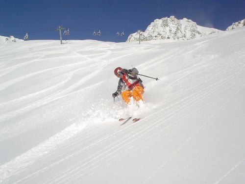
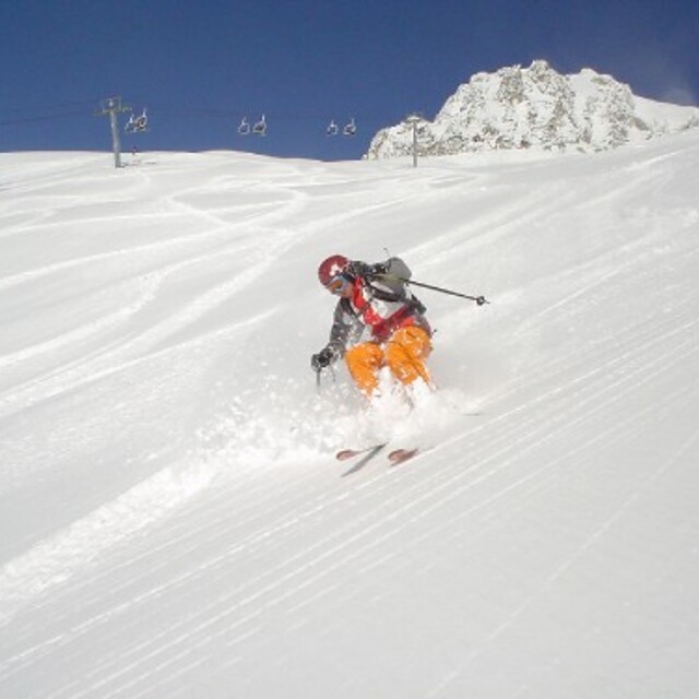
Very lovely little ski resort. Accommodation right on the slopes so ski in/ski out possible. Good upgrades to lift system help to speed skiers to the best snow, usually in better condition than Valmorel which is busier and more expensive than here. Still has button drag lifts; very useful when it is very windy. Great pisted runs for all levels of skier, unusually powder does not get skied out on the very first day after snow. The snow conditions this January were superb, mogul fields absent largely (a pity!). Will visit again soon. The people were extremely welcoming.
Cjris Trace from United Kingdom writes:
Very lovely little ski resort. Accommodation right on the slopes so ski in/ski out possible. Good upgrades to lift system help to speed skiers to the best snow, usually in better condition than Valmorel which is busier and more expensive than here. Still has button drag lifts; very useful when it is very windy. Great pisted runs for all levels of skier, unusually powder does not get skied out on the very first day after snow. The snow conditions this January were superb, mogul fields absent largely (a pity!). Will visit again soon. The people were extremely welcoming.
Read 4 more reviews of Saint François Longchamp or submit your own


 Nearest