

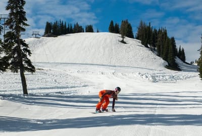
North America Weekly Snow Roundup #317
Weekly Snow News for North America, updated 4 June 2026: Mammoth extends operations, Copper reopens summer terrain and fresh snowfall boosts late-season conditions.

Next 3 days weather summary:Mostly dry. Very mild (max 17°C on Sun afternoon, min 6°C on Fri morning). Wind will be generally light. | Days 4-6 weather summary:Light rain (total 7.0mm), mostly falling on Mon night. Very mild (max 18°C on Mon afternoon, min 9°C on Tue night). Wind will be generally light. | |||||||||||||||||
Friday 5 | Saturday 6 | Sunday 7 | Monday 8 | Tuesday 9 | Wednesday 10 | |||||||||||||
AM | PM | night | AM | PM | night | AM | PM | night | AM | PM | night | AM | PM | night | AM | PM | night | |
clear | some clouds | some clouds | clear | clear | clear | clear | some clouds | clear | clear | rain shwrs | rain shwrs | risk thun- der | rain shwrs | cloudy | some clouds | some clouds | some clouds | |
km/h | ||||||||||||||||||
Snow map |  |  |  |  |  |  | ||||||||||||
— | — | — | — | — | — | — | — | — | — | — | — | — | — | — | — | — | — | |
— | — | — | — | — | — | — | — | — | — | 1 | 4 | 1 | 1 | — | — | — | — | |
max °C | 9 | 13 | 12 | 12 | 16 | 15 | 15 | 17 | 16 | 16 | 18 | 16 | 14 | 16 | 13 | 11 | 15 | 13 |
min °C | 6 | 12 | 9 | 9 | 14 | 12 | 12 | 16 | 13 | 14 | 17 | 12 | 12 | 16 | 9 | 9 | 14 | 9 |
5 | 12 | 9 | 9 | 14 | 12 | 12 | 16 | 13 | 14 | 17 | 12 | 12 | 16 | 8 | 8 | 14 | 9 | |
59 | 48 | 74 | 50 | 43 | 58 | 47 | 40 | 57 | 44 | 57 | 77 | 72 | 54 | 62 | 57 | 44 | 66 | |
3250 | 3250 | 3400 | 3300 | 3400 | 3650 | 3650 | 3600 | 3750 | 3700 | 3700 | 3800 | 3650 | 3700 | 3700 | 3550 | 3550 | 3450 | |
5:50 | — | — | 5:50 | — | — | 5:50 | — | — | 5:50 | — | — | 5:50 | — | — | 5:48 | — | — | |
— | — | 9:15 | — | — | 9:15 | — | — | 9:16 | — | — | 9:17 | — | — | 9:17 | — | — | 9:19 | |
Avalanche information: European Avalanche Warning Services (EAWS)
Latest snow reports near Saint Léger Les Mélèzes:
| Top snow depth: | — |
|---|---|
| Bottom snow depth: | — |
| Fresh snowfall depth: | — |
| Last snowfall: | 15 May 2026 |
| Snow Alerts | Create Alert |
0.0 | Bluebird Powder days Fresh snow, mostly sunny, light wind. |
|---|---|
0.0 | Powder days Fresh snow, limited sun, any wind. |
0.0 | Bluebird days Average snow, mostly sunny, light wind. |
The above table gives the weather forecast for Saint Léger Les Mélèzes at the specific elevation of 1626 m. Our sophisticated weather models allow us to provide snow forecasts for the top, middle and bottom ski stations of Saint Léger Les Mélèzes. To access the weather forecasts for the other elevations, use the tab navigation above the table. For a wider view of the weather, check out the Weather Map of France.
Click here to read further information on freezing levels and how we forecast our temperatures.
Resort name is also written as Saint Leger Les Melezes.


 Nearest