Skied first time there for 3 days end of December 2024.
Positives: seems to be snowsure mid-mountain and upper, unreal/fun terrain and tree runs (Ripper chair all day), base village is very close to Town (8 min drive to downtown), quiet runs (rarely saw a soul off Ripper in the trees), warm temps usually
Neutrals: intermediate-advanced only (if you want to have any fun), sidecountry has great runs but can get cliffed out, gondola line bottleneck can be a wait on a good snow day if you're there late.
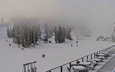
Negatives: perennial fog and poorly marked mountain means getting lost often. Skied around 10 resorts in CA and EU and never seen fog so bad. Locals commented the good runs were 'gatekept' and it felt like that.
Would recommend this hill to someone who books trips in advance. Great chance of having good conditions, but would tell first-timers to get a lesson or guide to show them around.
I felt like I missed out on a lot as the runs are poorly marked (then you add on fog), and a lot of the "good" spots are tough to traverse to and back. Especially because everything around mid-mountain and lower had bad conditions, so you don't prefer to end up down there. That, with the short lift hours, makes for a short day if you're bumbling around looking for the right run.
I'm a level 6 advanced skier of 20 yrs, but this is a steep drop and it messes with your mind. It was super fun, but I was skiing cautious b/c I didn't ever know where I was, and locals warned me you can get cliffed out in a few areas.
Whole town and resort feels like a fun local hill where their infrastructure hasn't kept up with the demand a little.
All that being said, I can't wait to get back and find my bearings, I did the same chair (Ripper) for 3 days and had a blast and would do it again, though looking forward to exploring more of the hill.





 Snow
 Hourly & 16-day forecasts



 Sign up or Login to access
 Upload new photo

 Nearest