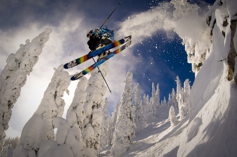


Portillo Storm Snowfall Total Passes 5m / 17 Feet
A snow storm that has now continued for nine days has taken Chilean ski resort Portillo to a snowfall total of 5.2 metres (17 feet) so far, with more snow forecast.

Next 3 days weather summary:Mostly dry. Warm (max 22°C on Thu afternoon, min 11°C on Wed morning). Winds decreasing (fresh winds from the SSW on Tue afternoon, calm by Wed night). | Days 4-6 weather summary:Mostly dry. Warm (max 23°C on Fri afternoon, min 7°C on Sun morning). Winds decreasing (near gales from the SW on Sat afternoon, calm by Mon morning). | ||||||||||||||||
Tue 28 | Wednesday 29 | Thursday 30 | Friday 31 | Saturday 1 | Sunday 2 | ||||||||||||
PM | night | AM | PM | night | AM | PM | night | AM | PM | night | AM | PM | night | AM | PM | night | |
clear | clear | clear | clear | clear | clear | clear | clear | clear | clear | clear | clear | clear | clear | clear | some clouds | clear | |
km/h | |||||||||||||||||
Snow map | 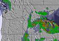 |  |  | 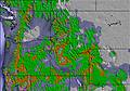 |  |  | |||||||||||
— | — | — | — | — | — | — | — | — | — | — | — | — | — | — | — | — | |
mm | — | — | — | — | — | — | — | — | — | — | — | — | — | — | — | — | — |
max °C | 20 | 20 | 14 | 20 | 20 | 18 | 22 | 22 | 18 | 23 | 23 | 19 | 21 | 13 | 10 | 15 | 12 |
min °C | 19 | 13 | 11 | 18 | 16 | 15 | 21 | 18 | 17 | 22 | 19 | 18 | 19 | 8 | 7 | 14 | 8 |
chill °C | 18 | 12 | 10 | 18 | 16 | 15 | 21 | 18 | 17 | 22 | 19 | 18 | 18 | 7 | 6 | 13 | 6 |
Humid % | 30 | 37 | 34 | 22 | 24 | 26 | 17 | 23 | 26 | 19 | 22 | 29 | 25 | 41 | 42 | 29 | 53 |
Freeze m | 4050 | 3950 | 3850 | 4000 | 4100 | 4100 | 4300 | 4400 | 4500 | 4500 | 4650 | 4250 | 4000 | 3050 | 2800 | 3150 | 3000 |
— | — | 5:18 | — | — | 5:20 | — | — | 5:22 | — | — | 5:22 | — | — | 5:24 | — | — | |
— | 8:36 | — | — | 8:35 | — | — | 8:32 | — | — | 8:31 | — | — | 8:30 | — | — | 8:29 | |
Go pro and carve into:
Avalanche information: Avalanche Canada
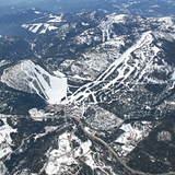
Latest snow reports near Red Mountain Resort:
| Top snow depth: | 0 cm |
|---|---|
| Bottom snow depth: | 0 cm |
| Fresh snowfall depth: | — |
| Last snowfall: | 6 Jun 2026 |
| Snow Alerts | Create Alert |
0.0 | Bluebird Powder days Fresh snow, mostly sunny, light wind. |
|---|---|
0.0 | Powder days Fresh snow, limited sun, any wind. |
0.0 | Bluebird days Average snow, mostly sunny, light wind. |

The above table gives the weather forecast for Red Mountain Resort at the specific elevation of 1628 m. Our sophisticated weather models allow us to provide snow forecasts for the top, middle and bottom ski stations of Red Mountain Resort. To access the weather forecasts for the other elevations, use the tab navigation above the table. For a wider view of the weather, check out the Weather Map of Canada.
Click here to read further information on freezing levels and how we forecast our temperatures.
Overall 3.6 Based on 115 votes and 39 reviews
What a joke ... overpromise and under deliver. Used to be an amazing mountain but new management and changes directing energy and resources toward slope side real estate development with total neglect of operational efficiency for the mountain itself. Had friends travel from Oregon for a surprise visit expecting the great conditions promoted on the website ... off-piste not recommended by locals as the underbrush has not been maintained for ages, sketchy grooming with much less terrain taken care of than even two years ago, and an overly optimistic presentation of the true depth of the base. 97% of runs open ... more like 10%. Very disappointed and with the 20% increase in daily lift ticket prices from a year ago the place has become a total rip-off!
SteveP from Canada writes:
What a joke ... overpromise and under deliver. Used to be an amazing mountain but new management and changes directing energy and resources toward slope side real estate development with total neglect of operational efficiency for the mountain itself. Had friends travel from Oregon for a surprise visit expecting the great conditions promoted on the website ... off-piste not recommended by locals as the underbrush has not been maintained for ages, sketchy grooming with much less terrain taken care of than even two years ago, and an overly optimistic presentation of the true depth of the base. 97% of runs open ... more like 10%. Very disappointed and with the 20% increase in daily lift ticket prices from a year ago the place has become a total rip-off!
Read 38 more reviews of Red Mountain Resort or submit your own


 Nearest