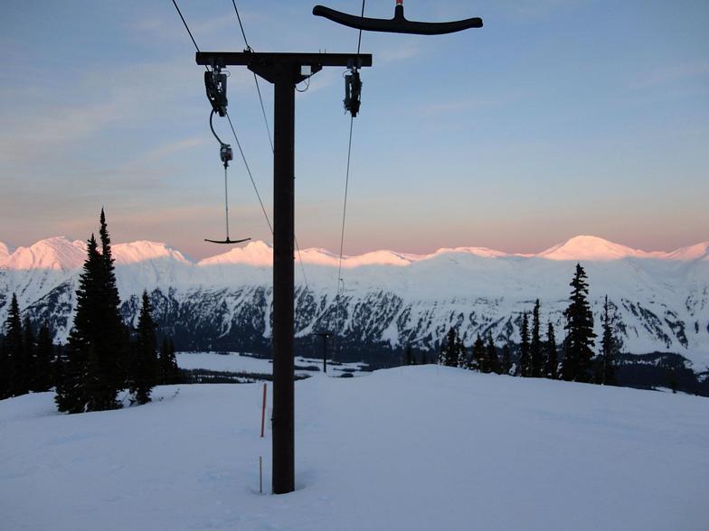


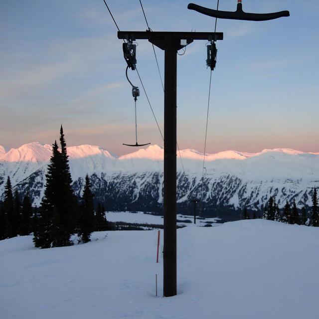
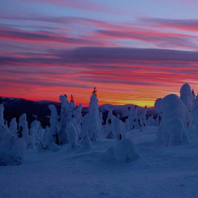
Portillo Storm Snowfall Total Passes 5m / 17 Feet
A snow storm that has now continued for nine days has taken Chilean ski resort Portillo to a snowfall total of 5.2 metres (17 feet) so far, with more snow forecast.

Next 3 days weather summary:Light rain (total 9.0mm), mostly falling on Tue afternoon. Very mild (max 16°C on Thu afternoon, min 6°C on Tue night). Wind will be generally light. | Days 4-6 weather summary:Heavy rain (total 75.0mm), heaviest during Sat afternoon. Very mild (max 18°C on Fri afternoon, min 6°C on Sat night). Wind will be generally light. | |||||||||||||||||
Tuesday 28 | Wednesday 29 | Thursday 30 | Friday 31 | Saturday 1 | Sunday 2 | |||||||||||||
AM | PM | night | AM | PM | night | AM | PM | night | AM | PM | night | AM | PM | night | AM | PM | night | |
t-storm risk | light rain | rain shwrs | some clouds | some clouds | cloudy | cloudy | cloudy | cloudy | some clouds | cloudy | mod. rain | heavy rain | heavy rain | heavy rain | mod. rain | light rain | cloudy | |
km/h | ||||||||||||||||||
Snow map | 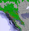 | 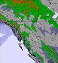 | 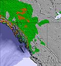 | 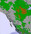 | 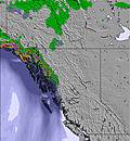 | 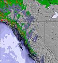 | ||||||||||||
— | — | — | — | — | — | — | — | — | — | — | — | — | — | — | — | — | — | |
mm | 2 | 5 | 2 | — | — | — | — | — | — | — | — | 7 | 11 | 21 | 27 | 8 | 1 | — |
max °C | 12 | 11 | 10 | 9 | 14 | 14 | 14 | 16 | 15 | 15 | 18 | 17 | 11 | 10 | 10 | 6 | 7 | 8 |
min °C | 10 | 10 | 6 | 6 | 13 | 12 | 12 | 16 | 12 | 12 | 17 | 12 | 10 | 10 | 6 | 6 | 7 | 7 |
chill °C | 10 | 9 | 3 | 3 | 11 | 12 | 12 | 16 | 12 | 12 | 16 | 12 | 9 | 8 | 4 | 4 | 6 | 4 |
Humid % | 74 | 86 | 81 | 68 | 41 | 44 | 49 | 47 | 63 | 52 | 47 | 89 | 98 | 88 | 95 | 98 | 98 | 98 |
Freeze m | 2900 | 2700 | 2600 | 2650 | 2800 | 2950 | 2950 | 3050 | 3300 | 3150 | 3300 | 3350 | 3050 | 2800 | 2650 | 2350 | 2750 | 3100 |
5:09 | — | — | 5:11 | — | — | 5:13 | — | — | 5:15 | — | — | 5:16 | — | — | 5:18 | — | — | |
— | — | 9:22 | — | — | 9:20 | — | — | 9:17 | — | — | 9:15 | — | — | 9:14 | — | — | 9:12 | |
Go pro and carve into:
Avalanche information: Avalanche Canada
Latest snow reports near Powder King:
| Top snow depth: | — |
|---|---|
| Bottom snow depth: | — |
| Fresh snowfall depth: | — |
| Last snowfall: | 22 Apr 2026 |
| Snow Alerts | Create Alert |
0.0 | Bluebird Powder days Fresh snow, mostly sunny, light wind. |
|---|---|
0.0 | Powder days Fresh snow, limited sun, any wind. |
0.0 | Bluebird days Average snow, mostly sunny, light wind. |
The above table gives the weather forecast for Powder King at the specific elevation of 1255 m. Our sophisticated weather models allow us to provide snow forecasts for the top, middle and bottom ski stations of Powder King. To access the weather forecasts for the other elevations, use the tab navigation above the table. For a wider view of the weather, check out the Weather Map of Canada.
Click here to read further information on freezing levels and how we forecast our temperatures.
Overall 2.8 Based on 34 votes and 13 reviews
Great snow. No lineups. Amazing trees. Plenty of slack-country. Don’t tell anyone.
Karen from Canada writes:
Great snow. No lineups. Amazing trees. Plenty of slack-country. Don’t tell anyone.


 Nearest