

Global Weekly Snow Roundup #320
Weekly Snow News for the world, updated 25 June 2026: Chile and New Zealand's seasons proper set to begin, Tignes and Sunshine reopen for summer skiing. weekend as Riksgransen ends its 2026 season.

Next 3 days weather summary:Light rain (total 4.0mm), mostly falling on Sat afternoon. Freeze-thaw conditions (max 16°C on Fri afternoon, min -1°C on Sun morning). Mainly severe gales. | Days 4-6 weather summary:Some drizzle, heaviest during Tue afternoon. Freeze-thaw conditions (max 13°C on Wed afternoon, min 0°C on Mon morning). Winds increasing (calm on Mon night, strong winds from the SW by Wed afternoon). | |||||||||||||||||
Friday 26 | Saturday 27 | Sunday 28 | Monday 29 | Tuesday 30 | Wednesday 1 | |||||||||||||
AM | PM | night | AM | PM | night | AM | PM | night | AM | PM | night | AM | PM | night | AM | PM | night | |
clear | clear | some clouds | rain shwrs | t-storm risk | rain shwrs | snow shwrs | clear | snow shwrs | clear | clear | some clouds | clear | rain shwrs | clear | some clouds | some clouds | some clouds | |
km/h | ||||||||||||||||||
Snow map | 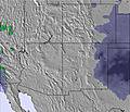 | 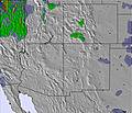 | 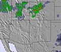 | 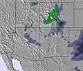 | 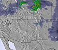 |  | ||||||||||||
— | — | — | — | — | — | — | — | — | — | — | — | — | — | — | — | — | — | |
mm | — | — | — | 1 | 2 | 1 | — | — | — | — | — | — | — | 1 | — | — | — | — |
max °C | 14 | 16 | 9 | 8 | 8 | 5 | 1 | 3 | 1 | 5 | 10 | 10 | 9 | 8 | 9 | 11 | 13 | 13 |
min °C | 13 | 16 | 6 | 6 | 7 | 1 | -1 | 2 | -1 | 0 | 8 | 9 | 8 | 8 | 8 | 9 | 12 | 9 |
chill °C | 10 | 13 | 5 | 3 | 2 | -3 | -4 | -3 | -6 | -4 | 5 | 7 | 5 | 4 | 5 | 7 | 9 | 5 |
Humid % | 23 | 9 | 51 | 67 | 59 | 58 | 98 | 47 | 65 | 62 | 25 | 21 | 26 | 33 | 35 | 33 | 21 | 22 |
Freeze m | 4800 | 4950 | 4200 | 3850 | 4000 | 3800 | 2950 | 3450 | 2950 | 3000 | 4150 | 4350 | 4100 | 3950 | 4250 | 4150 | 4500 | 4550 |
5:56 | — | — | 5:56 | — | — | 5:56 | — | — | 5:56 | — | — | 5:58 | — | — | 5:58 | — | — | |
— | — | 9:00 | — | — | 9:00 | — | — | 9:00 | — | — | 9:00 | — | — | 9:00 | — | — | 9:00 | |
Go pro and carve into:
Avalanche information: National Avalanche Center
Latest snow reports near Park City:
| Top snow depth: | 0 cm |
|---|---|
| Bottom snow depth: | 0 cm |
| Fresh snowfall depth: | — |
| Last snowfall: | 30 May 2026 |
| Snow Alerts | Create Alert |
0.0 | Bluebird Powder days Fresh snow, mostly sunny, light wind. |
|---|---|
0.1 | Powder days Fresh snow, limited sun, any wind. |
0.0 | Bluebird days Average snow, mostly sunny, light wind. |
The above table gives the weather forecast for Park City at the specific elevation of 3047 m. Our sophisticated weather models allow us to provide snow forecasts for the top, middle and bottom ski stations of Park City. To access the weather forecasts for the other elevations, use the tab navigation above the table. For a wider view of the weather, check out the Weather Map of United States.
Click here to read further information on freezing levels and how we forecast our temperatures.
Overall 4.5 Based on 17 votes and 5 reviews
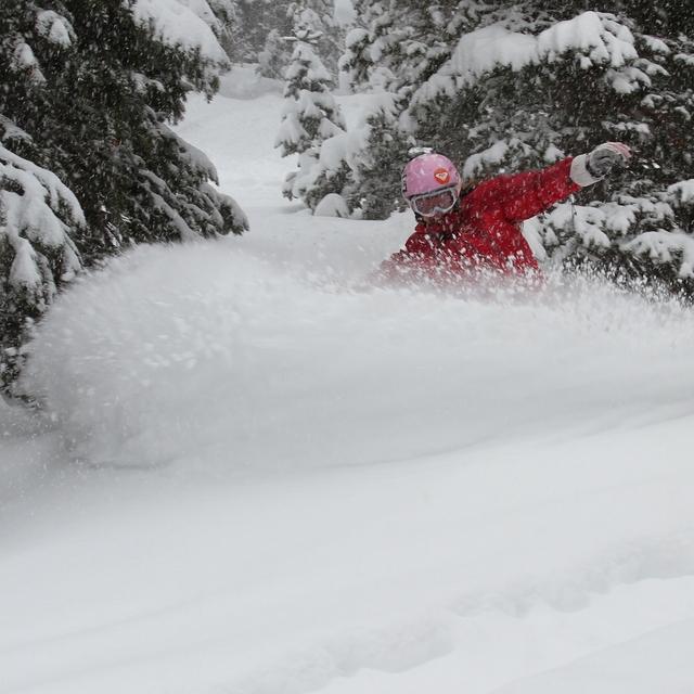
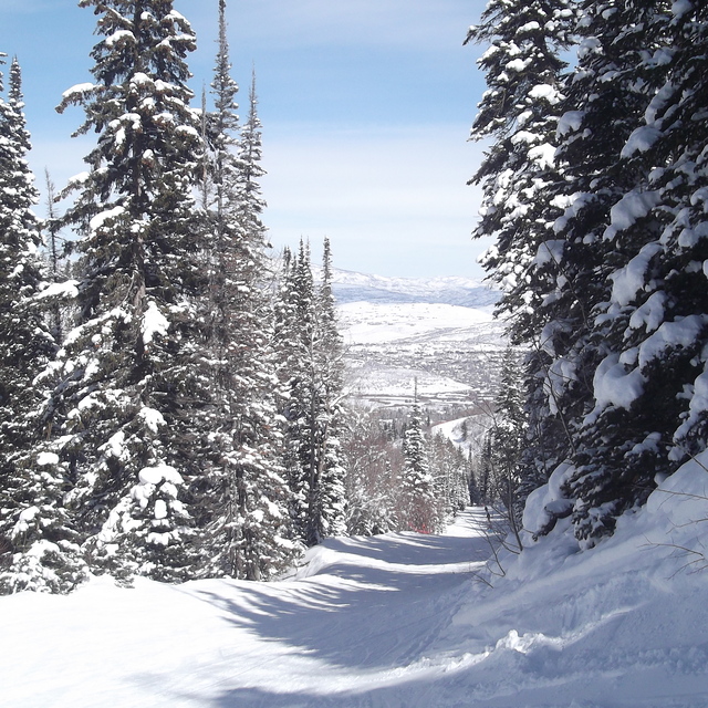
I love Park City! The good: First of all, the convenience of the airport is second to none for a major resort town. Flying into SLC is a breeze, the rental car counter is right across from baggage claim (no shuttle bus!), and the resort is, no exaggeration, a thirty-five to forty minute drive. Lodging is reasonable. Ski-in ski-out places are expensive, but in-line with the good value of what you would pay at a world class resort. Plenty of affordable option as well, from places in town to VRBO condos. Parking is still convenient and free at the base of Park City or the Canyons Village (which has a gondola from parking to the lift). The mountain is awesome. It’s big, with plenty of skiable acreage for all ability levels. Plenty of blue groomers, and plenty of black runs, chutes, bumps, and tree skiing for the more advanced skiers. There is even really accessible back country skiing just through the gates. (Don’t let the easy accessibility of back country skiing lull you into complacency. There have been a few avalanche deaths in recent years, including one this year, in back country skiing just off property). The staff is insanely friendly (I was shocked to see the negative review on that front on this site). I’m Hispanic, but unlike the other reviewer have never felt uncomfortable. In fact, there are a huge number of Latin American workers at Park City, and I have found the PC staff, from the ticket kiosk attendants, to the chair operators, to the ski instructors, to be amongst the friendliest around. Park City’s Main Street is a blast. This isn’t a place where non-skiers are going to go stir crazy in the room or a hotel lobby. There is plenty of shopping on Main Street, and a lot of really good restaurants. Gorsuch has to be one of the best merchandised stores I’ve ever been in, although as you get in these resort towns, it is very high-end and I enjoy just browsing. Just outside town toward Salt Lake is a shopping complex with factory outlets. One of my guests last year forgot his ski pants, and inside twenty minutes we had replacements from the Columbia Outlet for $79. Tell me a ski town where you can get a pair of ski pants in town and not feel like you got bent over? The bad: Well, during the peak New Years week, and President’s Day weekend, you can be on the mountain with a lot of people. Shocker, I know. During the peak times, get up and get to the resort. The longest lines are at the base of the mountain, and things really get busy around 9:30 on. Being at the resort when the lifts open (they generally start loading before the official 9am open, especially on busy days) saves you from spending a frustrating first twenty minutes in line. The mountain is big, and once you get up (unless you are a beginner in the ski school section) the crowds quickly dissipate, and the phenomenal high-speed lifts make even seemingly long lines go quickly. The Canyons side is generally less crowded than the Park City side, especially if you have graduated past the high concentration of blue runs at mid-mountain. Food is expensive. When Vail bought Park City they brought it in line with all their resorts. So food on the mountain is really expensive. And lessons are very expensive. Shocker, I know.... Other than that, the only complaint could be**relatively** the Big Cottonwood Canyon resorts and Little Cottonwood Canyon resorts get more snow (just on the SLC side of the mountains). If PC gets 6”, Snowbird almost certainly got 8”. But once again, this is a relative item. This year (2020/2021) has been a poor year for snow all around, but when it does snow they get plenty. If you want epic skiing (no pun intended) with plenty of terrain, a wide variety of lodging and dining options, and plenty to keep everyone entertained, with flights that are reasonable (less expensive than Eagle or Aspen, maybe marginally more than Denver, but you're in your car in ten minutes and to the hotel in thirty five, instead of thirty to get your car and two hours to the hotel) Park City Utah is your place.
Colin from United States writes:
I love Park City!
The good:
First of all, the convenience of the airport is second to none for a major resort town. Flying into SLC is a breeze, the rental car counter is right across from baggage claim (no shuttle bus!), and the resort is, no exaggeration, a thirty-five to forty minute drive.
Lodging is reasonable. Ski-in ski-out places are expensive, but in-line with the good value of what you would pay at a world class resort. Plenty of affordable option as well, from places in town to VRBO condos. Parking is still convenient and free at the base of Park City or the Canyons Village (which has a gondola from parking to the lift).
The mountain is awesome. It’s big, with plenty of skiable acreage for all ability levels. Plenty of blue groomers, and plenty of black runs, chutes, bumps, and tree skiing for the more advanced skiers. There is even really accessible back country skiing just through the gates. (Don’t let the easy accessibility of back country skiing lull you into complacency. There have been a few avalanche deaths in recent years, including one this year, in back country skiing just off property).
The staff is insanely friendly (I was shocked to see the negative review on that front on this site). I’m Hispanic, but unlike the other reviewer have never felt uncomfortable. In fact, there are a huge number of Latin American workers at Park City, and I have found the PC staff, from the ticket kiosk attendants, to the chair operators, to the ski instructors, to be amongst the friendliest around.
Park City’s Main Street is a blast. This isn’t a place where non-skiers are going to go stir crazy in the room or a hotel lobby. There is plenty of shopping on Main Street, and a lot of really good restaurants. Gorsuch has to be one of the best merchandised stores I’ve ever been in, although as you get in these resort towns, it is very high-end and I enjoy just browsing. Just outside town toward Salt Lake is a shopping complex with factory outlets. One of my guests last year forgot his ski pants, and inside twenty minutes we had replacements from the Columbia Outlet for $79. Tell me a ski town where you can get a pair of ski pants in town and not feel like you got bent over?
The bad:
Well, during the peak New Years week, and President’s Day weekend, you can be on the mountain with a lot of people. Shocker, I know. During the peak times, get up and get to the resort. The longest lines are at the base of the mountain, and things really get busy around 9:30 on. Being at the resort when the lifts open (they generally start loading before the official 9am open, especially on busy days) saves you from spending a frustrating first twenty minutes in line. The mountain is big, and once you get up (unless you are a beginner in the ski school section) the crowds quickly dissipate, and the phenomenal high-speed lifts make even seemingly long lines go quickly. The Canyons side is generally less crowded than the Park City side, especially if you have graduated past the high concentration of blue runs at mid-mountain.
Food is expensive. When Vail bought Park City they brought it in line with all their resorts. So food on the mountain is really expensive. And lessons are very expensive. Shocker, I know....
Other than that, the only complaint could be**relatively** the Big Cottonwood Canyon resorts and Little Cottonwood Canyon resorts get more snow (just on the SLC side of the mountains). If PC gets 6”, Snowbird almost certainly got 8”. But once again, this is a relative item. This year (2020/2021) has been a poor year for snow all around, but when it does snow they get plenty.
If you want epic skiing (no pun intended) with plenty of terrain, a wide variety of lodging and dining options, and plenty to keep everyone entertained, with flights that are reasonable (less expensive than Eagle or Aspen, maybe marginally more than Denver, but you're in your car in ten minutes and to the hotel in thirty five, instead of thirty to get your car and two hours to the hotel) Park City Utah is your place.


 Nearest