

Portillo Storm Snowfall Total Passes 5m / 17 Feet
A snow storm that has now continued for nine days has taken Chilean ski resort Portillo to a snowfall total of 5.2 metres (17 feet) so far, with more snow forecast.

Next 3 days weather summary:Some drizzle, heaviest during Fri night. Warm (max 27°C on Thu afternoon, min 14°C on Fri night). Wind will be generally light. | Days 4-6 weather summary:Some drizzle, heaviest during Tue night. Warm (max 26°C on Sun afternoon, min 13°C on Mon night). Wind will be generally light. | |||||||||||||||||
Thursday 30 | Friday 31 | Saturday 1 | Sunday 2 | Monday 3 | Tuesday 4 | |||||||||||||
AM | PM | night | AM | PM | night | AM | PM | night | AM | PM | night | AM | PM | night | AM | PM | night | |
clear | clear | clear | some clouds | some clouds | rain shwrs | clear | clear | clear | clear | clear | clear | some clouds | some clouds | clear | clear | some clouds | rain shwrs | |
km/h | ||||||||||||||||||
Snow map |  |  |  |  |  |  | ||||||||||||
— | — | — | — | — | — | — | — | — | — | — | — | — | — | — | — | — | — | |
mm | — | — | — | — | — | 1 | — | — | — | — | — | — | — | — | — | — | — | 1 |
max °C | 24 | 27 | 24 | 24 | 26 | 22 | 22 | 25 | 22 | 23 | 26 | 23 | 23 | 24 | 20 | 21 | 23 | 18 |
min °C | 18 | 27 | 17 | 18 | 26 | 14 | 16 | 25 | 15 | 17 | 26 | 16 | 17 | 23 | 13 | 15 | 21 | 13 |
chill °C | 18 | 27 | 17 | 18 | 26 | 14 | 16 | 25 | 15 | 17 | 26 | 16 | 17 | 23 | 13 | 15 | 21 | 13 |
Humid % | 29 | 23 | 48 | 29 | 31 | 69 | 43 | 31 | 61 | 34 | 22 | 52 | 32 | 31 | 51 | 41 | 49 | 71 |
Freeze m | 4700 | 5000 | 4850 | 4750 | 4850 | 4700 | 4650 | 4800 | 4750 | 4750 | 4950 | 4700 | 4600 | 4550 | 4500 | 4500 | 4650 | 4600 |
6:43 | — | — | 6:43 | — | — | 6:45 | — | — | 6:46 | — | — | 6:47 | — | — | 6:48 | — | — | |
— | — | 9:16 | — | — | 9:15 | — | — | 9:14 | — | — | 9:13 | — | — | 9:12 | — | — | 9:10 | |
Go pro and carve into:
Avalanche information: European Avalanche Warning Services (EAWS)
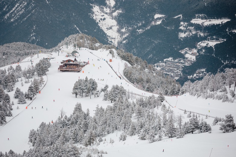
Latest snow reports near Pal:
| Top snow depth: | 0 cm |
|---|---|
| Bottom snow depth: | 0 cm |
| Fresh snowfall depth: | — |
| Last snowfall: | 17 May 2026 |
| Snow Alerts | Create Alert |
0.0 | Bluebird Powder days Fresh snow, mostly sunny, light wind. |
|---|---|
0.0 | Powder days Fresh snow, limited sun, any wind. |
0.0 | Bluebird days Average snow, mostly sunny, light wind. |
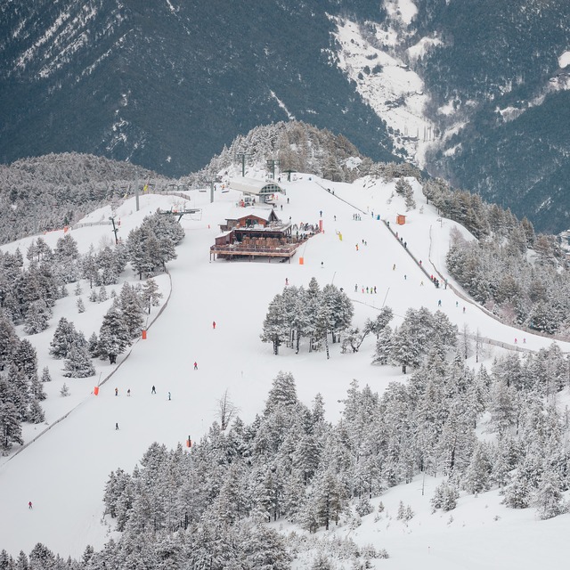

The above table gives the weather forecast for Pal at the specific elevation of 1780 m. Our sophisticated weather models allow us to provide snow forecasts for the top, middle and bottom ski stations of Pal. To access the weather forecasts for the other elevations, use the tab navigation above the table. For a wider view of the weather, check out the Weather Map of Andorra.
Click here to read further information on freezing levels and how we forecast our temperatures.
Overall 3.7 Based on 14 votes and 4 reviews
Stayed in Magic hotel, La Massana (Pal) 11-18 January 2009. Great hotel with small but adequate leisure facilities. Clean with friendly staff and good food. Convenient to slopes of Pal with gondola less than 100m away. Totally hassle-free with no queues. Great snow on piste, lovely weather (only felt the cold when we returned home.) Hire a locker at the ski centre for 9 euro per day so that you can relax and get those horrid ski boots off prior to returning to your hotel each day. Make a point of visiting Andorra La Vella (10 mins on bus) to see how the other half lives.
Stephen Darragh from Ireland writes:
Stayed in Magic hotel, La Massana (Pal) 11-18 January 2009. Great hotel with small but adequate leisure facilities. Clean with friendly staff and good food. Convenient to slopes of Pal with gondola less than 100m away. Totally hassle-free with no queues. Great snow on piste, lovely weather (only felt the cold when we returned home.) Hire a locker at the ski centre for 9 euro per day so that you can relax and get those horrid ski boots off prior to returning to your hotel each day. Make a point of visiting Andorra La Vella (10 mins on bus) to see how the other half lives.


 Nearest