Issued by Snow-Forecast.com at:1 am (local time) / 01 Jul 2026
Last 6 daysScroll left for last 6 daysNow
Next 3 days weather summary:
Mild with moderate rain (total 12.0mm) on Wed afternoon, Becoming colder with a light covering of snow, mostly falling on Wed afternoon. Mild temperatures (max 7°C on Fri afternoon, min 1°C on Wed afternoon). Wind will be generally light.
Days 4-6 weather summary:
Light rain (total 4.0mm), mostly falling on Sun night. Mild temperatures (max 8°C on Sun afternoon, min 4°C on Sat morning). Wind will be generally light.
The above table gives the weather forecast for Obergurgl at the specific elevation of 3080 m. Our sophisticated weather models allow us to provide snow forecasts for the top, middle and bottom ski stations of Obergurgl. To access the weather forecasts for the other elevations, use the tab navigation above the table. For a wider view of the weather, check out the Weather Map of Austria.
Click here to read further information on freezing levels and how we forecast our temperatures.
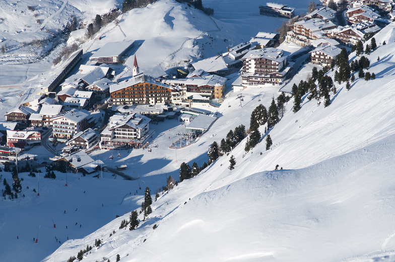
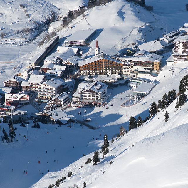
Just returned from a week in Obergurgl staying at Haus Verwall Apartments. Accommodation was excellent, clean, modern, great breakfasts, wonderful host and right by ski school and bottom lifts. Would recommend this accommodation to anybody with a number of restaurants and takeaways within a few minutes walk. Weather was excellent, blue skies, no wind and the slopes well groomed. Temperatures slightly higher than normal so best skiing in the morning leaving the afternoons for playing in the sun. Nederhutte can't be beaten for apres-ski and you can still ski down to the town or ride on a skidoo if you've overdone the partying. Overall, a good family oriented resort with a good mix of runs for all abilities. If you run out of pistes to explore there is a free bus service to Solden and the lift pass covers it all. Great time was had by all from age 4 to 62.
Just returned from a week in Obergurgl staying at Haus Verwall Apartments. Accommodation was excellent, clean, modern, great breakfasts, wonderful host and right by ski school and bottom lifts. Would recommend this accommodation to anybody with a number of restaurants and takeaways within a few minutes walk. Weather was excellent, blue skies, no wind and the slopes well groomed. Temperatures slightly higher than normal so best skiing in the morning leaving the afternoons for playing in the sun. Nederhutte can't be beaten for apres-ski and you can still ski down to the town or ride on a skidoo if you've overdone the partying. Overall, a good family oriented resort with a good mix of runs for all abilities. If you run out of pistes to explore there is a free bus service to Solden and the lift pass covers it all. Great time was had by all from age 4 to 62.
Free Snow-Forecast.com weather widget for your website
Embed the Obergurgl weather widget on your site for free. It provides a weekly snapshot of snow and rain conditions across all elevations. Follow the two quick steps to grab your custom code and paste it into your site. Choose between metric or imperial units. Click here to get the code.


 Nearest