The above table gives the weather forecast for Obergurgl at the specific elevation of 1800 m. Our sophisticated weather models allow us to provide snow forecasts for the top, middle and bottom ski stations of Obergurgl. To access the weather forecasts for the other elevations, use the tab navigation above the table. For a wider view of the weather, check out the Weather Map of Austria.
Click here to read further information on freezing levels and how we forecast our temperatures.
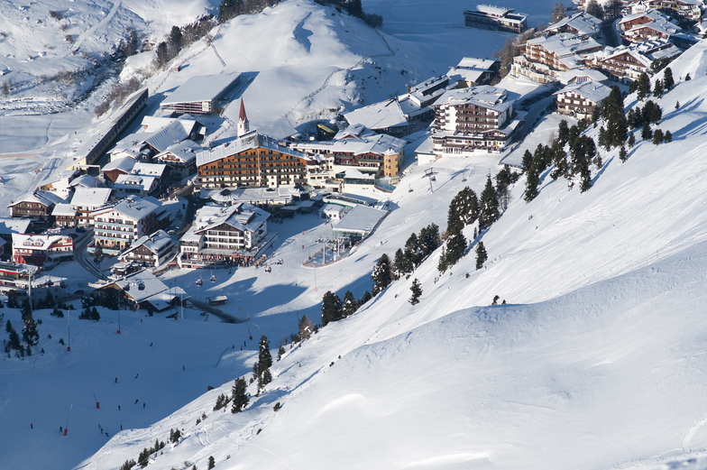
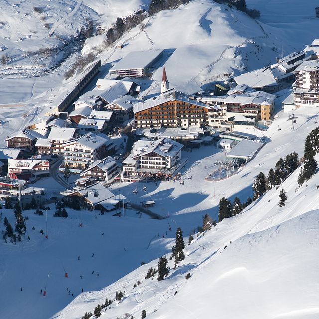
I would reiterate what most of the other reviews have said. The lift infrastructure is excellent with hardly any slow lifts or drag lifts. Consequently, there are few queues. However, the so-called Top Express link to Hochgurgl is hardly speedy, and it would probably be quicker to get on the frequent ski buses that plough up and down the valley. If you're expecting to see something like the link between Les Arc and La Plagne, you will be disappointed. The lift pass is quite expensive by Austrian standards, even allowing for the fact that it's valid in Sölden. The main lifts from the resort close promptly at 4 p.m., which, again, is early compared to other resorts.
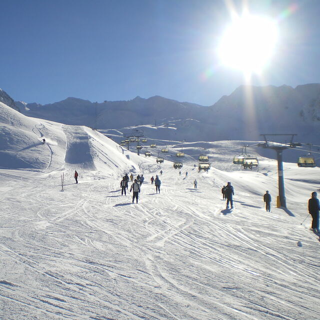
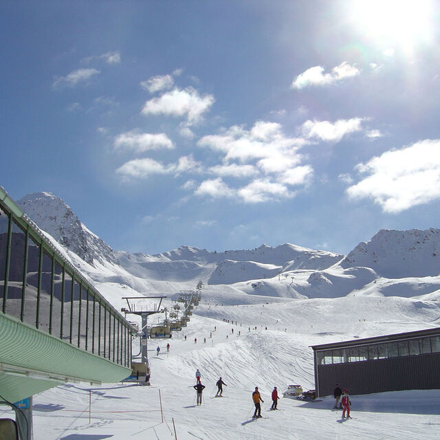
The skiing and snow conditions were generally excellent, mostly of reds and blues, but there are a few 'token' blacks. There's probably more variety in Hochgurgl than Obergurgl. Good intermediate skiers would probably ski out the resort in a couple of days. Piste marking is poor - only one side of the piste is marked, which made it quite interesting when we found ourselves skiing in misty/snowy conditions. Signposting isn’t great, either.
You need to bear in mind that this is one of the highest resorts in Austria. This is great for snow conditions and snow sureness, but the resort is also susceptible to high winds. So, on one day, despite the sunny weather, all of the resort lifts were closed, and on another day most of the lifts were closed in the morning with only the low-down lifts on the W of the resort operational.
It is possible on days like this to get the bus to Sölden, which is a lower resort. But, as everybody from Obergurgl seemed to be doing that on the day we went, there is the inevitable crowding and chaos on the narrow pistes down to Sölden. Another possibility on days such as these is to visit the fantastic motor cycle museum at Top Mountain Crosspoint. It’s a must for motorcycle buffs and entry is included on most lift passes.
The resort is very quiet in the evening - great for oldies - but if you're looking for vibrant apres-ski, you'll need to look elsewhere. For those in self-catering accommodation, there are few shops selling Lebensmittel, and the largest shop in the village (Spar) closes at 4.30; just in time for you to miss out after your last run down to the resort (!)
Overall, though, it’s a good resort for beginners and intermediates, especially later in the season when the lower Austrian resorts revert to slush in the afternoon.
I would reiterate what most of the other reviews have said. The lift infrastructure is excellent with hardly any slow lifts or drag lifts. Consequently, there are few queues. However, the so-called Top Express link to Hochgurgl is hardly speedy, and it would probably be quicker to get on the frequent ski buses that plough up and down the valley. If you're expecting to see something like the link between Les Arc and La Plagne, you will be disappointed. The lift pass is quite expensive by Austrian standards, even allowing for the fact that it's valid in Sölden. The main lifts from the resort close promptly at 4 p.m., which, again, is early compared to other resorts.
The skiing and snow conditions were generally excellent, mostly of reds and blues, but there are a few 'token' blacks. There's probably more variety in Hochgurgl than Obergurgl. Good intermediate skiers would probably ski out the resort in a couple of days. Piste marking is poor - only one side of the piste is marked, which made it quite interesting when we found ourselves skiing in misty/snowy conditions. Signposting isn’t great, either.
You need to bear in mind that this is one of the highest resorts in Austria. This is great for snow conditions and snow sureness, but the resort is also susceptible to high winds. So, on one day, despite the sunny weather, all of the resort lifts were closed, and on another day most of the lifts were closed in the morning with only the low-down lifts on the W of the resort operational.
It is possible on days like this to get the bus to Sölden, which is a lower resort. But, as everybody from Obergurgl seemed to be doing that on the day we went, there is the inevitable crowding and chaos on the narrow pistes down to Sölden. Another possibility on days such as these is to visit the fantastic motor cycle museum at Top Mountain Crosspoint. It’s a must for motorcycle buffs and entry is included on most lift passes.
The resort is very quiet in the evening - great for oldies - but if you're looking for vibrant apres-ski, you'll need to look elsewhere. For those in self-catering accommodation, there are few shops selling Lebensmittel, and the largest shop in the village (Spar) closes at 4.30; just in time for you to miss out after your last run down to the resort (!)
Overall, though, it’s a good resort for beginners and intermediates, especially later in the season when the lower Austrian resorts revert to slush in the afternoon.
Free Snow-Forecast.com weather widget for your website
Embed the Obergurgl weather widget on your site for free. It provides a weekly snapshot of snow and rain conditions across all elevations. Follow the two quick steps to grab your custom code and paste it into your site. Choose between metric or imperial units. Click here to get the code.


 Nearest