

America’s Next Indoor Snow Centre Takes Shape
Construction of a new indoor snow centre for skiers, boarders and tubers appears to be making good progress at Heritage Farm in Wayne County, West Virginia.

Next 4 days weather summary:Moderate rain (total 16.0mm), heaviest on Mon afternoon. Warm (max 30°C on Wed morning, min 22°C on Mon night). Wind will be generally light. | Days 5-7 weather summary:Moderate rain (total 13.0mm), heaviest on Fri night. Warm (max 29°C on Thu morning, min 21°C on Wed night). Wind will be generally light. | |||||||||||||||
Monday 20 | Tuesday 21 | Wednesday 22 | Thursday 23 | Friday 24 | ||||||||||||
night | AM | PM | night | AM | PM | night | AM | PM | night | AM | PM | night | AM | PM | night | |
rain shwrs | rain shwrs | t-storm risk | rain shwrs | t-storm risk | t-storm risk | rain shwrs | rain shwrs | t-storm risk | rain shwrs | some clouds | t-storm risk | rain shwrs | cloudy | t-storm risk | rain shwrs | |
km/h | ||||||||||||||||
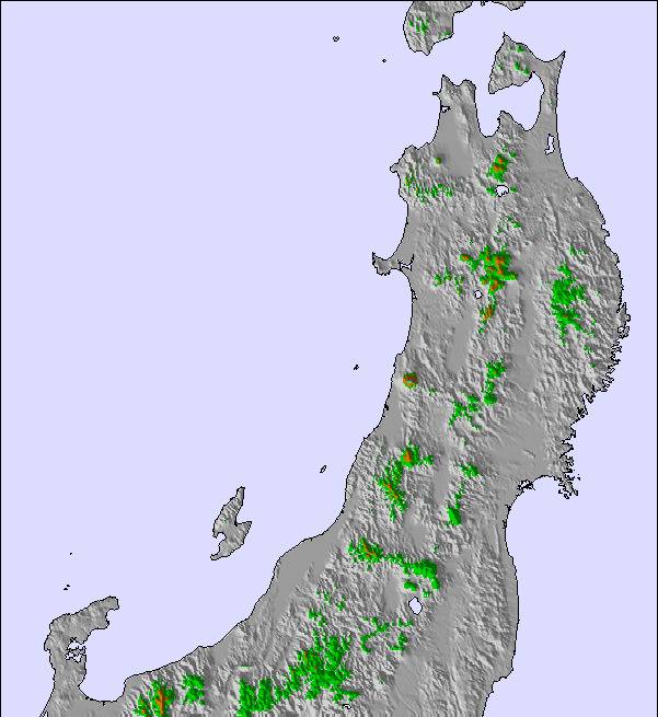
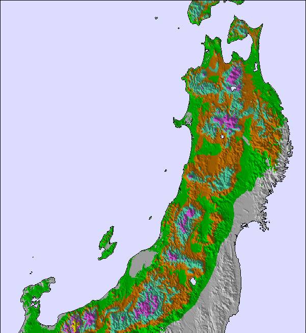
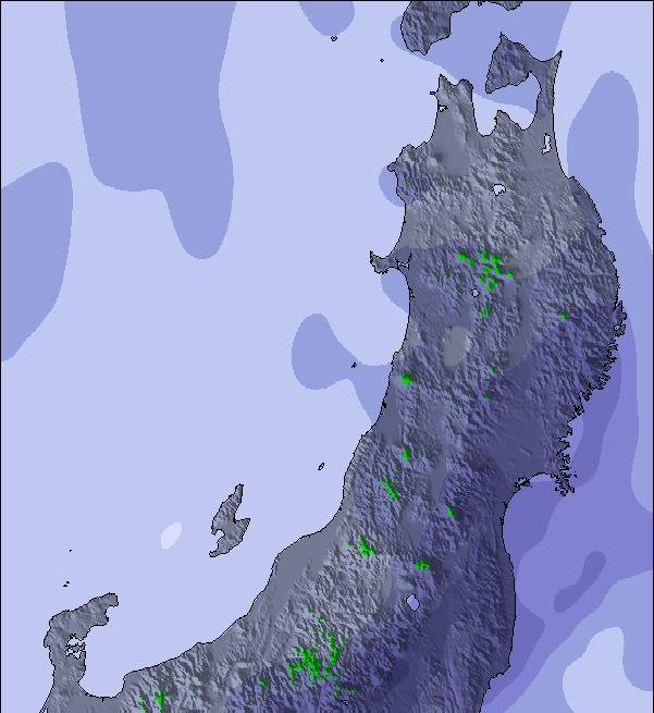
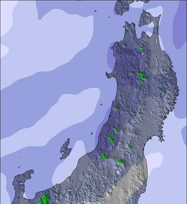
Snow map | 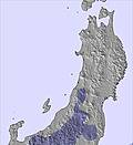 | 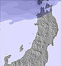 | 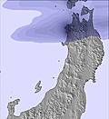 | 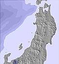 | 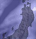 | 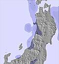 | ||||||||||
— | — | — | — | — | — | — | — | — | — | — | — | — | — | — | — | |
mm | 1 | 1 | 3 | 1 | 3 | 3 | 1 | 1 | 2 | 1 | — | 2 | 1 | — | 2 | 3 |
max °C | 24 | 29 | 28 | 23 | 28 | 28 | 23 | 30 | 28 | 22 | 29 | 28 | 22 | 29 | 28 | 22 |
min °C | 23 | 29 | 26 | 22 | 27 | 25 | 22 | 28 | 25 | 21 | 27 | 25 | 21 | 26 | 23 | 21 |
chill °C | 23 | 29 | 26 | 22 | 27 | 25 | 22 | 28 | 25 | 21 | 27 | 25 | 21 | 26 | 23 | 21 |
Humid % | 86 | 72 | 77 | 85 | 80 | 81 | 90 | 79 | 78 | 89 | 79 | 72 | 84 | 74 | 72 | 87 |
Freeze m | 5400 | 5450 | 5450 | 5450 | 5300 | 5350 | 5400 | 5250 | 5250 | 5150 | 5100 | 5150 | 5200 | 5100 | 5100 | 5050 |
— | 4:41 | — | — | 4:41 | — | — | 4:43 | — | — | 4:43 | — | — | 4:43 | — | — | |
— | — | 7:02 | — | — | 7:01 | — | — | 7:00 | — | — | 7:00 | — | — | 7:00 | — | |
Go pro and carve into:
Avalanche information: Japan Avalanche Network
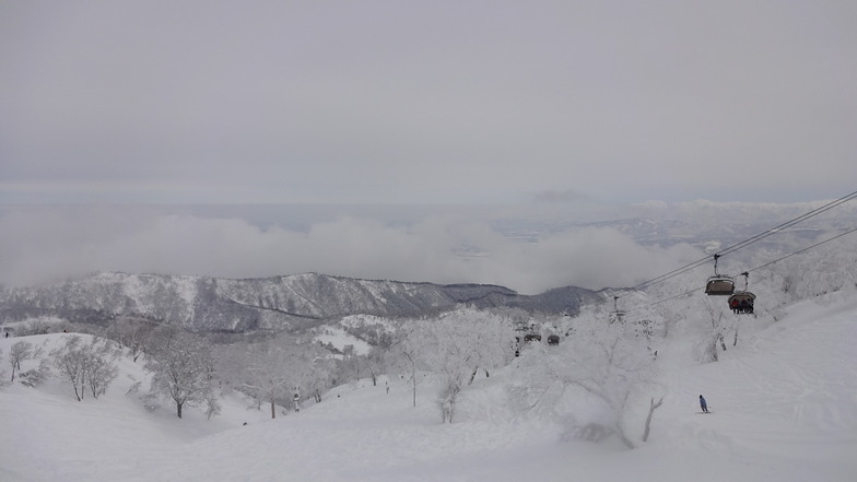
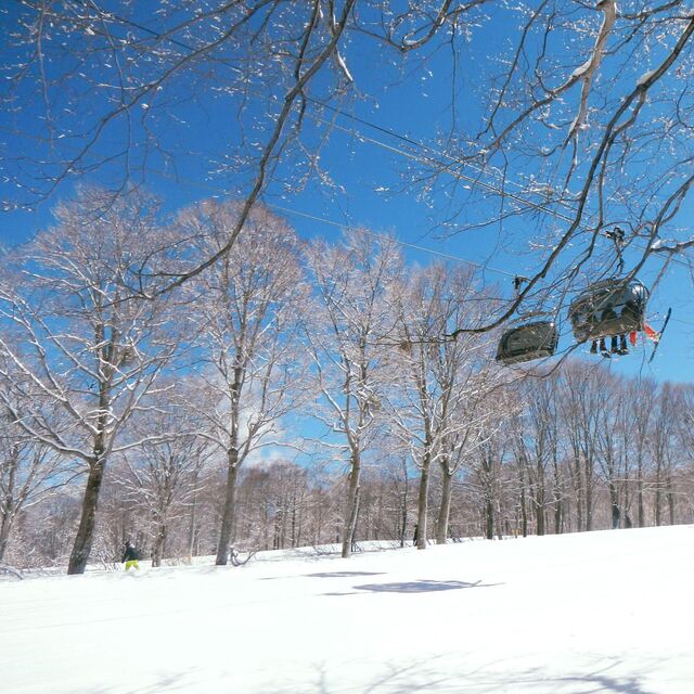
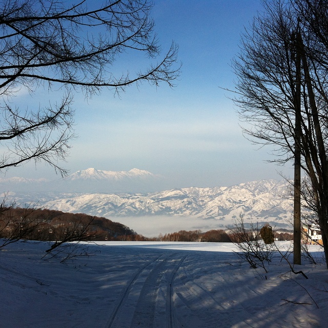
Latest snow reports near Nozawa Onsen:
| Top snow depth: | 0 cm |
|---|---|
| Bottom snow depth: | 0 cm |
| Fresh snowfall depth: | — |
| Last snowfall: | 7 Apr 2026 |
| Snow Alerts | Create Alert |
0.0 | Bluebird Powder days Fresh snow, mostly sunny, light wind. |
|---|---|
0.0 | Powder days Fresh snow, limited sun, any wind. |
0.0 | Bluebird days Average snow, mostly sunny, light wind. |
The above table gives the weather forecast for Nozawa Onsen at the specific elevation of 565 m. Our sophisticated weather models allow us to provide snow forecasts for the top, middle and bottom ski stations of Nozawa Onsen. To access the weather forecasts for the other elevations, use the tab navigation above the table. For a wider view of the weather, check out the Weather Map of Japan.
Click here to read further information on freezing levels and how we forecast our temperatures.
Overall 4.0 Based on 45 votes and 14 reviews
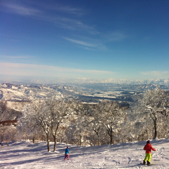
Nozawa is growing up. While the ratio of Japanese visitors to international visitors in the winter is fairly constant (70:30ish), there's increasingly more of the services that inbound guests want. There are several places to get excellent coffee, breadcentric breakfasts, etc, and the accommodation base in the village is gradually being upgraded. But this remains a real working mountain village (3,600 residents year-round) that just happens to have an Olympic-quality ski field. It feels much more like a small European resort (think Lech, Gstaad, or its twin, St. Anton), although culturally you're absolutely aware that you're in Japan. There's been a ski resort here for over 100 years so the snow and mountain management is world class. The village continues to invest and will replace the main gondola over the next two years. After the opening of the new shinkansen a few years ago, it's just over two hours from Tokyo so much more accessible than it used to be. The green season is picking up, with a lot of winter athletes training on the artificial slope, as well as mountain bikers rubbing shoulders with the regular guests looking for cool weather, local food/sake/beer and onsen.
Peter from United States writes:
Nozawa is growing up. While the ratio of Japanese visitors to international visitors in the winter is fairly constant (70:30ish), there's increasingly more of the services that inbound guests want. There are several places to get excellent coffee, breadcentric breakfasts, etc, and the accommodation base in the village is gradually being upgraded.
But this remains a real working mountain village (3,600 residents year-round) that just happens to have an Olympic-quality ski field. It feels much more like a small European resort (think Lech, Gstaad, or its twin, St. Anton), although culturally you're absolutely aware that you're in Japan. There's been a ski resort here for over 100 years so the snow and mountain management is world class.
The village continues to invest and will replace the main gondola over the next two years. After the opening of the new shinkansen a few years ago, it's just over two hours from Tokyo so much more accessible than it used to be. The green season is picking up, with a lot of winter athletes training on the artificial slope, as well as mountain bikers rubbing shoulders with the regular guests looking for cool weather, local food/sake/beer and onsen.

 Nearest