


Global Weekly Snow Roundup #320
Weekly Snow News for the world, updated 25 June 2026: Chile and New Zealand's seasons proper set to begin, Tignes and Sunshine reopen for summer skiing. weekend as Riksgransen ends its 2026 season.

Next 3 days weather summary:Light rain (total 2.0mm), mostly falling on Sun morning. Very mild (max 16°C on Tue morning, min 11°C on Sun night). Wind will be generally light. | Days 4-6 weather summary:Light rain (total 6.0mm), mostly falling on Thu afternoon. Very mild (max 17°C on Thu morning, min 12°C on Fri night). Wind will be generally light. | |||||||||||||||||
Sunday 28 | Monday 29 | Tuesday 30 | Wednesday 1 | Thursday 2 | Friday 3 | |||||||||||||
AM | PM | night | AM | PM | night | AM | PM | night | AM | PM | night | AM | PM | night | AM | PM | night | |
rain shwrs | some clouds | clear | clear | rain shwrs | some clouds | some clouds | clear | clear | some clouds | some clouds | some clouds | rain shwrs | rain shwrs | rain shwrs | cloudy | cloudy | some clouds | |
km/h | ||||||||||||||||||
Snow map |  |  |  |  |  |  | ||||||||||||
— | — | — | — | — | — | — | — | — | — | — | — | — | — | — | — | — | — | |
mm | 1 | — | — | — | 1 | — | — | — | — | — | — | — | 1 | 3 | 2 | — | — | — |
max °C | 13 | 13 | 12 | 14 | 13 | 12 | 16 | 16 | 14 | 16 | 16 | 15 | 17 | 17 | 14 | 17 | 16 | 14 |
min °C | 12 | 13 | 11 | 13 | 13 | 11 | 15 | 15 | 13 | 16 | 16 | 15 | 17 | 15 | 13 | 15 | 15 | 12 |
chill °C | 11 | 12 | 10 | 13 | 12 | 10 | 15 | 15 | 12 | 15 | 15 | 15 | 17 | 15 | 13 | 15 | 15 | 12 |
Humid % | 86 | 83 | 78 | 68 | 76 | 78 | 40 | 57 | 70 | 64 | 68 | 75 | 70 | 88 | 94 | 68 | 80 | 84 |
Freeze m | 3400 | 3350 | 3150 | 3000 | 3100 | 3550 | 3550 | 3700 | 3800 | 3750 | 3850 | 3800 | 3800 | 3850 | 3850 | 3800 | 3800 | 3600 |
4:00 | — | — | 4:01 | — | — | 4:01 | — | — | 4:01 | — | — | 4:01 | — | — | 4:03 | — | — | |
— | 7:20 | — | — | 7:20 | — | — | 7:20 | — | — | 7:19 | — | — | 7:19 | — | — | 7:19 | — | |
Go pro and carve into:
Avalanche information: Japan Avalanche Network
Latest snow reports near Niseko Weiss:
| Top snow depth: | — |
|---|---|
| Bottom snow depth: | — |
| Fresh snowfall depth: | — |
| Last snowfall: | 4 May 2026 |
| Snow Alerts | Create Alert |
0.0 | Bluebird Powder days Fresh snow, mostly sunny, light wind. |
|---|---|
0.0 | Powder days Fresh snow, limited sun, any wind. |
0.0 | Bluebird days Average snow, mostly sunny, light wind. |

The above table gives the weather forecast for Niseko Weiss at the specific elevation of 940 m. Our sophisticated weather models allow us to provide snow forecasts for the top, middle and bottom ski stations of Niseko Weiss. To access the weather forecasts for the other elevations, use the tab navigation above the table. For a wider view of the weather, check out the Weather Map of Japan.
Click here to read further information on freezing levels and how we forecast our temperatures.
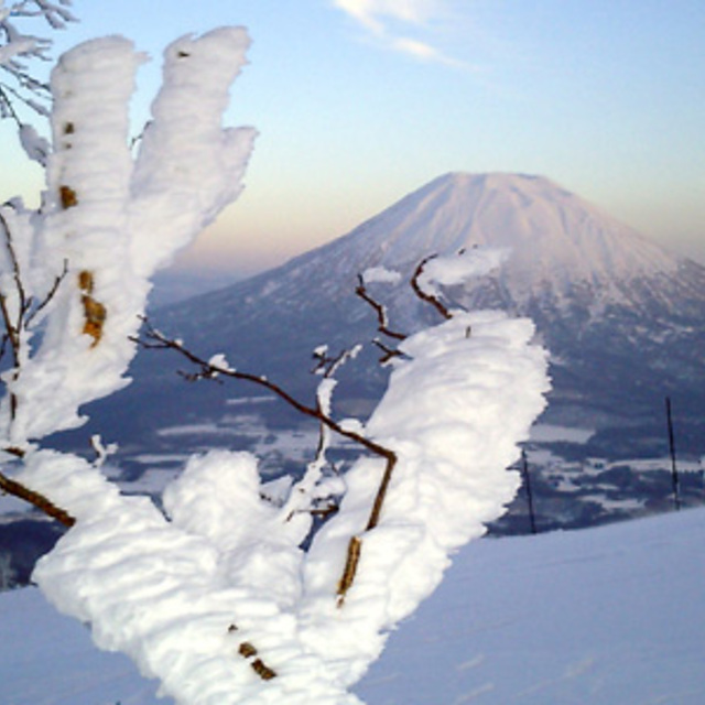
While the virgin snow on the slopes are beautiful visible from far - the resort has been meanwhile fully abandoned and even the snowcat services has been terminated three years ago.
John Birchwood from Japan writes:
While the virgin snow on the slopes are beautiful visible from far - the resort has been meanwhile fully abandoned and even the snowcat services has been terminated three years ago.


 Nearest