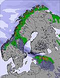
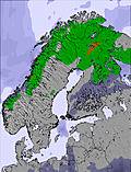
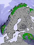
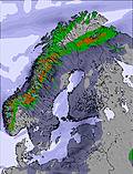
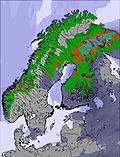
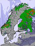
The above table gives the weather forecast for Narvik at the specific elevation of 1002 m. Our sophisticated weather models allow us to provide snow forecasts for the top, middle and bottom ski stations of Narvik. To access the weather forecasts for the other elevations, use the tab navigation above the table. For a wider view of the weather, check out the Weather Map of Norway.
Click here to read further information on freezing levels and how we forecast our temperatures.
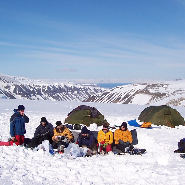
Great off-piste and tree runs, plus hiking to powder for the advanced people. Those looking for lots of long runs may be a little disappointed. Probably ok for beginners. Park is nice but not huge - a few funboxes and rails plus a kicker and table top. Tons of natural features everywhere though. No pipe.
Advise you to bring a head torch as it gets dark early and is floodlit but not in all areas. There are many tree runs in powder in semi-dark conditions!
Also, everyone should ideally have a pair of clear goggle lenses due to low light conditions - and in the week (Jan/Feb 2013) lifts open in the evening. Daytime at weekend.
When deciding to travel, check the official website for opening dates of the gondola to the top, as otherwise there is only one T bar from the bottom!
Free Snow-Forecast.com weather widget for your website
Embed the Narvik weather widget on your site for free. It provides a weekly snapshot of snow and rain conditions across all elevations. Follow the two quick steps to grab your custom code and paste it into your site. Choose between metric or imperial units. Click here to get the code.


 Nearest