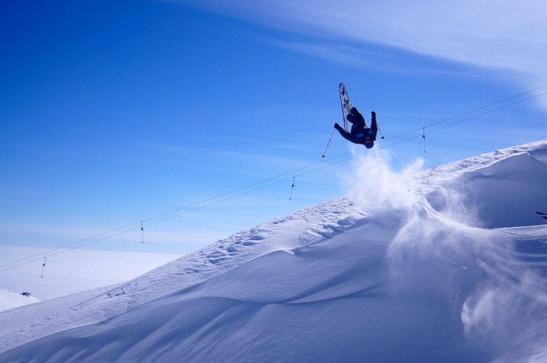


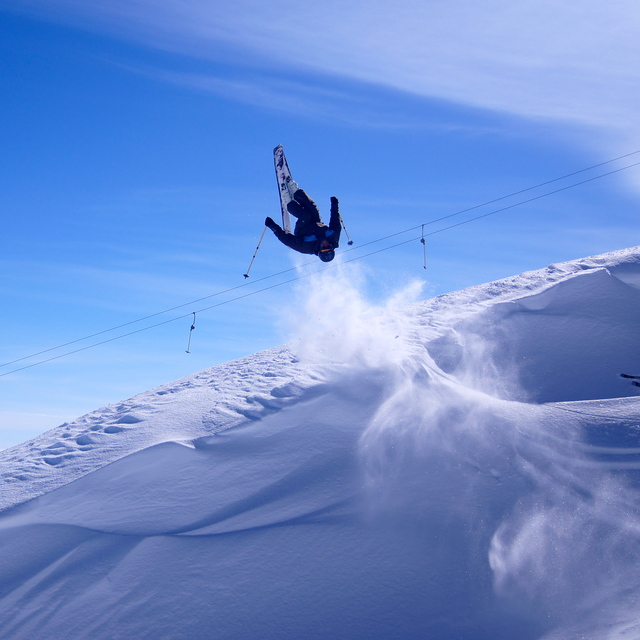
America’s Next Indoor Snow Centre Takes Shape
Construction of a new indoor snow centre for skiers, boarders and tubers appears to be making good progress at Heritage Farm in Wayne County, West Virginia.

Next 3 days weather summary:Mostly dry. Warm (max 23°C on Mon afternoon, min 10°C on Tue night). Winds increasing (calm on Sun afternoon, fresh winds from the W by Tue afternoon). | Days 4-6 weather summary:Heavy rain (total 43.0mm), heaviest during Fri night. Very mild (max 16°C on Wed afternoon, min 6°C on Fri night). Winds increasing (calm on Wed night, fresh winds from the E by Fri night). | |||||||||||||||||
Sunday 19 | Monday 20 | Tuesday 21 | Wednesday 22 | Thursday 23 | Friday 24 | |||||||||||||
AM | PM | night | AM | PM | night | AM | PM | night | AM | PM | night | AM | PM | night | AM | PM | night | |
clear | clear | clear | clear | some clouds | clear | clear | some clouds | some clouds | clear | some clouds | rain shwrs | rain shwrs | light rain | t-storm risk | light rain | t-storm risk | heavy rain | |
km/h | ||||||||||||||||||
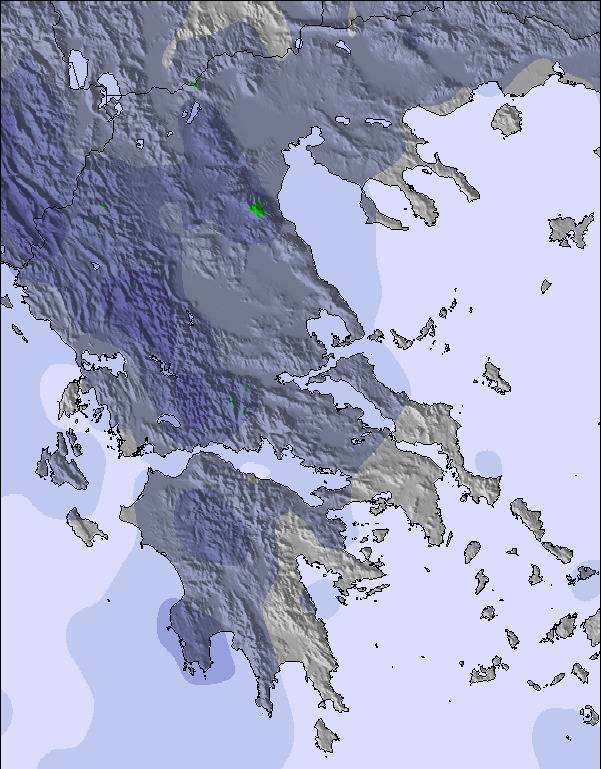
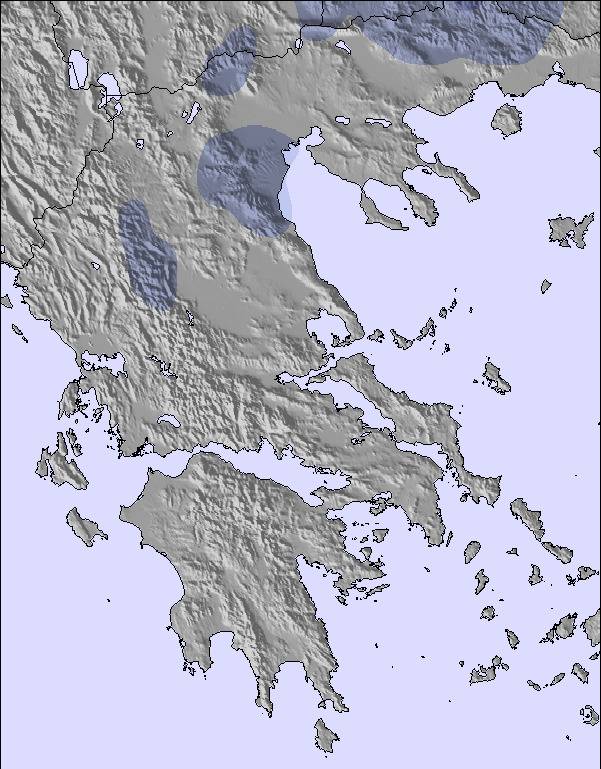
Snow map | 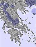 | 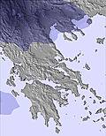 | 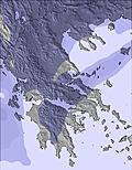 | 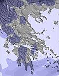 | 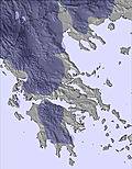 | 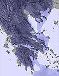 | ||||||||||||
— | — | — | — | — | — | — | — | — | — | — | — | — | — | — | — | — | — | |
mm | — | — | — | — | — | — | — | — | — | — | — | 1 | 1 | 2 | 5 | 5 | 11 | 18 |
max °C | 19 | 21 | 17 | 20 | 23 | 19 | 20 | 23 | 17 | 14 | 16 | 12 | 13 | 16 | 11 | 10 | 9 | 7 |
min °C | 16 | 21 | 14 | 17 | 23 | 14 | 17 | 22 | 10 | 12 | 16 | 8 | 11 | 14 | 8 | 8 | 8 | 6 |
chill °C | 16 | 21 | 13 | 17 | 23 | 13 | 17 | 22 | 7 | 10 | 16 | 8 | 11 | 14 | 6 | 6 | 5 | 2 |
Humid % | 60 | 41 | 41 | 37 | 30 | 41 | 49 | 32 | 49 | 67 | 52 | 60 | 72 | 52 | 63 | 92 | 93 | 96 |
Freeze m | 4350 | 4550 | 4750 | 4500 | 4700 | 4600 | 4500 | 4700 | 4400 | 4100 | 3800 | 3850 | 3650 | 3950 | 3800 | 3550 | 3550 | 3450 |
6:16 | — | — | 6:16 | — | — | 6:18 | — | — | 6:18 | — | — | 6:20 | — | — | 6:20 | — | — | |
— | — | 9:00 | — | — | 9:00 | — | 8:59 | — | — | 8:59 | — | — | 8:58 | — | — | 8:57 | — | |
Go pro and carve into:
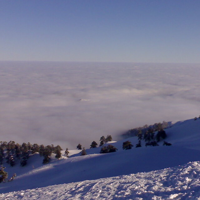
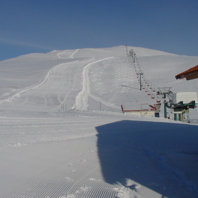
Latest snow reports near Mt Voras Kaimaktsalan:
| Top snow depth: | — |
|---|---|
| Bottom snow depth: | — |
| Fresh snowfall depth: | — |
| Last snowfall: | 19 May 2026 |
| Snow Alerts | Create Alert |
0.0 | Bluebird Powder days Fresh snow, mostly sunny, light wind. |
|---|---|
0.0 | Powder days Fresh snow, limited sun, any wind. |
0.0 | Bluebird days Average snow, mostly sunny, light wind. |
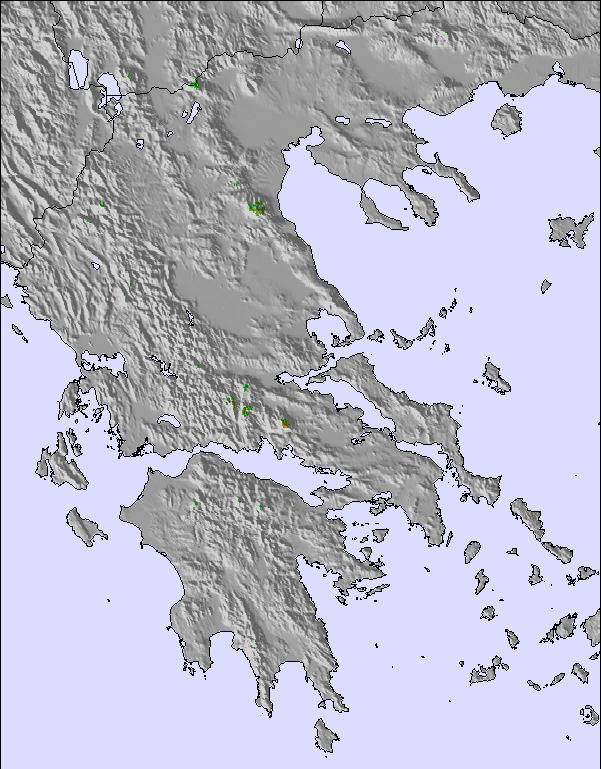
The above table gives the weather forecast for Mt Voras Kaimaktsalan at the specific elevation of 2050 m. Our sophisticated weather models allow us to provide snow forecasts for the top, middle and bottom ski stations of Mt Voras Kaimaktsalan. To access the weather forecasts for the other elevations, use the tab navigation above the table. For a wider view of the weather, check out the Weather Map of Greece.
Click here to read further information on freezing levels and how we forecast our temperatures.
Overall 3.4 Based on 47 votes and 30 reviews
Απαραδεκτη συμπεριφορα!κατα κυριο λογο απο την μπλε σχολη η οποια ειχε αναλαβει τη φυλαξη των πραγματων μας καθολη τη διαρκεια π ειμασταν εκει και εν τελη χαθηκαν.και επειτα, απο την διευθυνση του χιονοδρονικου κεντρου που αδιαφορησε εντελως για το γεγονος. Η μπλε σχολη κ η διευθυνση του χιονοδρομικου μας καθησυχασαν οτι θα εχουμε αισιο τελος αλλα αδιαφορησαν εντελως. Μας ειχαν πει οτι θα βγαλουμε ακρη στο τελος της σεζον (ενω δεν υπηρχε καμια λογικη σ αυτο) και εν τελη εξαφανιστηκαν χωρις να βγαλουμε ακρη. Η τσαντα περιειχε προσωπικα πραγματα αξιας οπως γυαλια κ κινητα. Ενα τετοιο γεγονος με κανει να αποτρεψω οποιον εχει σκοπο να παει διοτι κατα τη γνωμη μ ειναι τ πιο ανοργανωτο χιονοδρομικο. * κατα κυριο λογο ν αποφυγει τη μπλε σχολη η οποια δν μας εκοψε καν αποδειξεις για τις υπηρεσιες π μας προσεφερε. [note from the editor: *names of individuals are generally not included in reviews.]
Maria petropoulou from Greece writes:
Απαραδεκτη συμπεριφορα!κατα κυριο λογο απο την μπλε σχολη η οποια ειχε αναλαβει τη φυλαξη των πραγματων μας καθολη τη διαρκεια π ειμασταν εκει και εν τελη χαθηκαν.και επειτα, απο την διευθυνση του χιονοδρονικου κεντρου που αδιαφορησε εντελως για το γεγονος. Η μπλε σχολη κ η διευθυνση του χιονοδρομικου μας καθησυχασαν οτι θα εχουμε αισιο τελος αλλα αδιαφορησαν εντελως. Μας ειχαν πει οτι θα βγαλουμε ακρη στο τελος της σεζον (ενω δεν υπηρχε καμια λογικη σ αυτο) και εν τελη εξαφανιστηκαν χωρις να βγαλουμε ακρη. Η τσαντα περιειχε προσωπικα πραγματα αξιας οπως γυαλια κ κινητα. Ενα τετοιο γεγονος με κανει να αποτρεψω οποιον εχει σκοπο να παει διοτι κατα τη γνωμη μ ειναι τ πιο ανοργανωτο χιονοδρομικο. * κατα κυριο λογο ν αποφυγει τη μπλε σχολη η οποια δν μας εκοψε καν αποδειξεις για τις υπηρεσιες π μας προσεφερε.
[note from the editor: *names of individuals are generally not included in reviews.]
Read 29 more reviews of Mt Voras Kaimaktsalan or submit your own

 Nearest