Issued by Snow-Forecast.com at:1 am (local time) / 30 Jun 2026
Last 6 daysScroll left for last 6 daysNow
Next 3 days weather summary:
Light rain (total 3.0mm), mostly falling on Tue night. Warm (max 26°C on Thu afternoon, min 18°C on Tue morning). Winds increasing (light winds from the WSW on Tue morning, strong winds from the WNW by Thu night).
Days 4-6 weather summary:
Light rain (total 4.0mm), mostly falling on Fri afternoon. Warm (max 25°C on Fri afternoon, min 15°C on Sat night). Winds decreasing (near gales from the WNW on Sat night, calm by Sun night).
The above table gives the weather forecast for Mount Snow at the specific elevation of 1097 m. Our sophisticated weather models allow us to provide snow forecasts for the top, middle and bottom ski stations of Mount Snow. To access the weather forecasts for the other elevations, use the tab navigation above the table. For a wider view of the weather, check out the Weather Map of United States.
Click here to read further information on freezing levels and how we forecast our temperatures.
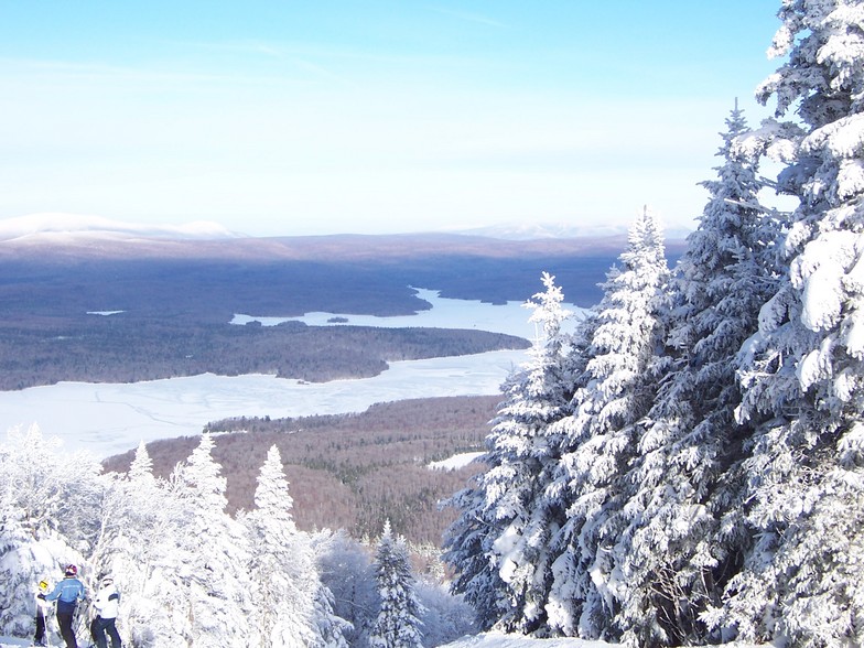
My home hill.
Middle-of-the-plate pitch for a New England resort with one caveat: If you're a park-rat (grom to shred; I'm not) Carinthia is the best terrain park in the East, walking away, with a whole face dedicated to jibbers.
As a whole, resort favours the intermediate skier with primarily groomed terrain. However, they have a boundary-to-boundary policy in place for when the snow flies. There are a variety of tree runs for all ability levels when there's snow.
Trail style runs the gamut from wide-open (Snowdance) to old-school Northeastern trails (Uncles). The "North Face" has decent incline; "Jaws" can be a real treat with good coverage. When there's no natural snow (and when there is) I think recent improvements put it in the top rank for snowmaking, nation-wide, actually.
All that said, this is an intermediate hill. A good place to progress your skiing but not an advance/expert playground-for-days. What sets it apart from other Vermont resorts (*cough* Stratton *cough*) is the laid-back, unpretentious vibe. People come here to ski and be with their family and friends, and that's it. Most of them will be happy to see you, too.
Free Snow-Forecast.com weather widget for your website
Embed the Mount Snow weather widget on your site for free. It provides a weekly snapshot of snow and rain conditions across all elevations. Follow the two quick steps to grab your custom code and paste it into your site. Choose between metric or imperial units. Click here to get the code.


 Nearest