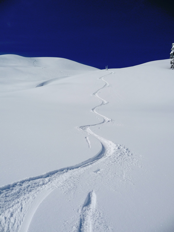


Global Weekly Snow Roundup #320
Weekly Snow News for the world, updated 25 June 2026: Chile and New Zealand's seasons proper set to begin, Tignes and Sunshine reopen for summer skiing. weekend as Riksgransen ends its 2026 season.

Next 3 days weather summary:Light rain (total 9.0mm), mostly falling on Sun afternoon. Mild temperatures (max 7°C on Mon afternoon, min 4°C on Sun morning). Wind will be generally light. | Days 4-6 weather summary:Light rain (total 9.0mm), mostly falling on Wed morning. Very mild (max 11°C on Fri night, min 4°C on Thu morning). Wind will be generally light. | |||||||||||||||||
Sunday 28 | Monday 29 | Tuesday 30 | Wednesday 1 | Thursday 2 | Friday 3 | |||||||||||||
AM | PM | night | AM | PM | night | AM | PM | night | AM | PM | night | AM | PM | night | AM | PM | night | |
cloudy | light rain | light rain | cloudy | light rain | light rain | light rain | light rain | rain shwrs | light rain | light rain | light rain | light rain | light rain | rain shwrs | some clouds | some clouds | clear | |
km/h | ||||||||||||||||||
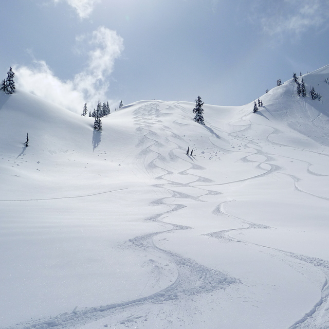
Snow map | 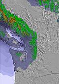 | 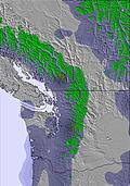 | 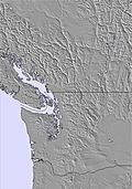 |  | 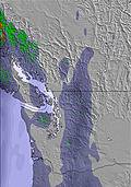 | 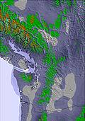 | ||||||||||||
— | — | — | — | — | — | — | — | — | — | — | — | — | — | — | — | — | — | |
mm | — | 2 | 1 | — | 1 | 1 | 1 | 2 | 1 | 1 | 2 | 1 | 2 | 2 | 1 | — | — | — |
max °C | 5 | 6 | 6 | 6 | 7 | 7 | 6 | 7 | 6 | 5 | 5 | 5 | 4 | 6 | 6 | 8 | 10 | 11 |
min °C | 4 | 5 | 5 | 6 | 7 | 6 | 6 | 6 | 6 | 5 | 5 | 5 | 4 | 5 | 5 | 5 | 9 | 10 |
chill °C | 4 | 3 | 4 | 6 | 6 | 5 | 5 | 5 | 5 | 5 | 4 | 4 | 4 | 4 | 5 | 5 | 8 | 10 |
Humid % | 91 | 96 | 97 | 94 | 97 | 90 | 94 | 90 | 83 | 98 | 97 | 92 | 95 | 88 | 83 | 77 | 69 | 61 |
Freeze m | 2900 | 3200 | 3300 | 3800 | 3700 | 3300 | 3200 | 3150 | 3050 | 2600 | 2850 | 3000 | 2800 | 2700 | 2700 | 3100 | 3350 | 3700 |
5:05 | — | — | 5:05 | — | — | 5:07 | — | — | 5:07 | — | — | 5:07 | — | — | 5:09 | — | — | |
— | — | 9:14 | — | — | 9:14 | — | — | 9:14 | — | — | 9:13 | — | — | 9:13 | — | — | 9:13 | |
Go pro and carve into:
Avalanche information: National Avalanche Center
Latest snow reports near Mount Baker:
| Top snow depth: | 0 cm |
|---|---|
| Bottom snow depth: | 0 cm |
| Fresh snowfall depth: | — |
| Last snowfall: | 9 Jun 2026 |
| Snow Alerts | Create Alert |
0.0 | Bluebird Powder days Fresh snow, mostly sunny, light wind. |
|---|---|
0.0 | Powder days Fresh snow, limited sun, any wind. |
0.0 | Bluebird days Average snow, mostly sunny, light wind. |
The above table gives the weather forecast for Mount Baker at the specific elevation of 1551 m. Our sophisticated weather models allow us to provide snow forecasts for the top, middle and bottom ski stations of Mount Baker. To access the weather forecasts for the other elevations, use the tab navigation above the table. For a wider view of the weather, check out the Weather Map of United States.
Click here to read further information on freezing levels and how we forecast our temperatures.
Overall 2.7 Based on 101 votes and 80 reviews
I have ridden almost all of the major resorts in the PNW. Baker is not for everyone. If you are the type that likes to go to ski resorts for everything but the riding, go spend your money at Whistler or Revelstoke. If you are a serious, and capable skier or snowboarder, Mt. Baker is the Mecca of powder and big terrain. Don't listen to the clueless wannabe's in the comments. Most negative reviews are glitzy daddy's money types looking for expensive bars, fancy hotels etc. Mt Baker has amazing staff, great facilities, and the lions share of the best terrain in the world. Not to mention, Baker also holds the world record for the most snowfall in a skiing season. There is a reason Baker is featured in many Burton, and K2 films. It is a hidden gem, and frankly, I hope it stays that way.
Justin from Canada writes:
I have ridden almost all of the major resorts in the PNW. Baker is not for everyone. If you are the type that likes to go to ski resorts for everything but the riding, go spend your money at Whistler or Revelstoke. If you are a serious, and capable skier or snowboarder, Mt. Baker is the Mecca of powder and big terrain. Don't listen to the clueless wannabe's in the comments. Most negative reviews are glitzy daddy's money types looking for expensive bars, fancy hotels etc. Mt Baker has amazing staff, great facilities, and the lions share of the best terrain in the world. Not to mention, Baker also holds the world record for the most snowfall in a skiing season. There is a reason Baker is featured in many Burton, and K2 films. It is a hidden gem, and frankly, I hope it stays that way.


 Nearest