
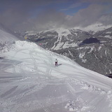
Coldest July Night Hits Glaciers: -12°C and Powder in the Alps
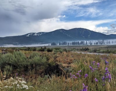
Updated July 30, 2025: Fresh snow dusts Lake Tahoe, Alpine glaciers score up to 40cm (16"), and Scandinavia clings to ski season.
By using Snow-Forecast, you agree to our Terms & Services.
Don't have an account? Join now
Alternatively, you can now use your Outside account to sign in to any brand in the Outside digital ecosystem, including Snow-Forecast, Surf-Forecast, and Mountain-Forecast.
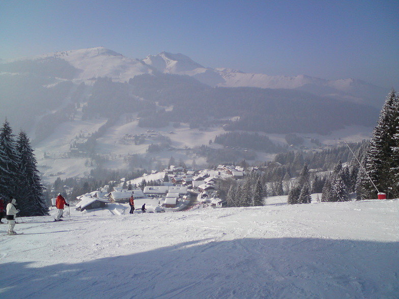


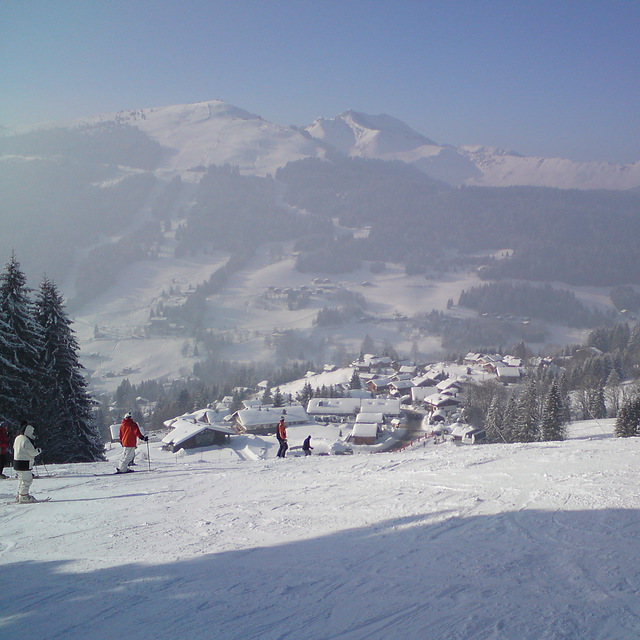
Morzine Weather (Next 3 days): The snow forecast for Morzine is: Light rain (total 3.0mm), mostly falling on Sat afternoon. Very mild (max 14°C on Mon afternoon, min 5°C on Sat night). Wind will be generally light.
Morzine Weather (Days 4-6): Light rain (total 4.0mm), mostly falling on Tue night. Very mild (max 17°C on Thu afternoon, min 9°C on Tue night). Wind will be generally light.
| Resort | Snow Depth | Temp. (°C) | Wind (km/h) | Weather | ||
|---|---|---|---|---|---|---|
| Top Lift: | 7 | |||||
| Middle Lift: | 12 | |||||
| Bottom Lift: | 16 |
Latest snow reports near Morzine:
Light rain reported from Sion at 339 metres elevation 5 kms WNW of Thyon-Printze but it is forecast cold enough for snow at higher elevations in the ski area from Thyon-Printze
Drizzle reported from Sion at 339 metres elevation 5 kms WNW of Thyon-Printze but it is forecast cold enough for snow at higher elevations in the ski area from Thyon-Printze

Sat 2 | Sunday 3 | Monday 4 | Tuesday 5 | Wednesday 6 | Thursday 7 | Friday 8 | ||||||||||||||
PM | night | AM | PM | night | AM | PM | night | AM | PM | night | AM | PM | night | AM | PM | night | AM | PM | night | |
rain shwrs | rain shwrs | clear | some clouds | some clouds | some clouds | some clouds | clear | clear | rain shwrs | rain shwrs | cloudy | cloudy | clear | clear | clear | clear | clear | some clouds | some clouds | |
km/h | ||||||||||||||||||||
Snow map |  |  |  |  |  |  |  | |||||||||||||
— | — | — | — | — | — | — | — | — | — | — | — | — | — | — | — | — | — | — | — | |
1 | 2 | — | — | — | — | — | — | — | 1 | 3 | — | — | — | — | — | — | — | — | — | |
max°C | 8 | 6 | 7 | 9 | 9 | 11 | 14 | 13 | 14 | 14 | 12 | 11 | 13 | 12 | 15 | 17 | 16 | 17 | 19 | 18 |
min°C | 7 | 5 | 5 | 9 | 8 | 9 | 13 | 13 | 13 | 14 | 9 | 10 | 11 | 11 | 12 | 16 | 16 | 16 | 19 | 16 |
6 | 4 | 3 | 7 | 6 | 7 | 12 | 13 | 13 | 13 | 9 | 10 | 11 | 11 | 12 | 16 | 16 | 16 | 19 | 16 | |
65 | 83 | 64 | 63 | 66 | 53 | 57 | 55 | 52 | 69 | 68 | 55 | 52 | 51 | 35 | 38 | 43 | 41 | 39 | 51 | |
2850 | 2850 | 3200 | 3250 | 3850 | 4050 | 4200 | 4500 | 4300 | 3950 | 3900 | 4200 | 4150 | 4400 | 4500 | 4550 | 4550 | 4500 | 4550 | 4450 | |
— | — | 6:16 | — | — | 6:16 | — | — | 6:18 | — | — | 6:20 | — | — | 6:20 | — | — | 6:22 | — | — | |
— | 9:01 | — | — | 9:00 | — | — | 9:00 | — | — | 8:58 | — | — | 8:57 | — | — | 8:54 | — | — | 8:53 | |
Light rain (total 3.0mm), mostly falling on Sat afternoon. Very mild (max 14°C on Mon afternoon, min 5°C on Sat night). Wind will be generally light.
Light rain (total 4.0mm), mostly falling on Tue night. Very mild (max 17°C on Thu afternoon, min 9°C on Tue night). Wind will be generally light.
Latest snow reports near Morzine:
Light rain reported from Sion at 339 metres elevation 5 kms WNW of Thyon-Printze but it is forecast cold enough for snow at higher elevations in the ski area from Thyon-Printze
Drizzle reported from Sion at 339 metres elevation 5 kms WNW of Thyon-Printze but it is forecast cold enough for snow at higher elevations in the ski area from Thyon-Printze
| Top snow depth: | — |
|---|---|
| Bottom snow depth: | — |
| Fresh snowfall depth: | — |
| Last snowfall: | 7 May 2025 |
| Snow Alerts | Create Alert |
0.0 | Bluebird Powder days Fresh snow, mostly sunny, light wind. |
|---|---|
0.0 | Powder days Fresh snow, limited sun, any wind. |
0.0 | Bluebird days Average snow, mostly sunny, light wind. |


The above table gives the weather forecast for Morzine at the specific elevation of 2019 m. Our sophisticated weather models allow us to provide snow forecasts for the top, middle and bottom ski stations of Morzine. To access the weather forecasts for the other elevations, use the tab navigation above the table. For a wider view of the weather, check out the Weather Map of France.
Click here to read further information on freezing levels and how we forecast our temperatures.
Overall 4.5 Based on 79 votes and 114 reviews
Been skiing a while but oddly never in PDS. But I had friends going so drove to meet them for a few days. SOOO disappointed! The skiing/altitude is what it is and you can always find something good and we were blessed with great snow. But the town itself was a real let down, bit grotty, spread out and full of grizzly middle aged men reliving their youth and worse, pathetically trying to ‘pull’. Overpriced, low quality tourist trap milking it’s proximity to GVA for weekenders. Left early.
Chris W from United Kingdom writes:
Been skiing a while but oddly never in PDS. But I had friends going so drove to meet them for a few days. SOOO disappointed! The skiing/altitude is what it is and you can always find something good and we were blessed with great snow. But the town itself was a real let down, bit grotty, spread out and full of grizzly middle aged men reliving their youth and worse, pathetically trying to ‘pull’. Overpriced, low quality tourist trap milking it’s proximity to GVA for weekenders. Left early.
The Morzine skiing weather widget is available to embed on external websites free of charge. It provides a daily summary of our Morzine snow forecast and current weather conditions. Simply go to the feed configuration page and follow the 3 simple steps to grab the custom html code snippet and paste it into your own site. You can choose the snow forecast elevation (summit, mid-mountain or bottom lift) and metric/imperial units for the snow forecast feed to suit your own website…. Click here to get the code.
View detailed snow forecast for Morzine at:
snow-forecast.com


 Nearest