
Galdhøpiggen Holds Out as Scandinavia’s Last Ski Zone Standing
Updated July 16, 2025: Saas Fee kicks off the 2025–26 ski season, fresh snow dusts Banff, and Timberline still spins—discover where summer turns are on now!
By using Snow-Forecast, you agree to our Terms & Services.
Don't have an account? Join now
Alternatively, you can now use your Outside account to sign in to any brand in the Outside digital ecosystem, including Snow-Forecast, Surf-Forecast, and Mountain-Forecast.


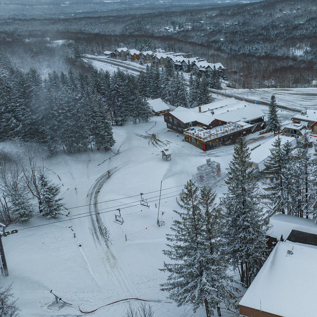
Mont Sutton Weather (Next 3 days): The snow forecast for Mont Sutton is: Light rain (total 7.0mm), mostly falling on Sun night. Warm (max 20°C on Sat afternoon, min 6°C on Sun night). Wind will be generally light.
Mont Sutton Weather (Days 4-6): Heavy rain (total 24.0mm), heaviest during Wed night. Warm (max 21°C on Wed afternoon, min 6°C on Mon night). Winds increasing (calm on Tue night, fresh winds from the SW by Wed afternoon).
| Resort | Snow Depth | Temp. (°C) | Wind (km/h) | Weather | ||
|---|---|---|---|---|---|---|
| Top Lift: | 9 | |||||
| Middle Lift: | 11 | |||||
| Bottom Lift: | 12 |
Latest snow reports near Mont Sutton:

Friday 18 | Saturday 19 | Sunday 20 | Monday 21 | Tuesday 22 | Wednesday 23 | Thursday 24 | |||||||||||||||
AM | PM | night | AM | PM | night | AM | PM | night | AM | PM | night | AM | PM | night | AM | PM | night | AM | PM | night | |
clear | clear | clear | some clouds | some clouds | light rain | light rain | rain shwrs | rain shwrs | some clouds | rain shwrs | clear | clear | clear | some clouds | cloudy | cloudy | heavy rain | risk thun- der | light rain | clear | |
km/h | |||||||||||||||||||||
Snow map |  |  |  |  |  |  |  | ||||||||||||||
— | — | — | — | — | — | — | — | — | — | — | — | — | — | — | — | — | — | — | — | — | |
— | — | — | — | — | 1 | 1 | 2 | 3 | — | 1 | — | — | — | — | — | — | 23 | 4 | 4 | — | |
max°C | 13 | 16 | 15 | 17 | 20 | 18 | 15 | 17 | 13 | 9 | 10 | 10 | 12 | 15 | 15 | 18 | 21 | 18 | 17 | 17 | 15 |
min°C | 11 | 15 | 13 | 15 | 19 | 14 | 15 | 16 | 6 | 7 | 10 | 6 | 9 | 14 | 13 | 16 | 21 | 17 | 17 | 16 | 13 |
8 | 14 | 13 | 14 | 19 | 12 | 14 | 15 | 3 | 4 | 7 | 4 | 7 | 14 | 13 | 15 | 21 | 16 | 17 | 16 | 13 | |
61 | 58 | 61 | 52 | 45 | 84 | 87 | 76 | 86 | 76 | 70 | 77 | 51 | 43 | 55 | 50 | 56 | 99 | 97 | 95 | 87 | |
3600 | 3500 | 3250 | 3600 | 3800 | 3650 | 3350 | 3300 | 2450 | 2100 | 2700 | 2600 | 3450 | 3800 | 3850 | 4300 | 4500 | 4400 | 4050 | 3900 | 4100 | |
5:18 | — | — | 5:20 | — | — | 5:20 | — | — | 5:22 | — | — | 5:22 | — | — | 5:24 | — | — | 5:24 | — | — | |
— | — | 8:31 | — | — | 8:30 | — | — | 8:30 | — | — | 8:29 | — | — | 8:28 | — | — | 8:27 | — | — | 8:25 | |
Light rain (total 7.0mm), mostly falling on Sun night. Warm (max 20°C on Sat afternoon, min 6°C on Sun night). Wind will be generally light.
Heavy rain (total 24.0mm), heaviest during Wed night. Warm (max 21°C on Wed afternoon, min 6°C on Mon night). Winds increasing (calm on Tue night, fresh winds from the SW by Wed afternoon).
Latest snow reports near Mont Sutton:
| Top snow depth: | — |
|---|---|
| Bottom snow depth: | — |
| Fresh snowfall depth: | — |
| Last snowfall: | 24 May 2025 |
| Snow Alerts | Create Alert |
0.0 | Bluebird Powder days Fresh snow, mostly sunny, light wind. |
|---|---|
0.0 | Powder days Fresh snow, limited sun, any wind. |
0.0 | Bluebird days Average snow, mostly sunny, light wind. |
The above table gives the weather forecast for Mont Sutton at the specific elevation of 740 m. Our sophisticated weather models allow us to provide snow forecasts for the top, middle and bottom ski stations of Mont Sutton. To access the weather forecasts for the other elevations, use the tab navigation above the table. For a wider view of the weather, check out the Weather Map of Canada.
Click here to read further information on freezing levels and how we forecast our temperatures.
Overall 4.0 Based on 7 votes and 4 reviews
Lundi 2 janvier 2017 - Wow! Domaine skiable 100%?ouvertincluant les3 superbes pistes du Sud . Bonne base de début de saison consolidé avec lus de 55 cm de nouvelle neige en une semaine, combiné avec du très bon travail de damsge. Et en plus le soleil était au RDV avec des températures clémentes . Perfect ski day.
Bernard Mailhot from Canada writes:
Lundi 2 janvier 2017 - Wow! Domaine skiable 100%?ouvertincluant les3 superbes pistes du Sud .
Bonne base de début de saison consolidé avec lus de 55 cm de nouvelle neige en une semaine, combiné avec du très bon travail de damsge.
Et en plus le soleil était au RDV avec des températures clémentes .
Perfect ski day.
The Mont Sutton skiing weather widget is available to embed on external websites free of charge. It provides a daily summary of our Mont Sutton snow forecast and current weather conditions. Simply go to the feed configuration page and follow the 3 simple steps to grab the custom html code snippet and paste it into your own site. You can choose the snow forecast elevation (summit, mid-mountain or bottom lift) and metric/imperial units for the snow forecast feed to suit your own website…. Click here to get the code.
View detailed snow forecast for Mont Sutton at:
snow-forecast.com


 Nearest