

Portillo Storm Snowfall Total Passes 5m / 17 Feet
A snow storm that has now continued for nine days has taken Chilean ski resort Portillo to a snowfall total of 5.2 metres (17 feet) so far, with more snow forecast.

Next 3 days weather summary:Moderate rain (total 14.0mm), heaviest on Thu afternoon. Warm (max 26°C on Sat afternoon, min 14°C on Thu night). Wind will be generally light. | Days 4-6 weather summary:Heavy rain (total 40.0mm), heaviest during Mon night. Warm (max 25°C on Sun afternoon, min 18°C on Sun night). Wind will be generally light. | |||||||||||||||||
Thursday 30 | Friday 31 | Saturday 1 | Sunday 2 | Monday 3 | Tuesday 4 | |||||||||||||
AM | PM | night | AM | PM | night | AM | PM | night | AM | PM | night | AM | PM | night | AM | PM | night | |
cloudy | mod. rain | light rain | rain shwrs | rain shwrs | rain shwrs | clear | some clouds | cloudy | cloudy | t-storm risk | light rain | cloudy | light rain | heavy rain | cloudy | t-storm risk | t-storm risk | |
km/h | ||||||||||||||||||
Snow map |  |  |  |  |  |  | ||||||||||||
— | — | — | — | — | — | — | — | — | — | — | — | — | — | — | — | — | — | |
mm | — | 6 | 3 | 1 | 3 | 1 | — | — | — | — | 1 | 5 | — | 4 | 20 | — | 5 | 5 |
max °C | 20 | 19 | 17 | 20 | 21 | 18 | 24 | 26 | 21 | 22 | 25 | 19 | 23 | 20 | 18 | 21 | 22 | 20 |
min °C | 16 | 18 | 14 | 16 | 19 | 15 | 19 | 25 | 18 | 20 | 22 | 18 | 19 | 18 | 18 | 18 | 22 | 19 |
chill °C | 16 | 18 | 14 | 16 | 19 | 15 | 19 | 25 | 18 | 20 | 22 | 18 | 19 | 18 | 18 | 18 | 22 | 19 |
Humid % | 71 | 83 | 88 | 75 | 75 | 87 | 58 | 54 | 67 | 68 | 69 | 87 | 63 | 98 | 100 | 85 | 87 | 92 |
Freeze m | 3350 | 3450 | 3400 | 3650 | 3750 | 4000 | 4200 | 4000 | 4000 | 4000 | 4100 | 4300 | 4400 | 4500 | 4500 | 4450 | 4600 | 4450 |
5:31 | — | — | 5:33 | — | — | 5:33 | — | — | 5:35 | — | — | 5:37 | — | — | 5:37 | — | — | |
— | — | 8:20 | — | — | 8:17 | — | — | 8:16 | — | — | 8:15 | — | — | 8:15 | — | — | 8:13 | |
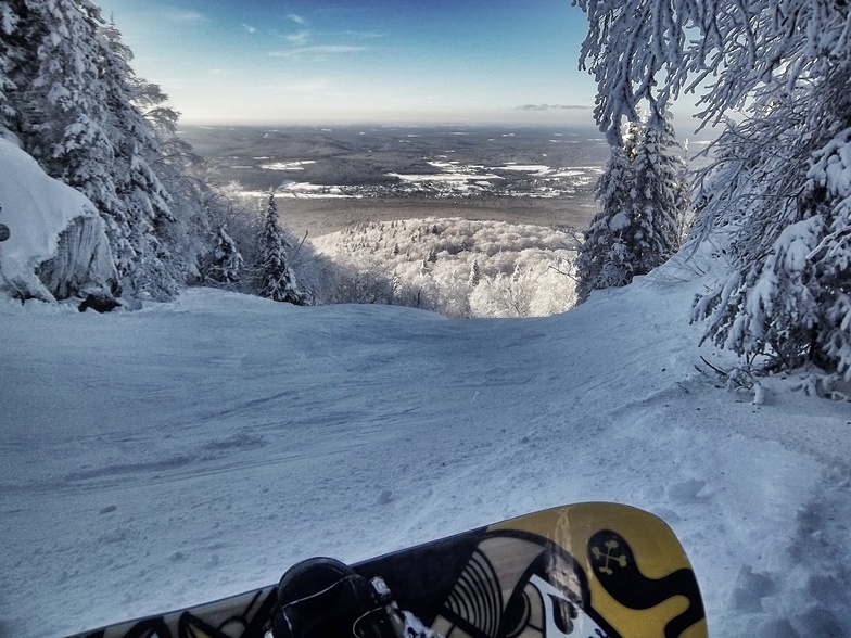
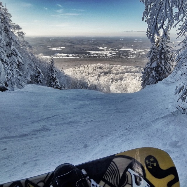
Go pro and carve into:
Avalanche information: Avalanche Canada
Latest snow reports near Mont Sutton:
| Top snow depth: | — |
|---|---|
| Bottom snow depth: | — |
| Fresh snowfall depth: | — |
| Last snowfall: | 7 May 2026 |
| Snow Alerts | Create Alert |
0.0 | Bluebird Powder days Fresh snow, mostly sunny, light wind. |
|---|---|
0.0 | Powder days Fresh snow, limited sun, any wind. |
0.0 | Bluebird days Average snow, mostly sunny, light wind. |
The above table gives the weather forecast for Mont Sutton at the specific elevation of 511 m. Our sophisticated weather models allow us to provide snow forecasts for the top, middle and bottom ski stations of Mont Sutton. To access the weather forecasts for the other elevations, use the tab navigation above the table. For a wider view of the weather, check out the Weather Map of Canada.
Click here to read further information on freezing levels and how we forecast our temperatures.
Overall 3.8 Based on 17 votes and 4 reviews
Je vous encourage fortement a y aller. cette année, il est tomber plus de 400 cm à la base de la montagne, de neige au 25 Février 2010. Il vient de neiger 125 cm de neige à la base, et il tombe généralement 60 cm par semaine!:D
Olivier from Canada writes:
Je vous encourage fortement a y aller. cette année, il est tomber plus de 400 cm à la base de la montagne, de neige au 25 Février 2010. Il vient de neiger 125 cm de neige à la base, et il tombe généralement 60 cm par semaine!:D


 Nearest