Alternatively, you can now use your Outside account to sign in to any brand in the Outside digital ecosystem, including Snow-Forecast, Surf-Forecast, and Mountain-Forecast.
The snow forecast for Mayrhofen is: Heavy rain (total 55.0mm), heaviest during Sun morning. Very mild (max 19°C on Sat afternoon, min 10°C on Sun night). Wind will be generally light.
Mayrhofen Weather (Next 3 days): The snow forecast for Mayrhofen is: Heavy rain (total 55.0mm), heaviest during Sun morning. Very mild (max 19°C on Sat afternoon, min 10°C on Sun night). Wind will be generally light.
Mayrhofen Weather (Days 4-6): Heavy rain (total 55.0mm), heaviest during Mon night. Very mild (max 16°C on Mon morning, min 5°C on Wed night). Wind will be generally light.
Mayrhofen Live Weather
Resort
Snow Depth
Temp. (°C)
Wind (km/h)
Weather
Top Lift:
0.0m
10
Middle Lift:
14
Bottom Lift:
0.0m
18
Powered by Snow-Forecast.com
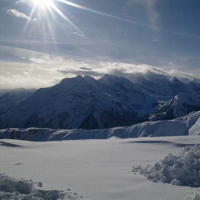
Mayrhofen Weather
(Next 3 days):
The snow forecast for Mayrhofen is: Heavy rain (total 55.0mm), heaviest during Sun morning. Very mild (max 19°C on Sat afternoon, min 10°C on Sun night). Wind will be generally light.
Mayrhofen Weather (Days 4-6):
Heavy rain (total 55.0mm), heaviest during Mon night. Very mild (max 16°C on Mon morning, min 5°C on Wed night). Wind will be generally light.
The above table gives the weather forecast for Mayrhofen at the specific elevation of 1565 m. Our sophisticated weather models allow us to provide snow forecasts for the top, middle and bottom ski stations of Mayrhofen. To access the weather forecasts for the other elevations, use the tab navigation above the table. For a wider view of the weather, check out the Weather Map of Austria.
Click here to read further information on freezing levels and how we forecast our temperatures.
I have read varied reports on Mayrhofen, but overall, I feel it does what it says on the tin.../it ban be wild, sedate or family fun, offering something for everyone. 1st, its a very quick transfer from Munich or Innsbruck (the latter airport can be tricky weather wise and flight cost) by car or train. 2nd, The new Penkenbahn gondola has by and large removed the congestion at peak times up and down. 3rd, The town offers a great mix of restaurants, bars and cafe's, good apres-ski at various points, Ice bar, Bruck and Stadl (typical Austrian fayre) and other quieter but nonetheless good fun. The 4th, Zillertell pass will at minimum connect you to Zell am Ziller, Hintertux and the main areas of Ahorn and Penken. For families you'll find the ski schools operating at the Penken and this means that parents can ski quite widely and always get back to the school area for lunch/meeting up etc, which is quite a bonus and reassuring. The pistes are a mix of blue crusing and red a little more challenging (yes, the piste ratings aren't as aggressive as France), but the blacks are genuinely achievable for a good/intermediate skier and the Harakiri brilliantly positioned for the adventurous and fun on fresh snow and deeply challenging in compact/ice conditions. Best viewed from a chairlift that passes up the side of the piste! So, it gets a big tick from me. Brits have been coming here for years for a reason. You should put this on your calendar, along with St Anton, 3 valleys, Morzine/Avoriaz, Zermatt, Dolomites, Espace Killy and Otzal valley (obergurgl, Hochgurgl, Solden) So naysayers, back in the box and try Mayrhofen. The deli at the bottom of the Penken is great fun and good value, Brasserie Q, Mr Lei's, Mo's Diner and Pane Vino great places to eat to name a few.
I have read varied reports on Mayrhofen, but overall, I feel it does what it says on the tin.../it ban be wild, sedate or family fun, offering something for everyone. 1st, its a very quick transfer from Munich or Innsbruck (the latter airport can be tricky weather wise and flight cost) by car or train. 2nd, The new Penkenbahn gondola has by and large removed the congestion at peak times up and down. 3rd, The town offers a great mix of restaurants, bars and cafe's, good apres-ski at various points, Ice bar, Bruck and Stadl (typical Austrian fayre) and other quieter but nonetheless good fun. The 4th, Zillertell pass will at minimum connect you to Zell am Ziller, Hintertux and the main areas of Ahorn and Penken. For families you'll find the ski schools operating at the Penken and this means that parents can ski quite widely and always get back to the school area for lunch/meeting up etc, which is quite a bonus and reassuring. The pistes are a mix of blue crusing and red a little more challenging (yes, the piste ratings aren't as aggressive as France), but the blacks are genuinely achievable for a good/intermediate skier and the Harakiri brilliantly positioned for the adventurous and fun on fresh snow and deeply challenging in compact/ice conditions. Best viewed from a chairlift that passes up the side of the piste! So, it gets a big tick from me. Brits have been coming here for years for a reason. You should put this on your calendar, along with St Anton, 3 valleys, Morzine/Avoriaz, Zermatt, Dolomites, Espace Killy and Otzal valley (obergurgl, Hochgurgl, Solden) So naysayers, back in the box and try Mayrhofen. The deli at the bottom of the Penken is great fun and good value, Brasserie Q, Mr Lei's, Mo's Diner and Pane Vino great places to eat to name a few.
Free Snow-Forecast.com weather widget for your website
The Mayrhofen skiing weather widget is available to embed on external websites free of charge. It provides a daily summary of our Mayrhofen snow forecast and current weather conditions. Simply go to the feed configuration page and follow the 3 simple steps to grab the custom html code snippet and paste it into your own site. You can choose the snow forecast elevation (summit, mid-mountain or bottom lift) and metric/imperial units for the snow forecast feed to suit your own website…. Click here to get the code.


 Nearest