Visiting Mauna Kea
Helpful resort information to assist planning your trip.
- Opens—
- Closes—
- Accommodation—
- Restaurants | Bars— | —
- Nearest Airport Honolulu
- Nearest Train Station —
- Tourist Office Website
- Tourist Office Phone—
- Avalanche information:
Mauna Kea Features
The terrain at Mauna Kea includes:
- Halfpipes—
- Terrain Parks—
- X-Country—
- Ski Hire—
What's it like at Mauna Kea?
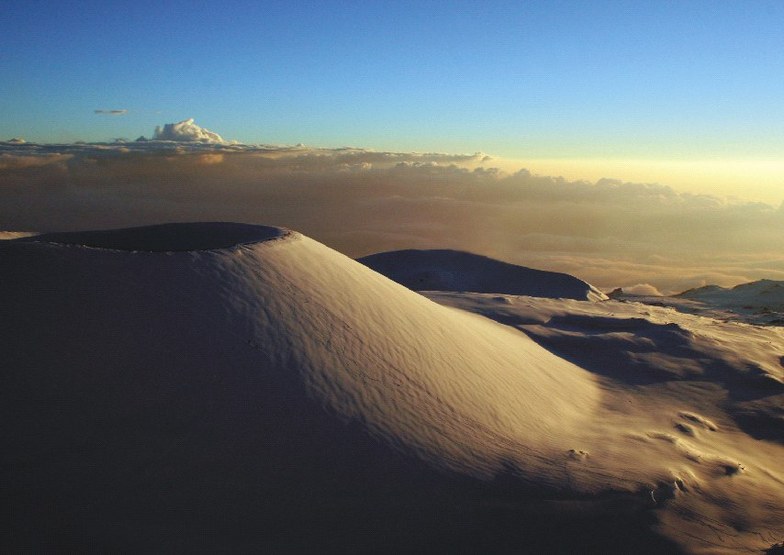
Mauna Kea, a dormant volcano, is one of the highest island mountains in the world. It is located on the main island of Hawaii along with its slightly smaller neighboring mountain, Mauna Loa (13,667 ft.). If Mauna Kea's height is measured from its base (18,000 feet below sea level), it surpasses even Mount Everest, and is the world's highest mountain (31,796 ft.). Although there is no historical record of Mauna Kea's eruption, geologic evidence suggests that the volcano last erupted around 1650, and eruptions are present in traditional Hawaiian folklore. According to legend, Mauna Kea and Mauna Loa were the domains of two opposing goddesses, Poliahu and Pele, respectively. Earthquakes and volcanic eruptions were produced from their violent rivalry.
Explore Mauna Kea Location Map
Interactive Mauna Kea trail map and piste map. View the piste and trails as well as the surrounding terrain and mountain contours for backcountry action. Find and compare nearby resorts by clicking on the resort markers.

When's the snowiest month to visit Mauna Kea?

Visitor Reviews of Mauna Kea
Grant Matsushige from United States writes:
Best snow ever. Thick powder with some cornballs and dingo balls. Rode from CHF down to Subaru with my skis. No wind. Lift tickets were $2.36 per lift. Snow bunnies galore! Temperature was about $9.65 at the bitcoin rate of 5% per #3 Look At Me.
Resorts close to Mauna Kea
Discover ski resorts near Mauna Kea. Click below to view there ski resort guides.
 Mt ShastaLast snow: 1.0 cm Wed 27 May
 Lifts: 4
 Pistes: 313951 km away
- Stover Mountain Ski AreaLast snow: 1.0 cm Sun 26 AprLifts: 1Pistes: —3963 km away
- Dodge RidgeLast snow: 3.0 cm Thu 28 MayLifts: 12Pistes: 303979 km away
- Yosemite-Badger Pass Ski AreaLast snow: 3.0 cm Thu 28 MayLifts: 5Pistes: 103982 km away
 Nearest