

Portillo Storm Snowfall Total Passes 5m / 17 Feet
A snow storm that has now continued for nine days has taken Chilean ski resort Portillo to a snowfall total of 5.2 metres (17 feet) so far, with more snow forecast.

Next 3 days weather summary:Heavy rain (total 36.0mm), heaviest during Fri afternoon. Very mild (max 19°C on Thu afternoon, min 14°C on Wed morning). Wind will be generally light. | Days 4-6 weather summary:Heavy rain (total 42.0mm), heaviest during Sun night. Very mild (max 18°C on Sat morning, min 13°C on Sun night). Wind will be generally light. | |||||||||||||||||
Wednesday 29 | Thursday 30 | Friday 31 | Saturday 1 | Sunday 2 | Monday 3 | |||||||||||||
AM | PM | night | AM | PM | night | AM | PM | night | AM | PM | night | AM | PM | night | AM | PM | night | |
t-storm risk | t-storm risk | rain shwrs | clear | t-storm risk | rain shwrs | clear | mod. rain | rain shwrs | some clouds | light rain | rain shwrs | rain shwrs | mod. rain | heavy rain | rain shwrs | t-storm risk | rain shwrs | |
km/h | ||||||||||||||||||
Snow map |  |  |  |  |  |  | ||||||||||||
— | — | — | — | — | — | — | — | — | — | — | — | — | — | — | — | — | — | |
mm | 3 | 7 | 3 | — | 1 | 4 | — | 8 | 10 | — | 2 | 1 | 1 | 8 | 15 | 2 | 4 | 9 |
max °C | 15 | 17 | 16 | 18 | 19 | 18 | 19 | 19 | 16 | 18 | 17 | 16 | 16 | 16 | 16 | 16 | 17 | 15 |
min °C | 14 | 16 | 15 | 16 | 19 | 16 | 17 | 17 | 14 | 16 | 16 | 15 | 15 | 16 | 13 | 15 | 17 | 14 |
chill °C | 14 | 16 | 15 | 16 | 19 | 16 | 17 | 17 | 13 | 16 | 16 | 15 | 15 | 16 | 13 | 15 | 17 | 14 |
Humid % | 77 | 68 | 67 | 33 | 54 | 56 | 47 | 66 | 51 | 49 | 54 | 55 | 73 | 76 | 78 | 64 | 62 | 72 |
Freeze m | 4400 | 4600 | 4450 | 4600 | 4650 | 4600 | 4650 | 4550 | 4650 | 4550 | 4650 | 4550 | 4550 | 4550 | 4450 | 4450 | 4550 | 4400 |
6:05 | — | — | 6:07 | — | — | 6:07 | — | — | 6:09 | — | — | 6:11 | — | — | 6:11 | — | — | |
— | — | 9:01 | — | — | 9:00 | — | — | 8:59 | — | — | 8:58 | — | — | 8:57 | — | — | 8:54 | |
Go pro and carve into:
Avalanche information: European Avalanche Warning Services (EAWS)
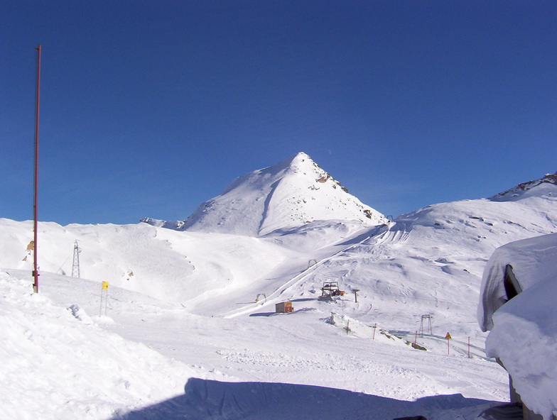
Latest snow reports near Macugnaga:
| Top snow depth: | 0 cm |
|---|---|
| Bottom snow depth: | 0 cm |
| Fresh snowfall depth: | — |
| Last snowfall: | 18 May 2026 |
| Snow Alerts | Create Alert |
0.0 | Bluebird Powder days Fresh snow, mostly sunny, light wind. |
|---|---|
0.0 | Powder days Fresh snow, limited sun, any wind. |
0.0 | Bluebird days Average snow, mostly sunny, light wind. |
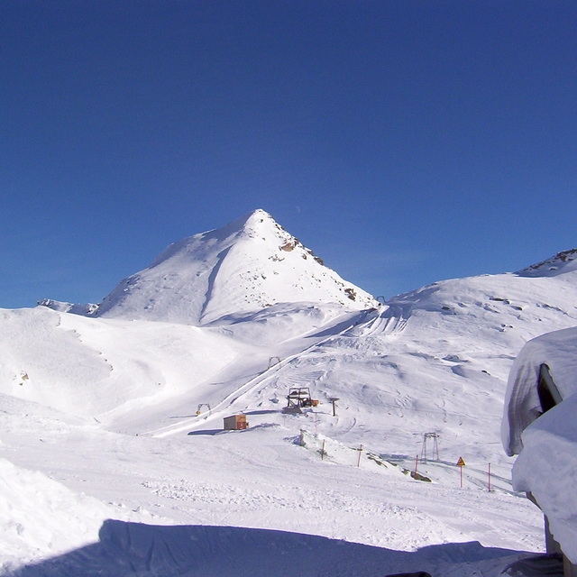
The above table gives the weather forecast for Macugnaga at the specific elevation of 2150 m. Our sophisticated weather models allow us to provide snow forecasts for the top, middle and bottom ski stations of Macugnaga. To access the weather forecasts for the other elevations, use the tab navigation above the table. For a wider view of the weather, check out the Weather Map of Italy.
Click here to read further information on freezing levels and how we forecast our temperatures.
Overall 3.6 Based on 20 votes and 17 reviews
I went in the winter of 1998 or 1999 I think. First time on piste on a chairlift when there was a huge avalanche. Does anyone remember this?
Mark from United Kingdom writes:
I went in the winter of 1998 or 1999 I think. First time on piste on a chairlift when there was a huge avalanche. Does anyone remember this?


 Nearest