

Global Weekly Snow Roundup #320
Weekly Snow News for the world, updated 25 June 2026: Chile and New Zealand's seasons proper set to begin, Tignes and Sunshine reopen for summer skiing. weekend as Riksgransen ends its 2026 season.

Next 4 days weather summary:Heavy rain (total 47.0mm), heaviest during Sun afternoon. Very mild (max 14°C on Sat afternoon, min 9°C on Mon afternoon). Wind will be generally light. | Days 5-7 weather summary:Heavy rain (total 32.0mm), heaviest during Mon night. Very mild (max 10°C on Mon night, min 2°C on Wed night). Wind will be generally light. | |||||||||||||||
Saturday 27 | Sunday 28 | Monday 29 | Tuesday 30 | Wednesday 1 | ||||||||||||
night | AM | PM | night | AM | PM | night | AM | PM | night | AM | PM | night | AM | PM | night | |
t-storm risk | some clouds | t-storm risk | rain shwrs | t-storm risk | heavy rain | rain shwrs | rain shwrs | rain shwrs | rain shwrs | light rain | mod. rain | rain shwrs | light rain | rain shwrs | rain shwrs | |
km/h | ||||||||||||||||
Snow map |  |  |  |  |  |  | ||||||||||
— | — | — | — | — | — | — | — | — | — | — | — | — | — | — | — | |
mm | 3 | — | 4 | 9 | 3 | 13 | 7 | 1 | 7 | 8 | 3 | 9 | 5 | 4 | 2 | 1 |
max °C | 13 | 13 | 14 | 12 | 12 | 13 | 11 | 11 | 12 | 10 | 9 | 9 | 9 | 6 | 5 | 3 |
min °C | 11 | 12 | 14 | 11 | 12 | 10 | 10 | 10 | 9 | 9 | 9 | 9 | 7 | 4 | 5 | 2 |
chill °C | 11 | 12 | 14 | 10 | 11 | 9 | 10 | 10 | 8 | 8 | 9 | 8 | 6 | 1 | 2 | -2 |
Humid % | 73 | 74 | 66 | 69 | 68 | 78 | 65 | 68 | 88 | 76 | 82 | 81 | 83 | 96 | 77 | 76 |
Freeze m | 4550 | 4550 | 4750 | 4600 | 4550 | 4400 | 4550 | 4400 | 4300 | 4250 | 4150 | 4200 | 4100 | 3500 | 3450 | 3100 |
— | 5:28 | — | — | 5:28 | — | — | 5:28 | — | — | 5:28 | — | — | 5:30 | — | — | |
— | — | — | 9:15 | — | — | 9:15 | — | — | 9:15 | — | — | 9:15 | — | — | 9:15 | |
Go pro and carve into:
Avalanche information: European Avalanche Warning Services (EAWS)
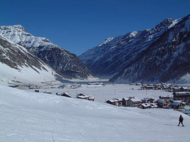
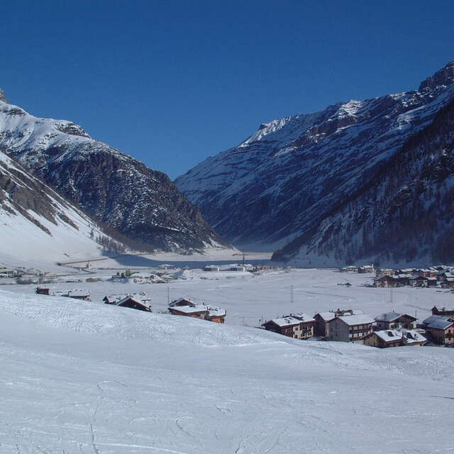
Latest snow reports near Livigno:
| Top snow depth: | 0 cm |
|---|---|
| Bottom snow depth: | 0 cm |
| Fresh snowfall depth: | — |
| Last snowfall: | 10 Jun 2026 |
| Snow Alerts | Create Alert |
0.1 | Bluebird Powder days Fresh snow, mostly sunny, light wind. |
|---|---|
0.4 | Powder days Fresh snow, limited sun, any wind. |
0.0 | Bluebird days Average snow, mostly sunny, light wind. |
The above table gives the weather forecast for Livigno at the specific elevation of 2797 m. Our sophisticated weather models allow us to provide snow forecasts for the top, middle and bottom ski stations of Livigno. To access the weather forecasts for the other elevations, use the tab navigation above the table. For a wider view of the weather, check out the Weather Map of Italy.
Click here to read further information on freezing levels and how we forecast our temperatures.
Overall 4.6 Based on 71 votes and 78 reviews
This year me and 11 other friends decided to do our ski vacation in Livigno because the date that worked out for us was the beginning of December And I must say we had a lot of fun. It was a bit of a gamble but there was enough snow to open most of the site and as we have only been skiing for 5 years it was definitely enough for us Everything is well maintained and taken care of. The emptiest time of the year. We didn't wait more than 2 minutes in any elevator or gondola. I recommend finding out before going out when there is no traffic, it's just a pleasure to surf the site almost alone There were quantities of new off-piste that no human foot had touched...
Ezra from Israel writes:
This year me and 11 other friends decided to do our ski vacation in Livigno because the date that worked out for us was the beginning of December
And I must say we had a lot of fun. It was a bit of a gamble but there was enough snow to open most of the site and as we have only been skiing for 5 years it was definitely enough for us
Everything is well maintained and taken care of. The emptiest time of the year. We didn't wait more than 2 minutes in any elevator or gondola.
I recommend finding out before going out when there is no traffic, it's just a pleasure to surf the site almost alone
There were quantities of new off-piste that no human foot had touched...


 Nearest