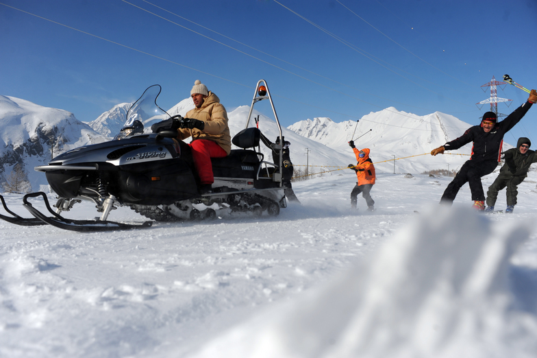


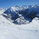
Portillo Re-Opens To Guests Arriving By Helicopter
Chile’s famous Portillo ski resort is reported to have re-opened to guests arriving by helicopter after being cut off by road for more than two weeks by over 6m/20 feet of snowfall.

Next 3 days weather summary:Heavy rain (total 25.0mm), heaviest during Tue afternoon. Warm (max 20°C on Mon afternoon, min 12°C on Mon night). Wind will be generally light. | Days 4-6 weather summary:Moderate rain (total 14.0mm), heaviest on Thu afternoon. Very mild (max 19°C on Thu afternoon, min 12°C on Thu night). Wind will be generally light. | |||||||||||||||||
Monday 3 | Tuesday 4 | Wednesday 5 | Thursday 6 | Friday 7 | Saturday 8 | |||||||||||||
AM | PM | night | AM | PM | night | AM | PM | night | AM | PM | night | AM | PM | night | AM | PM | night | |
t-storm risk | t-storm risk | rain shwrs | t-storm risk | mod. rain | rain shwrs | clear | light rain | rain shwrs | clear | t-storm risk | rain shwrs | clear | t-storm risk | rain shwrs | clear | clear | clear | |
km/h | ||||||||||||||||||
Snow map |  |  |  |  |  |  | ||||||||||||
— | — | — | — | — | — | — | — | — | — | — | — | — | — | — | — | — | — | |
mm | 1 | 2 | 3 | 1 | 6 | 7 | — | 3 | 2 | — | 8 | 4 | — | 1 | 1 | — | — | — |
max °C | 18 | 20 | 17 | 17 | 19 | 16 | 17 | 19 | 16 | 18 | 19 | 14 | 15 | 18 | 14 | 16 | 18 | 16 |
min °C | 14 | 17 | 12 | 13 | 17 | 13 | 15 | 18 | 15 | 15 | 14 | 12 | 12 | 17 | 13 | 13 | 18 | 14 |
chill °C | 14 | 17 | 12 | 13 | 17 | 13 | 15 | 18 | 15 | 15 | 14 | 12 | 12 | 17 | 13 | 13 | 18 | 14 |
Humid % | 54 | 62 | 81 | 60 | 61 | 73 | 56 | 61 | 64 | 46 | 84 | 82 | 57 | 65 | 74 | 54 | 41 | 48 |
Freeze m | 4500 | 4550 | 4450 | 4450 | 4450 | 4450 | 4400 | 4500 | 4500 | 4400 | 4400 | 4250 | 4200 | 4350 | 4350 | 4250 | 4400 | 4400 |
6:16 | — | — | 6:18 | — | — | 6:18 | — | — | 6:20 | — | — | 6:20 | — | — | 6:22 | — | — | |
— | — | 8:59 | — | — | 8:57 | — | — | 8:55 | — | — | 8:53 | — | — | 8:52 | — | — | 8:52 | |
Go pro and carve into:
Avalanche information: European Avalanche Warning Services (EAWS)
Latest snow reports near La Thuile:
| Top snow depth: | 0 cm |
|---|---|
| Bottom snow depth: | 0 cm |
| Fresh snowfall depth: | — |
| Last snowfall: | 16 May 2026 |
| Snow Alerts | Create Alert |
0.0 | Bluebird Powder days Fresh snow, mostly sunny, light wind. |
|---|---|
0.0 | Powder days Fresh snow, limited sun, any wind. |
0.0 | Bluebird days Average snow, mostly sunny, light wind. |
The above table gives the weather forecast for La Thuile at the specific elevation of 2046 m. Our sophisticated weather models allow us to provide snow forecasts for the top, middle and bottom ski stations of La Thuile. To access the weather forecasts for the other elevations, use the tab navigation above the table. For a wider view of the weather, check out the Weather Map of Italy.
Click here to read further information on freezing levels and how we forecast our temperatures.
Overall 3.8 Based on 42 votes and 37 reviews
Just back from La Thuile. Truly a hidden gem. If you are an intermediate cruiser you will find fantastic long runs that go from valley to valley, with excellent lifts, well groomed slopes and the variety aspect; to ski over to France (on the same ski pass). In the village we stayed at the 5 star Montana Lodge, which was worth every penny and it costed less than a 3 star hotel in Courchevel, but was truly 5 star. Minimal lift queues, excellent views, good snow and a charming village. Mountain huts have charm (but the food in Corvara, Courmayeur is better).
walter from South Africa writes:
Just back from La Thuile. Truly a hidden gem. If you are an intermediate cruiser you will find fantastic long runs that go from valley to valley, with excellent lifts, well groomed slopes and the variety aspect; to ski over to France (on the same ski pass). In the village we stayed at the 5 star Montana Lodge, which was worth every penny and it costed less than a 3 star hotel in Courchevel, but was truly 5 star. Minimal lift queues, excellent views, good snow and a charming village. Mountain huts have charm (but the food in Corvara, Courmayeur is better).


 Nearest