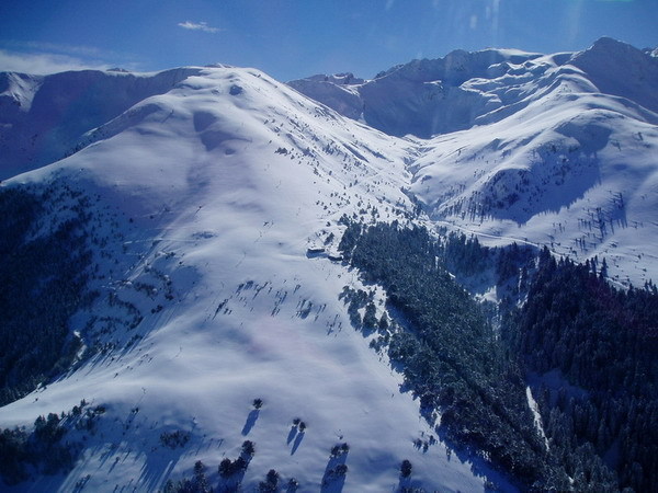


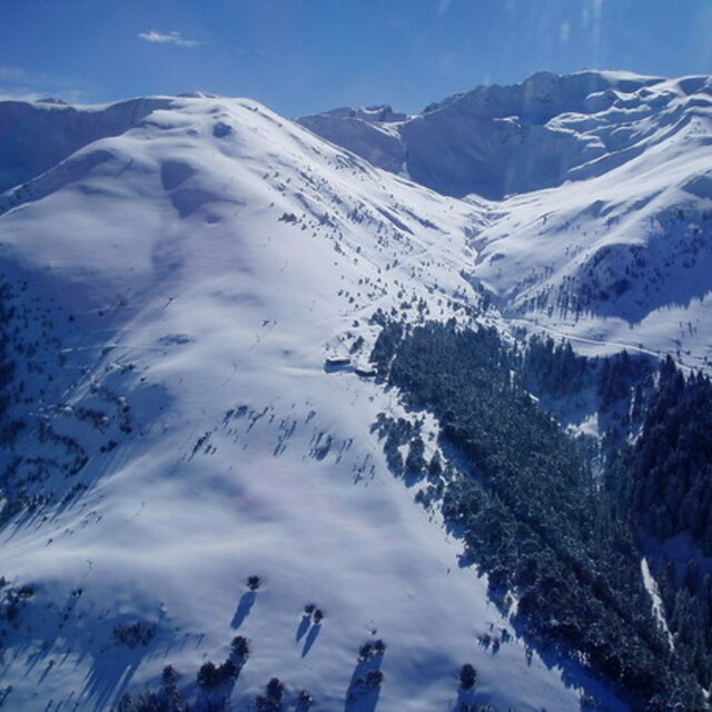
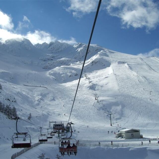
Portillo Storm Snowfall Total Passes 5m / 17 Feet
A snow storm that has now continued for nine days has taken Chilean ski resort Portillo to a snowfall total of 5.2 metres (17 feet) so far, with more snow forecast.

Next 3 days weather summary:Mostly dry. Warm (max 32°C on Thu afternoon, min 20°C on Wed morning). Mainly strong winds. | Days 4-6 weather summary:Mostly dry. Warm (max 31°C on Sat afternoon, min 15°C on Mon night). Mainly fresh winds. | |||||||||||||||||
Wednesday 29 | Thursday 30 | Friday 31 | Saturday 1 | Sunday 2 | Monday 3 | |||||||||||||
AM | PM | night | AM | PM | night | AM | PM | night | AM | PM | night | AM | PM | night | AM | PM | night | |
clear | clear | clear | clear | some clouds | some clouds | some clouds | some clouds | clear | clear | clear | clear | clear | clear | some clouds | some clouds | clear | clear | |
km/h | ||||||||||||||||||
Snow map |  |  |  |  |  |  | ||||||||||||
— | — | — | — | — | — | — | — | — | — | — | — | — | — | — | — | — | — | |
mm | — | — | — | — | — | — | — | — | — | — | — | — | — | — | — | — | — | — |
max °C | 27 | 31 | 29 | 26 | 32 | 30 | 26 | 30 | 29 | 25 | 31 | 30 | 24 | 29 | 27 | 22 | 27 | 26 |
min °C | 20 | 29 | 20 | 21 | 30 | 22 | 21 | 30 | 20 | 20 | 30 | 19 | 18 | 28 | 17 | 16 | 26 | 15 |
chill °C | 20 | 29 | 20 | 21 | 30 | 22 | 21 | 30 | 20 | 20 | 30 | 19 | 18 | 28 | 17 | 16 | 26 | 15 |
Humid % | 26 | 17 | 21 | 25 | 16 | 18 | 22 | 16 | 20 | 22 | 12 | 18 | 28 | 17 | 29 | 38 | 19 | 40 |
Freeze m | 4850 | 4950 | 4800 | 4900 | 4950 | 4800 | 4750 | 4850 | 4850 | 4750 | 5000 | 4850 | 4700 | 4800 | 4750 | 4700 | 4750 | 4850 |
7:05 | — | — | 7:05 | — | — | 7:07 | — | — | 7:07 | — | — | 7:09 | — | — | 7:09 | — | — | |
— | — | 9:34 | — | — | 9:32 | — | — | 9:31 | — | — | 9:30 | — | — | 9:30 | — | — | 9:28 | |
Go pro and carve into:
Avalanche information: European Avalanche Warning Services (EAWS)
Latest snow reports near La-Pinilla:
| Top snow depth: | — |
|---|---|
| Bottom snow depth: | — |
| Fresh snowfall depth: | — |
| Last snowfall: | 15 May 2026 |
| Snow Alerts | Create Alert |
0.0 | Bluebird Powder days Fresh snow, mostly sunny, light wind. |
|---|---|
0.0 | Powder days Fresh snow, limited sun, any wind. |
0.0 | Bluebird days Average snow, mostly sunny, light wind. |
The above table gives the weather forecast for La-Pinilla at the specific elevation of 1500 m. Our sophisticated weather models allow us to provide snow forecasts for the top, middle and bottom ski stations of La-Pinilla. To access the weather forecasts for the other elevations, use the tab navigation above the table. For a wider view of the weather, check out the Weather Map of Spain.
Click here to read further information on freezing levels and how we forecast our temperatures.
Overall 3.1 Based on 22 votes and 10 reviews
Lo tiene todo para ser la mejor estación del Sistema Central, por su variedad de pistas, algunas muy anchas y otras entre bosques, por su insuperable superficie indicada y por tener una enorme cantidad de pistas rojas... Pero desde los últimos años la gestión ha empeorado a gran velocidad, y se hace un uso muy limitado de sus cañones, se cierran remontes sin motivo y el pisado de pistas es tan malo que hay serio peligro en sus pistas.. Una pena.
Alejandro Fernández from Spain writes:
Lo tiene todo para ser la mejor estación del Sistema Central, por su variedad de pistas, algunas muy anchas y otras entre bosques, por su insuperable superficie indicada y por tener una enorme cantidad de pistas rojas... Pero desde los últimos años la gestión ha empeorado a gran velocidad, y se hace un uso muy limitado de sus cañones, se cierran remontes sin motivo y el pisado de pistas es tan malo que hay serio peligro en sus pistas.. Una pena.


 Nearest