The above table gives the weather forecast for Hochzeiger at the specific elevation of 1455 m. Our sophisticated weather models allow us to provide snow forecasts for the top, middle and bottom ski stations of Hochzeiger. To access the weather forecasts for the other elevations, use the tab navigation above the table. For a wider view of the weather, check out the Weather Map of Austria.
Click here to read further information on freezing levels and how we forecast our temperatures.
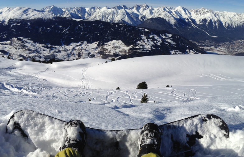
Hochzeiger resort is a great place to find that has not been over run by Brits. I have been going to this area since my army days of serious cross country skiing in 1967, when I was fit. My German friend introduced me to Hochzeiger 10 years ago and we normally stay in Wenns 6kms away. The hotel Schirgantblick is fantastic and will pick you up from the bars at the bottom of the lifts if you miss the last bus. The costs at this resort are a fraction of the large ones like St Anton. Last year, Feb 2008, we didn't come across any other Brits in the area and the hotel found us almost a novelty. Can't fault Hochzeiger, except my wife isn't keen on the free bus from Wenns (20mins) and 20 hairpin bends. Recommend it but fly to Innsbruck as the journey is only 55mins and the hotel will collect you free of charge.
Hochzeiger resort is a great place to find that has not been over run by Brits. I have been going to this area since my army days of serious cross country skiing in 1967, when I was fit. My German friend introduced me to Hochzeiger 10 years ago and we normally stay in Wenns 6kms away. The hotel Schirgantblick is fantastic and will pick you up from the bars at the bottom of the lifts if you miss the last bus. The costs at this resort are a fraction of the large ones like St Anton. Last year, Feb 2008, we didn't come across any other Brits in the area and the hotel found us almost a novelty. Can't fault Hochzeiger, except my wife isn't keen on the free bus from Wenns (20mins) and 20 hairpin bends. Recommend it but fly to Innsbruck as the journey is only 55mins and the hotel will collect you free of charge.
Free Snow-Forecast.com weather widget for your website
Embed the Hochzeiger weather widget on your site for free. It provides a weekly snapshot of snow and rain conditions across all elevations. Follow the two quick steps to grab your custom code and paste it into your site. Choose between metric or imperial units. Click here to get the code.


 Nearest