

Banff Sunshine Village Opening for Summer Skiing
Banff Sunshine Village has confirmed it will reopen for a fortnight of summer skiing, from this weekend. The only ski area in Canada to be open into July.

Next 3 days weather summary:Moderate rain (total 18.0mm), heaviest on Wed night. Mild temperatures (max 9°C on Tue afternoon, min 7°C on Tue morning). Wind will be generally light. | Days 4-6 weather summary:Heavy rain (total 33.0mm), heaviest during Sat night. Very mild (max 10°C on Sat afternoon, min 7°C on Sat night). Wind will be generally light. | |||||||||||||||||
Tuesday 23 | Wednesday 24 | Thursday 25 | Friday 26 | Saturday 27 | Sunday 28 | |||||||||||||
AM | PM | night | AM | PM | night | AM | PM | night | AM | PM | night | AM | PM | night | AM | PM | night | |
clear | clear | rain shwrs | clear | some clouds | rain shwrs | clear | t-storm risk | t-storm risk | clear | t-storm risk | rain shwrs | clear | t-storm risk | rain shwrs | clear | t-storm risk | rain shwrs | |
km/h | ||||||||||||||||||
Snow map |  |  |  |  |  |  | ||||||||||||
— | — | — | — | — | — | — | — | — | — | — | — | — | — | — | — | — | — | |
mm | — | — | 2 | — | — | 7 | — | 3 | 6 | — | 3 | 3 | — | 3 | 16 | — | 2 | 6 |
max °C | 7 | 9 | 8 | 8 | 9 | 8 | 8 | 9 | 8 | 8 | 9 | 9 | 9 | 10 | 10 | 9 | 9 | 9 |
min °C | 7 | 8 | 8 | 8 | 9 | 8 | 8 | 8 | 8 | 8 | 9 | 8 | 8 | 10 | 7 | 8 | 9 | 8 |
chill °C | 5 | 7 | 7 | 7 | 9 | 8 | 8 | 8 | 8 | 7 | 9 | 8 | 8 | 10 | 6 | 7 | 9 | 8 |
Humid % | 55 | 60 | 49 | 51 | 76 | 70 | 68 | 79 | 79 | 79 | 75 | 66 | 64 | 70 | 49 | 61 | 73 | 57 |
Freeze m | 4400 | 4600 | 4450 | 4450 | 4550 | 4500 | 4500 | 4550 | 4450 | 4500 | 4650 | 4650 | 4600 | 4750 | 4700 | 4600 | 4650 | 4650 |
5:39 | — | — | 5:39 | — | — | 5:39 | — | — | 5:39 | — | — | 5:39 | — | — | 5:41 | — | — | |
— | — | 9:25 | — | — | 9:25 | — | — | 9:25 | — | — | 9:25 | — | — | 9:25 | — | — | 9:25 | |
Go pro and carve into:
Avalanche information: European Avalanche Warning Services (EAWS)
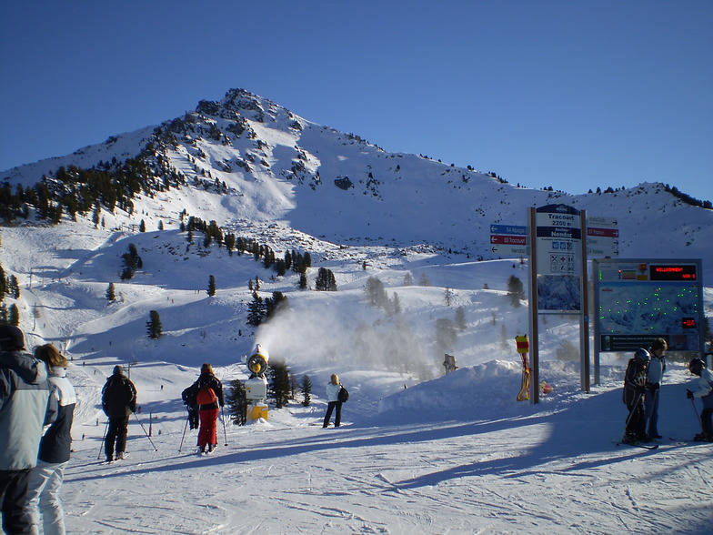
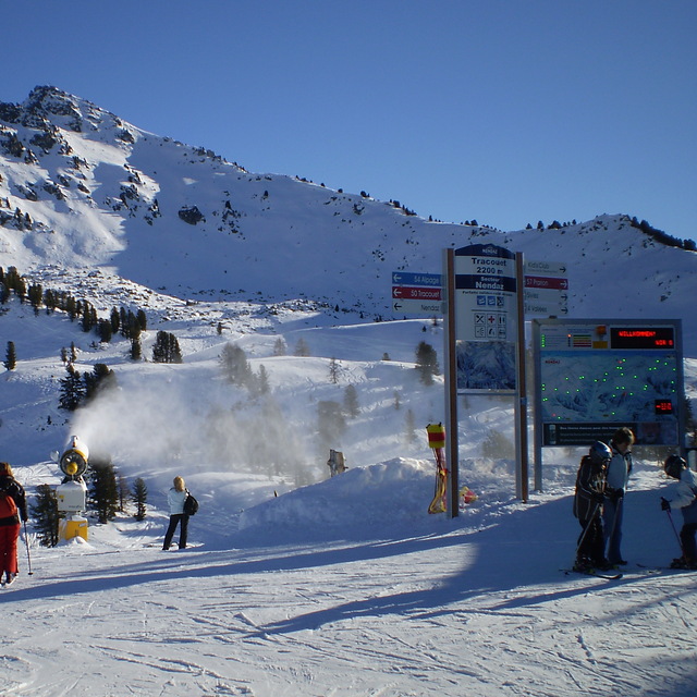
Latest snow reports near Haute Nendaz:
| Top snow depth: | — |
|---|---|
| Bottom snow depth: | — |
| Fresh snowfall depth: | — |
| Last snowfall: | 10 Jun 2026 |
| Snow Alerts | Create Alert |
0.1 | Bluebird Powder days Fresh snow, mostly sunny, light wind. |
|---|---|
0.4 | Powder days Fresh snow, limited sun, any wind. |
0.4 | Bluebird days Average snow, mostly sunny, light wind. |
The above table gives the weather forecast for Haute Nendaz at the specific elevation of 3330 m. Our sophisticated weather models allow us to provide snow forecasts for the top, middle and bottom ski stations of Haute Nendaz. To access the weather forecasts for the other elevations, use the tab navigation above the table. For a wider view of the weather, check out the Weather Map of Switzerland.
Click here to read further information on freezing levels and how we forecast our temperatures.
Overall 4.1 Based on 12 votes and 23 reviews
A lot of the reviews here are very accurate. The slopes, scenery, sheer size of the ski area and access are as good as Verbier. However, the parking in Siviez or Haute Nendaz is a problem ..so severe that one cannot get to the slopes in peak times. To rectify this a parking garage is required in Siviez. With that, Nendaz will be as good as Verbier at 30% less cost.
cecil clement from United Kingdom writes:
A lot of the reviews here are very accurate. The slopes, scenery, sheer size of the ski area and access are as good as Verbier. However, the parking in Siviez or Haute Nendaz is a problem ..so severe that one cannot get to the slopes in peak times. To rectify this a parking garage is required in Siviez. With that, Nendaz will be as good as Verbier at 30% less cost.


 Nearest