

Portillo Re-Opens To Guests Arriving By Helicopter
Chile’s famous Portillo ski resort is reported to have re-opened to guests arriving by helicopter after being cut off by road for more than two weeks by over 6m/20 feet of snowfall.

Next 4 days weather summary:A light covering of new snow, mostly falling on Mon night. Temperatures will be below freezing (max -1°C on Mon night, min -10°C on Tue morning). Winds decreasing (fresh winds from the S on Tue afternoon, light winds from the WSW by Thu morning). | Days 5-7 weather summary:A dusting of new snow. Freeze-thaw conditions (max 2°C on Fri morning, min -3°C on Sat night). Winds decreasing (fresh winds from the NW on Fri afternoon, calm by Sat night). | |||||||||||||||
Tuesday 4 | Wednesday 5 | Thursday 6 | Friday 7 | Saturday 8 | ||||||||||||
night | AM | PM | night | AM | PM | night | AM | PM | night | AM | PM | night | AM | PM | night | |
snow shwrs | light snow | light snow | snow shwrs | clear | clear | clear | clear | clear | some clouds | cloudy | light snow | light snow | cloudy | cloudy | cloudy | |
km/h | ||||||||||||||||
Snow map |  |  |  | 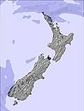 | 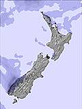 | 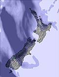 | ||||||||||
3 | 2 | 2 | — | — | — | — | — | — | — | — | — | — | — | — | — | |
mm | — | — | — | — | — | — | — | — | — | — | — | — | — | — | — | — |
max °C | -1 | -10 | -9 | -7 | -4 | -3 | -2 | -2 | -2 | 1 | 2 | 0 | 1 | 0 | -2 | -2 |
min °C | -7 | -10 | -9 | -9 | -6 | -4 | -3 | -2 | -2 | -1 | 1 | 0 | 1 | 0 | -2 | -3 |
chill °C | -14 | -18 | -18 | -18 | -10 | -8 | -6 | -4 | -5 | -3 | -4 | -7 | -5 | 0 | -4 | -3 |
Humid % | 79 | 95 | 94 | 78 | 58 | 60 | 41 | 14 | 41 | 17 | 14 | 85 | 65 | 67 | 93 | 96 |
Freeze m | 1050 | 400 | 550 | 0 | 500 | 1250 | 0 | 1350 | 1500 | 1700 | 2100 | 1750 | 1950 | 1850 | 1500 | 1300 |
— | 7:35 | — | — | 7:35 | — | — | 7:33 | — | — | 7:33 | — | — | 7:31 | — | — | |
— | — | 5:32 | — | — | 5:34 | — | — | 5:35 | — | — | 5:36 | — | — | 5:37 | — | |
Go pro and carve into:
Avalanche information: New Zealand Avalanche Advisory
Latest snow reports near Hanmer Springs Ski Area:
| Top snow depth: | — |
|---|---|
| Bottom snow depth: | — |
| Fresh snowfall depth: | — |
| Last snowfall: | 31 Jul 2026 |
| Snow Alerts | Create Alert |
0.4 | Bluebird Powder days Fresh snow, mostly sunny, light wind. |
|---|---|
1.5 | Powder days Fresh snow, limited sun, any wind. |
0.9 | Bluebird days Average snow, mostly sunny, light wind. |
The above table gives the weather forecast for Hanmer Springs Ski Area at the specific elevation of 1774 m. Our sophisticated weather models allow us to provide snow forecasts for the top, middle and bottom ski stations of Hanmer Springs Ski Area. To access the weather forecasts for the other elevations, use the tab navigation above the table. For a wider view of the weather, check out the Weather Map of New Zealand.
Click here to read further information on freezing levels and how we forecast our temperatures.
Overall 2.8 Based on 3 votes and 2 reviews
This place is pure magic. Low key, primo terrain and good old fashioned tow sheds with tractors driving the lifts. Get here now.
Richie from New Zealand writes:
This place is pure magic. Low key, primo terrain and good old fashioned tow sheds with tractors driving the lifts. Get here now.
Read 1 more reviews of Hanmer Springs Ski Area or submit your own


 Nearest