

Banff Sunshine Village Opening for Summer Skiing
Banff Sunshine Village has confirmed it will reopen for a fortnight of summer skiing, from this weekend. The only ski area in Canada to be open into July.

Next 4 days weather summary:Light rain (total 5.0mm), mostly falling on Fri night. Very mild (max 10°C on Sun afternoon, min 7°C on Fri night). Wind will be generally light. | Days 5-7 weather summary:Light rain (total 8.0mm), mostly falling on Thu afternoon. Very mild (max 10°C on Mon night, min 9°C on Mon night). Wind will be generally light. | |||||||||||||||
Saturday 20 | Sunday 21 | Monday 22 | Tuesday 23 | Wednesday 24 | ||||||||||||
night | AM | PM | night | AM | PM | night | AM | PM | night | AM | PM | night | AM | PM | night | |
rain shwrs | clear | some clouds | clear | clear | some clouds | rain shwrs | clear | clear | clear | clear | clear | clear | clear | some clouds | clear | |
km/h | ||||||||||||||||
Snow map |  |  |  |  |  |  | ||||||||||
— | — | — | — | — | — | — | — | — | — | — | — | — | — | — | — | |
mm | 4 | — | — | — | — | — | 1 | — | — | — | — | — | — | — | — | — |
max °C | 8 | 8 | 9 | 9 | 9 | 10 | 10 | 10 | 10 | 10 | 10 | 10 | 10 | 9 | 10 | 10 |
min °C | 7 | 7 | 9 | 8 | 9 | 10 | 9 | 9 | 10 | 9 | 9 | 10 | 9 | 9 | 10 | 9 |
chill °C | 3 | 6 | 9 | 6 | 8 | 10 | 8 | 7 | 9 | 8 | 6 | 10 | 8 | 8 | 10 | 8 |
Humid % | 54 | 56 | 68 | 55 | 59 | 74 | 54 | 47 | 71 | 43 | 31 | 71 | 45 | 53 | 79 | 78 |
Freeze m | 4200 | 4150 | 4250 | 4250 | 4200 | 4350 | 4350 | 4400 | 4400 | 4400 | 4400 | 4350 | 4450 | 4350 | 4400 | 4500 |
— | 5:37 | — | — | 5:37 | — | — | 5:37 | — | — | 5:37 | — | — | 5:37 | — | — | |
— | — | — | 9:25 | — | — | 9:27 | — | — | 9:27 | — | — | 9:27 | — | — | 9:27 | |
Go pro and carve into:
Avalanche information: European Avalanche Warning Services (EAWS)
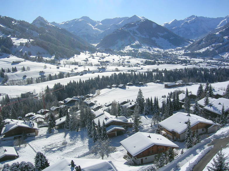
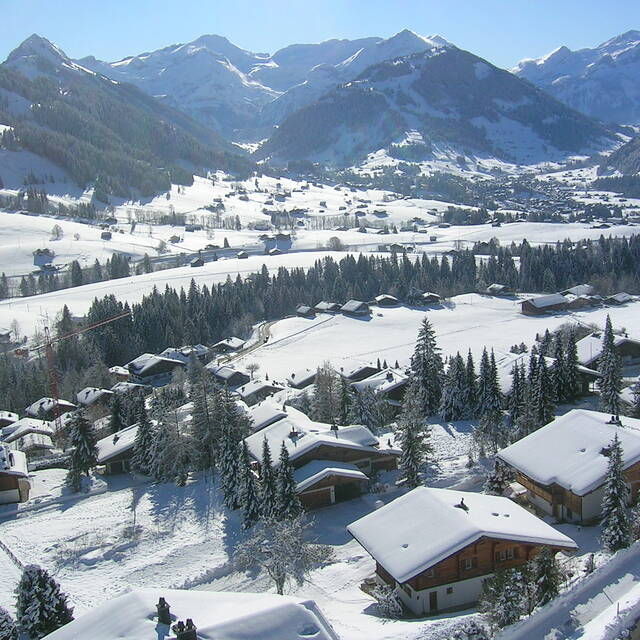
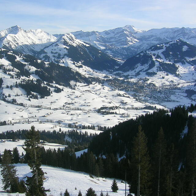
Latest snow reports near Gstaad:
| Top snow depth: | 0 cm |
|---|---|
| Bottom snow depth: | 0 cm |
| Fresh snowfall depth: | — |
| Last snowfall: | 10 Jun 2026 |
| Snow Alerts | Create Alert |
0.4 | Bluebird Powder days Fresh snow, mostly sunny, light wind. |
|---|---|
0.7 | Powder days Fresh snow, limited sun, any wind. |
0.1 | Bluebird days Average snow, mostly sunny, light wind. |
The above table gives the weather forecast for Gstaad at the specific elevation of 3000 m. Our sophisticated weather models allow us to provide snow forecasts for the top, middle and bottom ski stations of Gstaad. To access the weather forecasts for the other elevations, use the tab navigation above the table. For a wider view of the weather, check out the Weather Map of Switzerland.
Click here to read further information on freezing levels and how we forecast our temperatures.
Overall 4.1 Based on 24 votes and 4 reviews
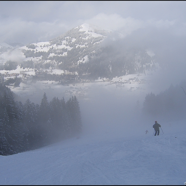
I am both an experienced snowboarder and skier. Spent a week in Gstaad. Snow was not the best as it had not snowed for 10 days when I got there. Then, on our second day, it snowed a bit (about 5cm). Snowmaking is decent in Eggli; very good in Schonried and terrible in Glacier 3000. If it hasn't snowed the week before the day you intend to ski, do not bother visiting Glacier 3000, except for pictures. As it is higher up, they probably don't think snowmaking is that necessary there. However, after a week without snow, the very cold weather makes everything hard as a stone. Loved the resort overall but there's a lot of driving as the city is not close enough to any of these three largest mountains. If you're into nightlife, that is not the place to go. Good restaurants, but very few options for bars and clubs.
Andre from Brazil writes:
I am both an experienced snowboarder and skier. Spent a week in Gstaad. Snow was not the best as it had not snowed for 10 days when I got there. Then, on our second day, it snowed a bit (about 5cm). Snowmaking is decent in Eggli; very good in Schonried and terrible in Glacier 3000. If it hasn't snowed the week before the day you intend to ski, do not bother visiting Glacier 3000, except for pictures. As it is higher up, they probably don't think snowmaking is that necessary there. However, after a week without snow, the very cold weather makes everything hard as a stone. Loved the resort overall but there's a lot of driving as the city is not close enough to any of these three largest mountains. If you're into nightlife, that is not the place to go. Good restaurants, but very few options for bars and clubs.


 Nearest