Alternatively, you can now use your Outside account to sign in to any brand in the Outside digital ecosystem, including Snow-Forecast, Surf-Forecast, and Mountain-Forecast.
The snow forecast for Gstaad is: Heavy rain (total 35.0mm), heaviest during Mon afternoon. Very mild (max 14°C on Sat night, min 3°C on Mon night). Wind will be generally light.
Gstaad Weather (Next 3 days): The snow forecast for Gstaad is: Heavy rain (total 35.0mm), heaviest during Mon afternoon. Very mild (max 14°C on Sat night, min 3°C on Mon night). Wind will be generally light.
Gstaad Weather (Days 4-6): Light rain (total 4.0mm), mostly falling on Tue night. Very mild (max 14°C on Fri afternoon, min 2°C on Tue night). Wind will be generally light.
Gstaad Live Weather
Resort
Snow Depth
Temp. (°C)
Wind (km/h)
Weather
Top Lift:
0.0m
5
Middle Lift:
12
Bottom Lift:
0.0m
16
Powered by Snow-Forecast.com
Gstaad Weather
(Next 3 days):
The snow forecast for Gstaad is: Heavy rain (total 35.0mm), heaviest during Mon afternoon. Very mild (max 14°C on Sat night, min 3°C on Mon night). Wind will be generally light.
Gstaad Weather (Days 4-6):
Light rain (total 4.0mm), mostly falling on Tue night. Very mild (max 14°C on Fri afternoon, min 2°C on Tue night). Wind will be generally light.
The above table gives the weather forecast for Gstaad at the specific elevation of 2000 m. Our sophisticated weather models allow us to provide snow forecasts for the top, middle and bottom ski stations of Gstaad. To access the weather forecasts for the other elevations, use the tab navigation above the table. For a wider view of the weather, check out the Weather Map of Switzerland.
Click here to read further information on freezing levels and how we forecast our temperatures.
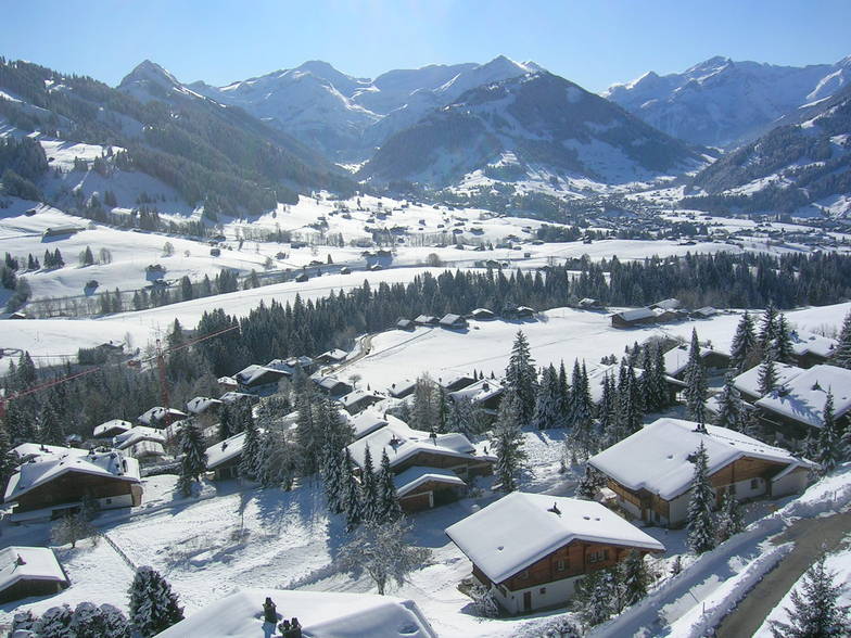
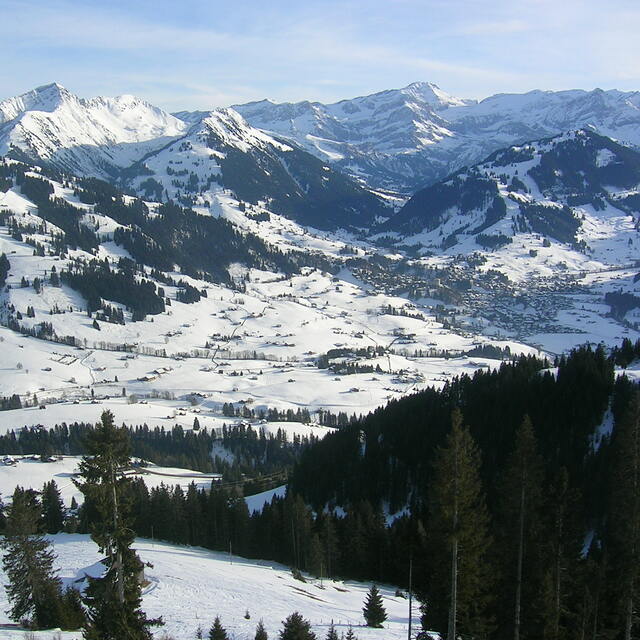
I am both an experienced snowboarder and skier. Spent a week in Gstaad. Snow was not the best as it had not snowed for 10 days when I got there. Then, on our second day, it snowed a bit (about 5cm). Snowmaking is decent in Eggli; very good in Schonried and terrible in Glacier 3000. If it hasn't snowed the week before the day you intend to ski, do not bother visiting Glacier 3000, except for pictures. As it is higher up, they probably don't think snowmaking is that necessary there. However, after a week without snow, the very cold weather makes everything hard as a stone. Loved the resort overall but there's a lot of driving as the city is not close enough to any of these three largest mountains. If you're into nightlife, that is not the place to go. Good restaurants, but very few options for bars and clubs.
I am both an experienced snowboarder and skier. Spent a week in Gstaad. Snow was not the best as it had not snowed for 10 days when I got there. Then, on our second day, it snowed a bit (about 5cm). Snowmaking is decent in Eggli; very good in Schonried and terrible in Glacier 3000. If it hasn't snowed the week before the day you intend to ski, do not bother visiting Glacier 3000, except for pictures. As it is higher up, they probably don't think snowmaking is that necessary there. However, after a week without snow, the very cold weather makes everything hard as a stone. Loved the resort overall but there's a lot of driving as the city is not close enough to any of these three largest mountains. If you're into nightlife, that is not the place to go. Good restaurants, but very few options for bars and clubs.
Free Snow-Forecast.com weather widget for your website
The Gstaad skiing weather widget is available to embed on external websites free of charge. It provides a daily summary of our Gstaad snow forecast and current weather conditions. Simply go to the feed configuration page and follow the 3 simple steps to grab the custom html code snippet and paste it into your own site. You can choose the snow forecast elevation (summit, mid-mountain or bottom lift) and metric/imperial units for the snow forecast feed to suit your own website…. Click here to get the code.


 Nearest