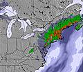
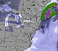
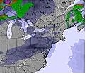
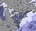
The above table gives the weather forecast for Greek Peak at the specific elevation of 365 m. Our sophisticated weather models allow us to provide snow forecasts for the top, middle and bottom ski stations of Greek Peak. To access the weather forecasts for the other elevations, use the tab navigation above the table. For a wider view of the weather, check out the Weather Map of United States.
Click here to read further information on freezing levels and how we forecast our temperatures.
Overall, a poor resort. There has not been an update to the hill in the 15 years I have skied there, however, the cost of riding has gone up time and time again. The terrain available is lacking and really aimed for first timers and beginners. You will not find anything challenging here. The snow coverage is poor at best and the season usually only last 3 months. The average snow fall is 50" so there are literally no powder days (maybe 1 a year if lucky). The terrain park is severely lacking, last year what they tried to pass of as a table top was laughable at best. The park crew is made up of local teenagers with no experience, and what basic features they do have are rarely groomed. There is no night life or anything around to do other than ski. No bars or restaurants other than the one on the hill and prices are very expensive for what you get. The overall cost to go the Greek peak is very high and really aimed at rich folks from the city who are first timers or beginners. They have promised trail expansion and new lifts year after year but it never seems to happen. If your a beginner / first timer with a lot of cash to spend this maybe a good option for you. Otherwise, there are much better priced options in the area at a much better price.
Overall, a poor resort. There has not been an update to the hill in the 15 years I have skied there, however, the cost of riding has gone up time and time again. The terrain available is lacking and really aimed for first timers and beginners. You will not find anything challenging here. The snow coverage is poor at best and the season usually only last 3 months. The average snow fall is 50" so there are literally no powder days (maybe 1 a year if lucky). The terrain park is severely lacking, last year what they tried to pass of as a table top was laughable at best. The park crew is made up of local teenagers with no experience, and what basic features they do have are rarely groomed. There is no night life or anything around to do other than ski. No bars or restaurants other than the one on the hill and prices are very expensive for what you get. The overall cost to go the Greek peak is very high and really aimed at rich folks from the city who are first timers or beginners. They have promised trail expansion and new lifts year after year but it never seems to happen. If your a beginner / first timer with a lot of cash to spend this maybe a good option for you. Otherwise, there are much better priced options in the area at a much better price.
Free Snow-Forecast.com weather widget for your website
Embed the Greek Peak weather widget on your site for free. It provides a weekly snapshot of snow and rain conditions across all elevations. Follow the two quick steps to grab your custom code and paste it into your site. Choose between metric or imperial units. Click here to get the code.


 Nearest