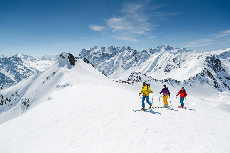


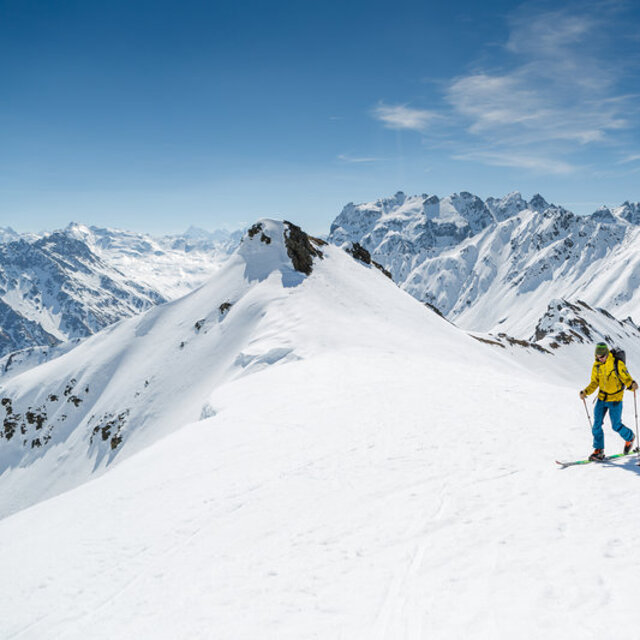
Portillo Re-Opens To Guests Arriving By Helicopter
Chile’s famous Portillo ski resort is reported to have re-opened to guests arriving by helicopter after being cut off by road for more than two weeks by over 6m/20 feet of snowfall.

Next 3 days weather summary:Heavy rain (total 22.0mm), heaviest during Wed night. Warm (max 22°C on Tue afternoon, min 15°C on Tue night). Wind will be generally light. | Days 4-6 weather summary:Heavy rain (total 42.0mm), heaviest during Thu night. Very mild (max 18°C on Thu afternoon, min 11°C on Thu night). Wind will be generally light. | ||||||||||||||||
Mon 3 | Tuesday 4 | Wednesday 5 | Thursday 6 | Friday 7 | Saturday 8 | ||||||||||||
PM | night | AM | PM | night | AM | PM | night | AM | PM | night | AM | PM | night | AM | PM | night | |
t-storm risk | rain shwrs | clear | some clouds | rain shwrs | t-storm risk | t-storm risk | rain shwrs | t-storm risk | t-storm risk | heavy rain | rain shwrs | t-storm risk | rain shwrs | some clouds | t-storm risk | rain shwrs | |
km/h | |||||||||||||||||
Snow map |  |  |  |  |  |  | |||||||||||
— | — | — | — | — | — | — | — | — | — | — | — | — | — | — | — | — | |
mm | 1 | 2 | — | — | 2 | 1 | 4 | 10 | 2 | 9 | 25 | 1 | 3 | 1 | — | 2 | 1 |
max °C | 21 | 19 | 20 | 22 | 20 | 18 | 20 | 16 | 18 | 18 | 14 | 14 | 14 | 13 | 15 | 16 | 15 |
min °C | 19 | 16 | 17 | 22 | 15 | 16 | 18 | 15 | 16 | 17 | 11 | 12 | 14 | 12 | 13 | 15 | 14 |
chill °C | 19 | 16 | 17 | 22 | 15 | 16 | 18 | 15 | 16 | 17 | 11 | 12 | 14 | 12 | 13 | 15 | 14 |
Humid % | 54 | 60 | 47 | 42 | 76 | 62 | 68 | 77 | 62 | 71 | 91 | 77 | 84 | 86 | 72 | 77 | 71 |
Freeze m | 4550 | 4450 | 4450 | 4650 | 4400 | 4400 | 4550 | 4350 | 4300 | 4350 | 3850 | 4000 | 4050 | 4050 | 4100 | 4100 | 4350 |
— | — | 6:01 | — | — | 6:03 | — | — | 6:05 | — | — | 6:05 | — | — | 6:07 | — | — | |
— | 8:50 | — | — | 8:49 | — | — | 8:47 | — | — | 8:45 | — | — | 8:45 | — | — | 8:43 | |
Go pro and carve into:
Avalanche information: European Avalanche Warning Services (EAWS)
Latest snow reports near Gargellen:
| Top snow depth: | 0 cm |
|---|---|
| Bottom snow depth: | 0 cm |
| Fresh snowfall depth: | — |
| Last snowfall: | 10 Jun 2026 |
| Snow Alerts | Create Alert |
0.0 | Bluebird Powder days Fresh snow, mostly sunny, light wind. |
|---|---|
0.0 | Powder days Fresh snow, limited sun, any wind. |
0.0 | Bluebird days Average snow, mostly sunny, light wind. |
The above table gives the weather forecast for Gargellen at the specific elevation of 1862 m. Our sophisticated weather models allow us to provide snow forecasts for the top, middle and bottom ski stations of Gargellen. To access the weather forecasts for the other elevations, use the tab navigation above the table. For a wider view of the weather, check out the Weather Map of Austria.
Click here to read further information on freezing levels and how we forecast our temperatures.
Overall 3.0 Based on 16 votes and 6 reviews
Gargellen is a wonderful village with great snow and a really good ski school. Ideal for us because I am a beginner and my husband is an off-piste man. We meet at the schaffberg mountain restaraunt for lunch and both get so much out of this resort. We stay at the Bradabella Hotel which is fantastic and just love Gargellen.
valerie coombs from United Kingdom writes:
Gargellen is a wonderful village with great snow and a really good ski school. Ideal for us because I am a beginner and my husband is an off-piste man. We meet at the schaffberg mountain restaraunt for lunch and both get so much out of this resort.
We stay at the Bradabella Hotel which is fantastic and just love Gargellen.


 Nearest