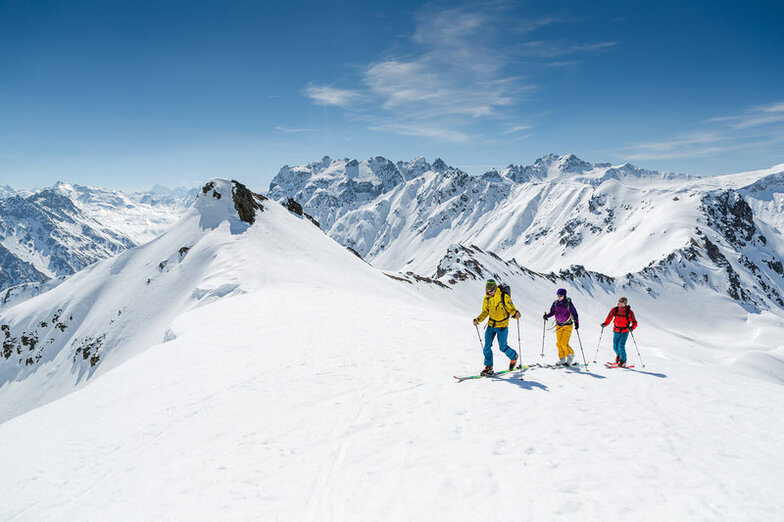


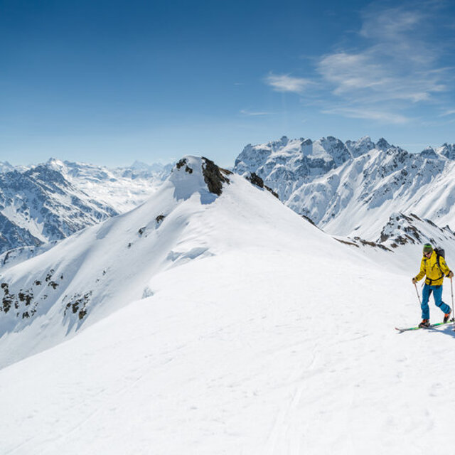
Portillo Storm Snowfall Total Passes 5m / 17 Feet
A snow storm that has now continued for nine days has taken Chilean ski resort Portillo to a snowfall total of 5.2 metres (17 feet) so far, with more snow forecast.

Next 3 days weather summary:Heavy rain (total 20.0mm), heaviest during Fri night. Warm (max 28°C on Fri afternoon, min 15°C on Fri night). Wind will be generally light. | Days 4-6 weather summary:Heavy rain (total 26.0mm), heaviest during Sat night. Warm (max 25°C on Mon afternoon, min 14°C on Sat night). Wind will be generally light. | ||||||||||||||||
Wed 29 | Thursday 30 | Friday 31 | Saturday 1 | Sunday 2 | Monday 3 | ||||||||||||
PM | night | AM | PM | night | AM | PM | night | AM | PM | night | AM | PM | night | AM | PM | night | |
t-storm risk | rain shwrs | clear | clear | some clouds | clear | t-storm risk | rain shwrs | rain shwrs | t-storm risk | rain shwrs | clear | t-storm risk | rain shwrs | cloudy | t-storm risk | rain shwrs | |
km/h | |||||||||||||||||
Snow map |  |  |  |  |  |  | |||||||||||
— | — | — | — | — | — | — | — | — | — | — | — | — | — | — | — | — | |
mm | 3 | 1 | — | — | — | — | 1 | 14 | 1 | 3 | 12 | — | 2 | 2 | — | 1 | 4 |
max °C | 24 | 20 | 24 | 27 | 22 | 26 | 28 | 16 | 22 | 24 | 17 | 23 | 24 | 19 | 22 | 25 | 18 |
min °C | 23 | 17 | 20 | 26 | 16 | 20 | 25 | 15 | 19 | 21 | 14 | 18 | 23 | 16 | 17 | 19 | 15 |
chill °C | 23 | 17 | 20 | 26 | 16 | 20 | 25 | 15 | 19 | 21 | 14 | 18 | 23 | 16 | 17 | 19 | 14 |
Humid % | 50 | 52 | 30 | 22 | 48 | 36 | 43 | 72 | 47 | 64 | 70 | 45 | 52 | 73 | 50 | 67 | 72 |
Freeze m | 4450 | 4350 | 4500 | 4700 | 4700 | 4650 | 4700 | 4500 | 4300 | 4400 | 4400 | 4500 | 4650 | 4550 | 4550 | 4550 | 4400 |
— | — | 5:56 | — | — | 5:56 | — | — | 5:58 | — | — | 6:00 | — | — | 6:01 | — | — | |
— | 8:57 | — | — | 8:55 | — | — | 8:54 | — | — | 8:52 | — | — | 8:52 | — | — | 8:50 | |
Go pro and carve into:
Avalanche information: European Avalanche Warning Services (EAWS)
Latest snow reports near Gargellen:
| Top snow depth: | 0 cm |
|---|---|
| Bottom snow depth: | 0 cm |
| Fresh snowfall depth: | — |
| Last snowfall: | 10 Jun 2026 |
| Snow Alerts | Create Alert |
0.0 | Bluebird Powder days Fresh snow, mostly sunny, light wind. |
|---|---|
0.0 | Powder days Fresh snow, limited sun, any wind. |
0.0 | Bluebird days Average snow, mostly sunny, light wind. |
The above table gives the weather forecast for Gargellen at the specific elevation of 1423 m. Our sophisticated weather models allow us to provide snow forecasts for the top, middle and bottom ski stations of Gargellen. To access the weather forecasts for the other elevations, use the tab navigation above the table. For a wider view of the weather, check out the Weather Map of Austria.
Click here to read further information on freezing levels and how we forecast our temperatures.
Overall 3.0 Based on 16 votes and 6 reviews
Stayed in the Hotel Madrisa in March 2006 with family - the hotel, although not cheap, it was worth every penny - very good service, friendly, accommodating, great facilities and lovely old world Austrian Alpine feel. The resort is very small but there are other resorts nearby. However, there is no connection by ski lift. Very attractive low key village with good snow due to its high altitude.
Rob Farrands from United Kingdom writes:
Stayed in the Hotel Madrisa in March 2006 with family - the hotel, although not cheap, it was worth every penny - very good service, friendly, accommodating, great facilities and lovely old world Austrian Alpine feel. The resort is very small but there are other resorts nearby. However, there is no connection by ski lift. Very attractive low key village with good snow due to its high altitude.


 Nearest