

Banff Sunshine Village Opening for Summer Skiing
Banff Sunshine Village has confirmed it will reopen for a fortnight of summer skiing, from this weekend. The only ski area in Canada to be open into July.

Next 3 days weather summary:Moderate rain (total 14.0mm), heaviest on Fri night. Very mild (max 17°C on Fri afternoon, min 11°C on Fri night). Wind will be generally light. | Days 4-6 weather summary:Moderate rain (total 10.0mm), heaviest on Mon night. Very mild (max 18°C on Wed afternoon, min 13°C on Mon night). Wind will be generally light. | ||||||||||||||||
Fri 19 | Saturday 20 | Sunday 21 | Monday 22 | Tuesday 23 | Wednesday 24 | ||||||||||||
PM | night | AM | PM | night | AM | PM | night | AM | PM | night | AM | PM | night | AM | PM | night | |
light rain | rain shwrs | clear | some clouds | some clouds | clear | some clouds | rain shwrs | clear | t-storm risk | rain shwrs | clear | t-storm risk | rain shwrs | clear | some clouds | rain shwrs | |
km/h | |||||||||||||||||
Snow map |  |  |  |  |  |  | |||||||||||
— | — | — | — | — | — | — | — | — | — | — | — | — | — | — | — | — | |
mm | 3 | 8 | — | — | — | — | — | 3 | — | 1 | 4 | — | 1 | 3 | — | — | 1 |
max °C | 17 | 13 | 14 | 16 | 15 | 15 | 17 | 15 | 15 | 17 | 15 | 15 | 16 | 14 | 15 | 18 | 16 |
min °C | 12 | 11 | 13 | 16 | 13 | 14 | 17 | 13 | 13 | 16 | 13 | 13 | 16 | 13 | 13 | 17 | 13 |
chill °C | 12 | 11 | 13 | 16 | 13 | 14 | 17 | 13 | 13 | 16 | 13 | 13 | 16 | 13 | 13 | 17 | 13 |
Humid % | 78 | 77 | 50 | 47 | 53 | 43 | 48 | 66 | 59 | 62 | 66 | 57 | 62 | 59 | 55 | 53 | 70 |
Freeze m | 4300 | 4200 | 4150 | 4400 | 4300 | 4250 | 4400 | 4250 | 4250 | 4450 | 4350 | 4250 | 4400 | 4350 | 4350 | 4700 | 4500 |
— | — | 5:24 | — | — | 5:24 | — | — | 5:24 | — | — | 5:24 | — | — | 5:24 | — | — | |
— | 9:16 | — | — | 9:16 | — | — | 9:16 | — | — | 9:16 | — | — | 9:17 | — | — | 9:17 | |
Go pro and carve into:
Avalanche information: European Avalanche Warning Services (EAWS)
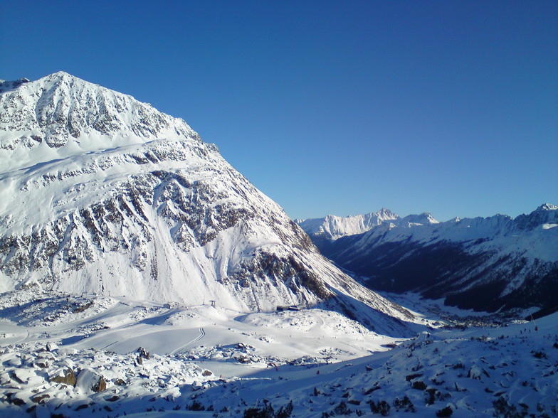
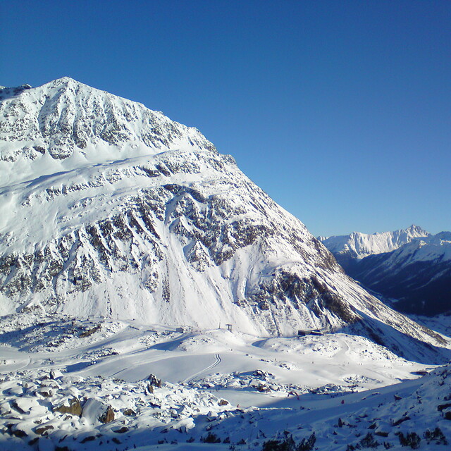
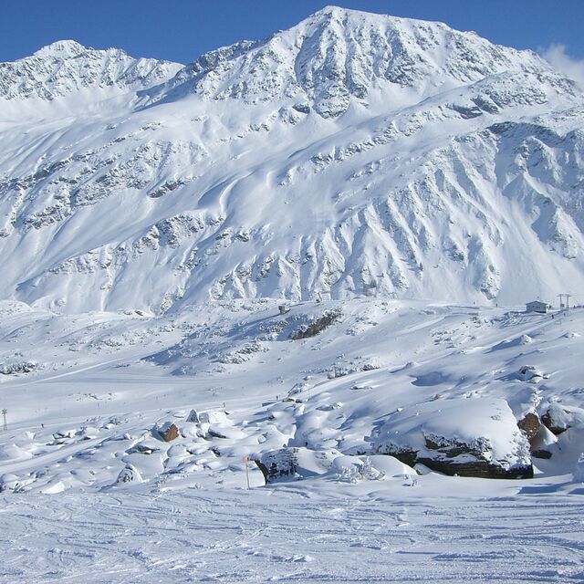
Latest snow reports near Galtur-Silvapark:
| Top snow depth: | 0 cm |
|---|---|
| Bottom snow depth: | 0 cm |
| Fresh snowfall depth: | — |
| Last snowfall: | 10 Jun 2026 |
| Snow Alerts | Create Alert |
0.0 | Bluebird Powder days Fresh snow, mostly sunny, light wind. |
|---|---|
0.1 | Powder days Fresh snow, limited sun, any wind. |
0.0 | Bluebird days Average snow, mostly sunny, light wind. |

The above table gives the weather forecast for Galtur-Silvapark at the specific elevation of 2300 m. Our sophisticated weather models allow us to provide snow forecasts for the top, middle and bottom ski stations of Galtur-Silvapark. To access the weather forecasts for the other elevations, use the tab navigation above the table. For a wider view of the weather, check out the Weather Map of Austria.
Click here to read further information on freezing levels and how we forecast our temperatures.
Resort name is also written as Galtur Silvapark.
Overall 4.2 Based on 11 votes and 3 reviews
29/03/08-05/04/08 Galtur is a small, pretty village best suited to families, mixed skiing ability groups but not those looking for great night life. It has lovely slopes which are great for getting ski legs back, also those learning to ski and it's close proximity to Ischgl means that the skiing is extensive for the more experienced. Free ski buses run frequently between the two resorts (8-10 mins) and can be used in the evening for visiting the night life in Ischgl. Galtur has a good Sports Centre with swimming pool, wellness facilities, bowling and a few bars. Otherwise, life is centred on the hotels and restaurants after a day skiing. Enjoyed our week with super snow and will return.
Kemp Family from United Kingdom writes:
29/03/08-05/04/08
Galtur is a small, pretty village best suited to families, mixed skiing ability groups but not those looking for great night life. It has lovely slopes which are great for getting ski legs back, also those learning to ski and it's close proximity to Ischgl means that the skiing is extensive for the more experienced. Free ski buses run frequently between the two resorts (8-10 mins) and can be used in the evening for visiting the night life in Ischgl. Galtur has a good Sports Centre with swimming pool, wellness facilities, bowling and a few bars. Otherwise, life is centred on the hotels and restaurants after a day skiing. Enjoyed our week with super snow and will return.


 Nearest