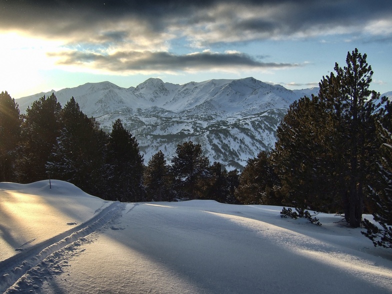
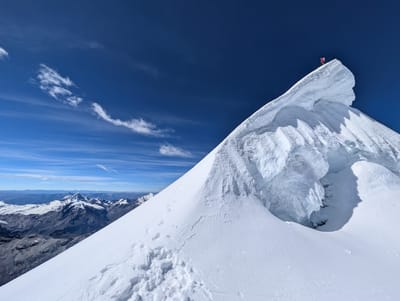
Formigueres snow
Ski France

Formigueres Snow Forecast

Weather Forecast for Formigueres at 2075 m
Issued: 6 am  20 Nov 2025 (local time)

New snow in Formigueres

8.1cm3.2in
Thu 20th (NGT)
The snow forecast for Formigueres is: A heavy fall of snow, heaviest during Thu night. Temperatures will be below freezing (max -1°C on Sat night, min -12°C on Fri morning). Winds decreasing (strong winds from the NNW on Fri morning, light winds from the WNW by Sat night).

Formigueres Weather (Next 3 days): The snow forecast for Formigueres is: A heavy fall of snow, heaviest during Thu night. Temperatures will be below freezing (max -1°C on Sat night, min -12°C on Fri morning). Winds decreasing (strong winds from the NNW on Fri morning, light winds from the WNW by Sat night).

Formigueres Weather (Days 4-6): A moderate fall of snow, heaviest on Mon night. Freeze-thaw conditions (max 1°C on Sun afternoon, min -8°C on Tue afternoon). Winds increasing (calm on Sun night, fresh winds from the NW by Tue night).


Formigueres Live Weather

ResortSnow DepthTemp. (°C)Wind (km/h)Weather
Top Lift: 
-9
25
light snow
Middle Lift: 
-7
20
light snow
Bottom Lift: 
-5
15
light snow
6 Day Forecast
Issued: 6 am 20 Nov 2025 / Updates in ::
Change Forecast Height
Choose Forecast
Last 6 daysScroll left for last 6 daysNow
Thursday
20
Friday
21
Saturday
22
Sunday
23
Monday
24
Tuesday
25
Wednesday
26
AM
PM
night
AM
PM
night
AM
PM
night
AM
PM
night
AM
PM
night
AM
PM
night
AM
PM
night
light snow
snow showers
snow showers
snow showers
snow showers
snow showers
clear
clear
snow showers
light snow
snow showers
light snow
light snow
snow showers
snow showers
snow showers
snow showers
snow showers
snow showers
snow showers
snow showers
light snow
snow shwrs
snow shwrs
snow shwrs
snow shwrs
snow shwrs
clear
clear
snow shwrs
light snow
snow shwrs
light snow
light snow
snow shwrs
snow shwrs
snow shwrs
snow shwrs
snow shwrs
snow shwrs
snow shwrs
snow shwrs
 km/h
20
WNW
20
WNW
20
WNW
40
NW
40
NNW
40
NNW
30
NNW
20
NNW
15
WNW
25
NW
15
WNW
5
SSW
15
WNW
30
WNW
20
WNW
20
NW
30
NW
30
NW
35
NNW
35
NW
20
N
Snow map
 cm 
9
6
2
4
2
3
1
1
5
1
2
5
6
1
 mm 
max°C
-6
-7
-8
-12
-12
-11
-5
-4
-1
0
1
-1
0
-2
-4
-5
-6
-7
-7
-8
-8
min°C
-6
-8
-11
-12
-12
-12
-7
-5
-4
0
0
-1
0
-4
-6
-5
-8
-8
-7
-9
-9
chill°C 
-13
-16
-21
-23
-24
-23
-16
-11
-10
-6
-3
-3
-4
-11
-13
-12
-17
-17
-16
-19
-18
Humid% 
75
80
84
91
82
93
25
34
59
98
91
88
86
86
94
89
73
86
89
88
66
Freezing level (m
1150
1100
800
500
450
400
700
1200
1250
2000
2200
1950
2000
1750
1250
1300
1250
800
1000
950
0
topliftbotliftSea lvl1000m2000m3000m4000m5000m
-9-10-12-15-14-13-8-6-4-2-2-3-2-5-7-7-9-10-10-12-10-4-6-7-8-9-10-6-5-310-11-2-5-3-5-6-5-7-9
Sunrise
7:48
7:48
7:50
7:52
7:52
7:54
7:54
Sunset
5:24
5:23
5:22
5:22
5:22
5:21
5:21

Snow Radar

Latest snow reports near Formigueres:

No recent snow reports

No recent snow reports

Formigueres Snow Conditions

Top snow depth:
Bottom snow depth:
Fresh snowfall depth:
Last snowfall:16 Nov 2025
Snow AlertsCreate Alert
Other resorts in France are reporting: powder (1) / good piste (0)


Snow History

Week 3 of November has on average:
0.4
Bluebird Powder days
Fresh snow, mostly sunny, light wind.
0.4
Powder days
Fresh snow, limited sun, any wind.
0.4
Bluebird days
Average snow, mostly sunny, light wind.