

Portillo Storm Snowfall Total Passes 5m / 17 Feet
A snow storm that has now continued for nine days has taken Chilean ski resort Portillo to a snowfall total of 5.2 metres (17 feet) so far, with more snow forecast.

Next 3 days weather summary:Heavy rain (total 28.0mm), heaviest during Wed afternoon. Warm (max 24°C on Thu afternoon, min 12°C on Tue morning). Wind will be generally light. | Days 4-6 weather summary:Moderate rain (total 19.0mm), heaviest on Sat night. Warm (max 26°C on Fri afternoon, min 14°C on Sat night). Wind will be generally light. | |||||||||||||||||
Tuesday 28 | Wednesday 29 | Thursday 30 | Friday 31 | Saturday 1 | Sunday 2 | |||||||||||||
AM | PM | night | AM | PM | night | AM | PM | night | AM | PM | night | AM | PM | night | AM | PM | night | |
clear | clear | clear | clear | t-storm risk | rain shwrs | clear | clear | clear | clear | clear | rain shwrs | clear | clear | rain shwrs | some clouds | rain shwrs | some clouds | |
km/h | ||||||||||||||||||
Snow map |  |  |  |  |  |  | ||||||||||||
— | — | — | — | — | — | — | — | — | — | — | — | — | — | — | — | — | — | |
mm | — | — | — | — | 22 | 6 | — | — | — | — | — | 1 | — | — | 17 | — | 1 | — |
max °C | 15 | 20 | 18 | 21 | 23 | 18 | 22 | 24 | 23 | 24 | 26 | 18 | 22 | 24 | 17 | 21 | 23 | 22 |
min °C | 12 | 19 | 16 | 17 | 14 | 16 | 19 | 24 | 20 | 20 | 24 | 15 | 18 | 23 | 14 | 18 | 20 | 18 |
chill °C | 12 | 19 | 16 | 17 | 14 | 16 | 19 | 24 | 20 | 20 | 24 | 15 | 18 | 23 | 14 | 18 | 20 | 18 |
Humid % | 60 | 42 | 73 | 52 | 86 | 53 | 38 | 29 | 47 | 28 | 35 | 75 | 42 | 40 | 75 | 50 | 45 | 52 |
Freeze m | 4050 | 4500 | 4550 | 4400 | 4150 | 4300 | 4300 | 4550 | 4500 | 4600 | 4700 | 4600 | 4650 | 4700 | 4550 | 4550 | 4600 | 4600 |
5:37 | — | — | 5:39 | — | — | 5:39 | — | — | 5:41 | — | — | 5:43 | — | — | 5:43 | — | — | |
— | — | 8:45 | — | — | 8:44 | — | — | 8:43 | — | — | 8:42 | — | — | 8:39 | — | — | 8:38 | |
Go pro and carve into:
Avalanche information: European Avalanche Warning Services (EAWS)
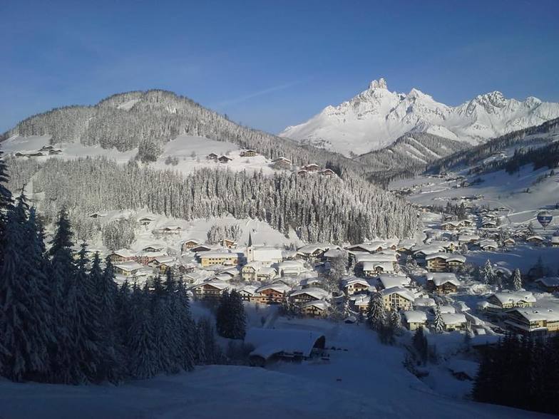
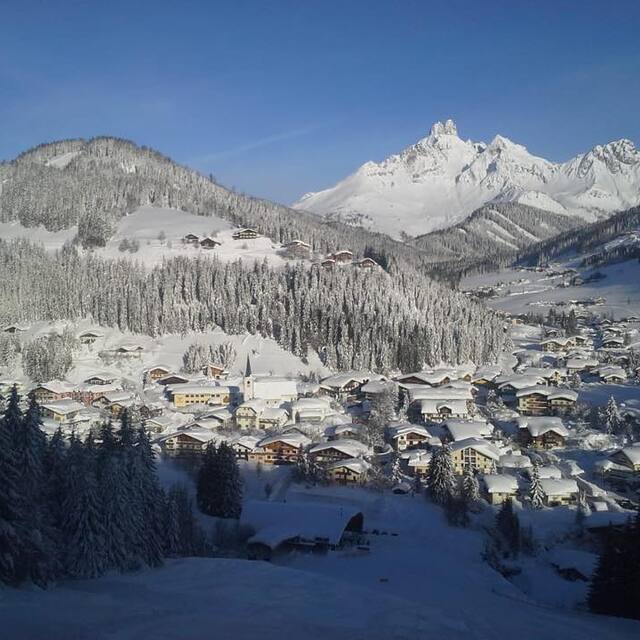
Latest snow reports near Filzmoos:
| Top snow depth: | 0 cm |
|---|---|
| Bottom snow depth: | 0 cm |
| Fresh snowfall depth: | — |
| Last snowfall: | 10 Jun 2026 |
| Snow Alerts | Create Alert |
0.0 | Bluebird Powder days Fresh snow, mostly sunny, light wind. |
|---|---|
0.0 | Powder days Fresh snow, limited sun, any wind. |
0.0 | Bluebird days Average snow, mostly sunny, light wind. |
The above table gives the weather forecast for Filzmoos at the specific elevation of 1645 m. Our sophisticated weather models allow us to provide snow forecasts for the top, middle and bottom ski stations of Filzmoos. To access the weather forecasts for the other elevations, use the tab navigation above the table. For a wider view of the weather, check out the Weather Map of Austria.
Click here to read further information on freezing levels and how we forecast our temperatures.
Overall 4.3 Based on 22 votes and 15 reviews
This is our 9th year skiing in Filzmoos. Having skiied in many different resorts, we are always drawn back to this beautiful friendly village. Each year our group grows in size, this year there was 18 of us all staying at the Happy Filzmoos! The absolute best place to go for apres-ski! The Happy Filzmoos Hotel is homely and welcoming, the rooms are extremely clean, warm and cosy, the food is delicious! The Hotel is perfectly situated so that you walk from the boot room straight out to the chair lift. We look forward to going back again at the end of Feb for a short break! Proste!
Kay Hill from United Kingdom writes:
This is our 9th year skiing in Filzmoos. Having skiied in many different resorts, we are always drawn back to this beautiful friendly village. Each year our group grows in size, this year there was 18 of us all staying at the Happy Filzmoos! The absolute best place to go for apres-ski! The Happy Filzmoos Hotel is homely and welcoming, the rooms are extremely clean, warm and cosy, the food is delicious! The Hotel is perfectly situated so that you walk from the boot room straight out to the chair lift. We look forward to going back again at the end of Feb for a short break! Proste!


 Nearest