

Portillo Re-Opens To Guests Arriving By Helicopter
Chile’s famous Portillo ski resort is reported to have re-opened to guests arriving by helicopter after being cut off by road for more than two weeks by over 6m/20 feet of snowfall.

Next 3 days weather summary:Heavy rain (total 37.0mm), heaviest during Mon night. Warm (max 28°C on Mon afternoon, min 16°C on Mon night). Wind will be generally light. | Days 4-6 weather summary:Heavy rain (total 27.0mm), heaviest during Thu afternoon. Warm (max 23°C on Thu afternoon, min 13°C on Fri night). Wind will be generally light. | ||||||||||||||||
Mon 3 | Tuesday 4 | Wednesday 5 | Thursday 6 | Friday 7 | Saturday 8 | ||||||||||||
PM | night | AM | PM | night | AM | PM | night | AM | PM | night | AM | PM | night | AM | PM | night | |
t-storm risk | rain shwrs | clear | rain shwrs | rain shwrs | t-storm risk | mod. rain | heavy rain | t-storm risk | t-storm risk | mod. rain | light rain | light rain | rain shwrs | clear | t-storm risk | rain shwrs | |
km/h | |||||||||||||||||
Snow map |  |  |  |  |  |  | |||||||||||
— | — | — | — | — | — | — | — | — | — | — | — | — | — | — | — | — | |
mm | 2 | 10 | — | 1 | 2 | 2 | 8 | 11 | 1 | 7 | 7 | 2 | 5 | 1 | — | 2 | 3 |
max °C | 28 | 17 | 27 | 28 | 21 | 23 | 25 | 17 | 24 | 23 | 18 | 16 | 16 | 16 | 21 | 22 | 17 |
min °C | 20 | 16 | 20 | 21 | 16 | 18 | 22 | 16 | 18 | 22 | 15 | 15 | 16 | 13 | 15 | 21 | 13 |
chill °C | 20 | 16 | 20 | 21 | 16 | 18 | 22 | 16 | 18 | 22 | 15 | 15 | 16 | 13 | 15 | 21 | 13 |
Humid % | 70 | 64 | 43 | 58 | 61 | 69 | 71 | 68 | 62 | 68 | 99 | 97 | 92 | 97 | 65 | 66 | 87 |
Freeze m | 4550 | 4550 | 4500 | 4600 | 4600 | 4450 | 4500 | 4450 | 4400 | 4400 | 4100 | 4000 | 4100 | 4050 | 3900 | 4000 | 4050 |
— | — | 5:46 | — | — | 5:48 | — | — | 5:48 | — | — | 5:50 | — | — | 5:52 | — | — | |
— | 8:37 | — | — | 8:36 | — | — | 8:35 | — | — | 8:32 | — | — | 8:30 | — | — | 8:30 | |
Go pro and carve into:
Avalanche information: European Avalanche Warning Services (EAWS)
Latest snow reports near Filzmoos:
| Top snow depth: | 0 cm |
|---|---|
| Bottom snow depth: | 0 cm |
| Fresh snowfall depth: | — |
| Last snowfall: | 10 Jun 2026 |
| Snow Alerts | Create Alert |
0.0 | Bluebird Powder days Fresh snow, mostly sunny, light wind. |
|---|---|
0.0 | Powder days Fresh snow, limited sun, any wind. |
0.0 | Bluebird days Average snow, mostly sunny, light wind. |
The above table gives the weather forecast for Filzmoos at the specific elevation of 1057 m. Our sophisticated weather models allow us to provide snow forecasts for the top, middle and bottom ski stations of Filzmoos. To access the weather forecasts for the other elevations, use the tab navigation above the table. For a wider view of the weather, check out the Weather Map of Austria.
Click here to read further information on freezing levels and how we forecast our temperatures.
Overall 4.3 Based on 22 votes and 15 reviews
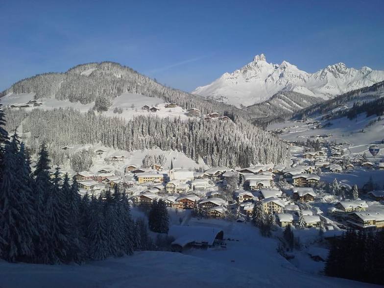
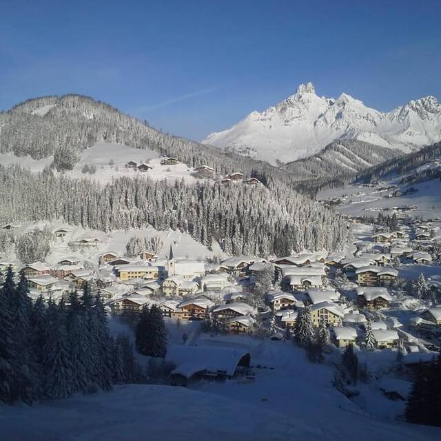
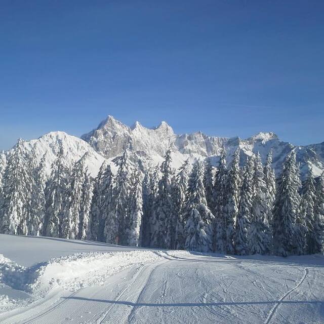
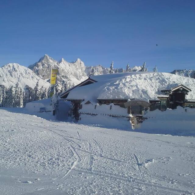
I first discovered Filzmoos in 1990 and since then I have had 14 or 15 holidays there, including 2 in the summer - I think that says it all! In fact, I am off there again in 2 weeks time and can't wait. During theses 20 years I have introduced many people to the village and without exception they have all been back again. In fact one of the great things about Filzmoos is seeing so many familiar faces over the years and all the new friends I have made. While Filzmoos does not have an enormous ski area there are several other resorts just down the valley that are included on your lift pass and my 2 favourites are Zauchensee and Flachauwinkl, both of which give you access to a large linked area. In all the years I have been going there I have never experienced a lack of snow and there have been some years when there has been so much that we have wondered if we would be able to get out of the village! However, if there is ever a problem with poor conditions, there is a glacier with guaranteed snow nearby. A short way further on is the World Cup resort of Schladming which is also well worth a visit. Back in Filzmoos things are fairly quiet at night but apres-ski at the Happy Filzmoos is not to be missed! There are several good eating places in the village for both lunch and dinner and some worthwhile stops for a drink. It is an especially good choice of resort for families and beginners and has a very safe and friendly environment. Give it a try and you will not be disappointed. If anyone would like any more information, they can email me at [email protected].
Mike Swanton from United Kingdom writes:
I first discovered Filzmoos in 1990 and since then I have had 14 or 15 holidays there, including 2 in the summer - I think that says it all! In fact, I am off there again in 2 weeks time and can't wait. During theses 20 years I have introduced many people to the village and without exception they have all been back again. In fact one of the great things about Filzmoos is seeing so many familiar faces over the years and all the new friends I have made.
While Filzmoos does not have an enormous ski area there are several other resorts just down the valley that are included on your lift pass and my 2 favourites are Zauchensee and Flachauwinkl, both of which give you access to a large linked area. In all the years I have been going there I have never experienced a lack of snow and there have been some years when there has been so much that we have wondered if we would be able to get out of the village! However, if there is ever a problem with poor conditions, there is a glacier with guaranteed snow nearby. A short way further on is the World Cup resort of Schladming which is also well worth a visit.
Back in Filzmoos things are fairly quiet at night but apres-ski at the Happy Filzmoos is not to be missed! There are several good eating places in the village for both lunch and dinner and some worthwhile stops for a drink. It is an especially good choice of resort for families and beginners and has a very safe and friendly environment. Give it a try and you will not be disappointed.
If anyone would like any more information, they can email me at [email protected].


 Nearest