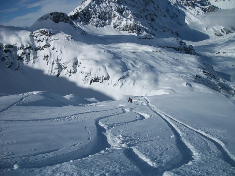


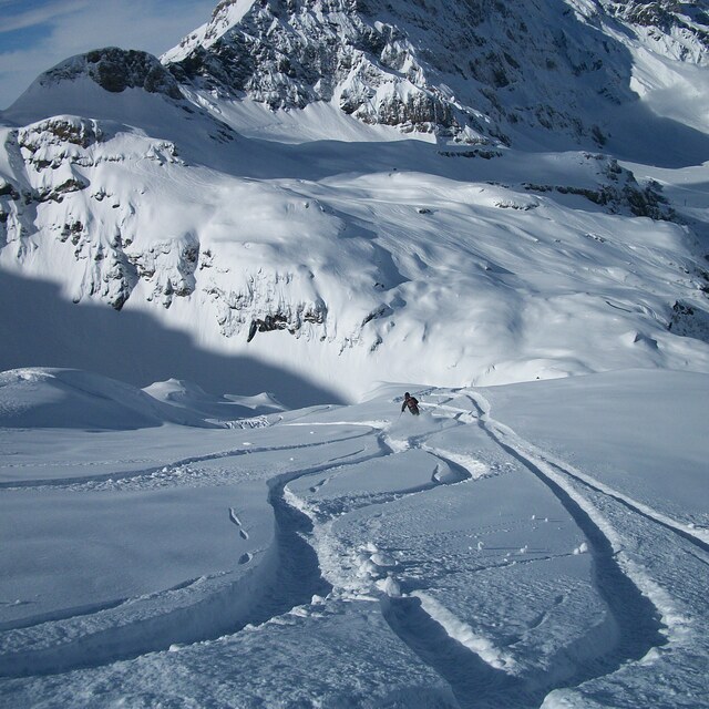
Portillo Re-Opens To Guests Arriving By Helicopter
Chile’s famous Portillo ski resort is reported to have re-opened to guests arriving by helicopter after being cut off by road for more than two weeks by over 6m/20 feet of snowfall.

Next 3 days weather summary:Heavy rain (total 30.0mm), heaviest during Tue night. Very mild (max 10°C on Mon morning, min 8°C on Tue night). Wind will be generally light. | Days 4-6 weather summary:Heavy rain (total 21.0mm), heaviest during Thu night. Mild temperatures (max 9°C on Thu morning, min 5°C on Thu night). Wind will be generally light. | |||||||||||||||||
Monday 3 | Tuesday 4 | Wednesday 5 | Thursday 6 | Friday 7 | Saturday 8 | |||||||||||||
AM | PM | night | AM | PM | night | AM | PM | night | AM | PM | night | AM | PM | night | AM | PM | night | |
some clouds | t-storm risk | rain shwrs | clear | some clouds | rain shwrs | rain shwrs | t-storm risk | rain shwrs | t-storm risk | t-storm risk | rain shwrs | clear | clear | some clouds | clear | some clouds | clear | |
km/h | ||||||||||||||||||
Snow map |  |  |  |  |  |  | ||||||||||||
— | — | — | — | — | — | — | — | — | — | — | — | — | — | — | — | — | — | |
mm | — | 2 | 3 | — | — | 9 | 1 | 7 | 8 | 1 | 9 | 11 | — | — | — | — | — | — |
max °C | 10 | 10 | 10 | 9 | 10 | 9 | 8 | 8 | 9 | 9 | 8 | 6 | 7 | 7 | 7 | 7 | 7 | 8 |
min °C | 10 | 10 | 9 | 9 | 10 | 8 | 8 | 8 | 8 | 8 | 7 | 5 | 6 | 7 | 6 | 6 | 7 | 7 |
chill °C | 10 | 10 | 7 | 7 | 8 | 6 | 7 | 8 | 7 | 7 | 6 | 2 | 6 | 6 | 6 | 5 | 5 | 5 |
Humid % | 58 | 67 | 67 | 73 | 72 | 76 | 77 | 90 | 71 | 75 | 93 | 77 | 66 | 86 | 79 | 80 | 82 | 52 |
Freeze m | 4500 | 4550 | 4500 | 4350 | 4550 | 4400 | 4350 | 4400 | 4400 | 4300 | 4200 | 4100 | 4050 | 4100 | 4150 | 4050 | 4100 | 4200 |
6:07 | — | — | 6:09 | — | — | 6:09 | — | — | 6:11 | — | — | 6:11 | — | — | 6:13 | — | — | |
— | — | 8:55 | — | — | 8:54 | — | — | 8:52 | — | — | 8:52 | — | — | 8:50 | — | — | 8:49 | |
Go pro and carve into:
Avalanche information: European Avalanche Warning Services (EAWS)
Latest snow reports near Engelberg:
| Top snow depth: | 0 cm |
|---|---|
| Bottom snow depth: | 0 cm |
| Fresh snowfall depth: | — |
| Last snowfall: | 10 Jun 2026 |
| Snow Alerts | Create Alert |
0.1 | Bluebird Powder days Fresh snow, mostly sunny, light wind. |
|---|---|
0.1 | Powder days Fresh snow, limited sun, any wind. |
0.2 | Bluebird days Average snow, mostly sunny, light wind. |

The above table gives the weather forecast for Engelberg at the specific elevation of 3020 m. Our sophisticated weather models allow us to provide snow forecasts for the top, middle and bottom ski stations of Engelberg. To access the weather forecasts for the other elevations, use the tab navigation above the table. For a wider view of the weather, check out the Weather Map of Switzerland.
Click here to read further information on freezing levels and how we forecast our temperatures.
Overall 3.8 Based on 32 votes and 21 reviews
Ok, so it’s been on my bucket list for ages to ski here on a perfect powder day. And it didn’t disappoint. The queues were as bad as all the reviews say, the lifts are shitty. And there were tons of intermediate off-pisters with the fully shiny gear. And yet it was still amazing. The pow was deep, the terrain is amazing. And you pop over a ridge and it just opens out into massive powder fields. But, even when the skiing is this good the experience just sucks and I won’t be rushing back.
Rangerdad from Germany writes:
Ok, so it’s been on my bucket list for ages to ski here on a perfect powder day. And it didn’t disappoint. The queues were as bad as all the reviews say, the lifts are shitty. And there were tons of intermediate off-pisters with the fully shiny gear. And yet it was still amazing. The pow was deep, the terrain is amazing. And you pop over a ridge and it just opens out into massive powder fields. But, even when the skiing is this good the experience just sucks and I won’t be rushing back.


 Nearest