


Portillo Storm Snowfall Total Passes 5m / 17 Feet
A snow storm that has now continued for nine days has taken Chilean ski resort Portillo to a snowfall total of 5.2 metres (17 feet) so far, with more snow forecast.

Next 3 days weather summary:Mostly dry. Warm (max 30°C on Fri afternoon, min 12°C on Wed night). Wind will be generally light. | Days 4-6 weather summary:Mostly dry. Warm (max 31°C on Sat afternoon, min 13°C on Sat night). Wind will be generally light. | ||||||||||||||||
Wed 29 | Thursday 30 | Friday 31 | Saturday 1 | Sunday 2 | Monday 3 | ||||||||||||
PM | night | AM | PM | night | AM | PM | night | AM | PM | night | AM | PM | night | AM | PM | night | |
clear | clear | clear | clear | clear | clear | clear | clear | clear | clear | clear | clear | clear | clear | clear | clear | clear | |
km/h | |||||||||||||||||
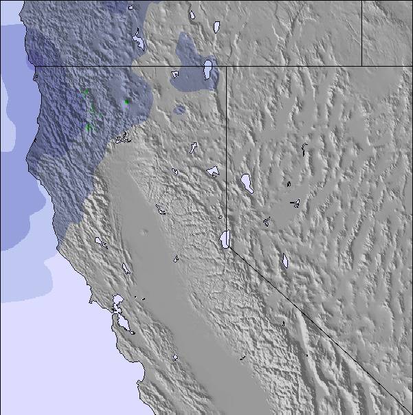
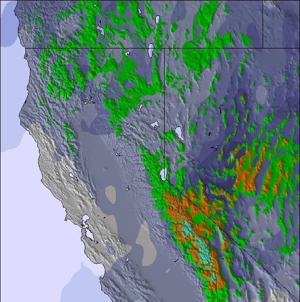
Snow map | 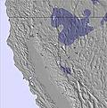 | 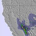 | 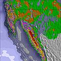 | 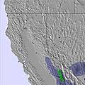 | 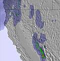 | 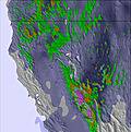 | |||||||||||
— | — | — | — | — | — | — | — | — | — | — | — | — | — | — | — | — | |
mm | — | — | — | — | — | — | — | — | — | — | — | — | — | — | — | — | — |
max °C | 27 | 21 | 24 | 28 | 21 | 26 | 30 | 22 | 27 | 31 | 22 | 26 | 30 | 22 | 25 | 31 | 23 |
min °C | 27 | 12 | 18 | 28 | 13 | 19 | 29 | 14 | 20 | 29 | 13 | 19 | 30 | 13 | 18 | 29 | 14 |
chill °C | 27 | 12 | 18 | 28 | 13 | 19 | 29 | 14 | 20 | 29 | 13 | 19 | 30 | 13 | 18 | 29 | 14 |
Humid % | 17 | 38 | 19 | 12 | 26 | 14 | 9 | 21 | 10 | 7 | 25 | 15 | 8 | 26 | 16 | 9 | 19 |
Freeze m | 4950 | 4800 | 4850 | 5100 | 5000 | 5250 | 5600 | 5500 | 5350 | 5450 | 5200 | 5150 | 5450 | 5100 | 5050 | 5500 | 5250 |
— | — | 5:56 | — | — | 5:58 | — | — | 5:58 | — | — | 6:00 | — | — | 6:01 | — | — | |
— | 8:20 | — | — | 8:19 | — | — | 8:17 | — | — | 8:16 | — | — | 8:15 | — | — | 8:15 | |
Go pro and carve into:
Avalanche information: National Avalanche Center
Latest snow reports near Coppervale:
| Top snow depth: | — |
|---|---|
| Bottom snow depth: | — |
| Fresh snowfall depth: | — |
| Last snowfall: | 26 Apr 2026 |
| Snow Alerts | Create Alert |
0.0 | Bluebird Powder days Fresh snow, mostly sunny, light wind. |
|---|---|
0.0 | Powder days Fresh snow, limited sun, any wind. |
0.0 | Bluebird days Average snow, mostly sunny, light wind. |
The above table gives the weather forecast for Coppervale at the specific elevation of 1859 m. Our sophisticated weather models allow us to provide snow forecasts for the top, middle and bottom ski stations of Coppervale. To access the weather forecasts for the other elevations, use the tab navigation above the table. For a wider view of the weather, check out the Weather Map of United States.
Click here to read further information on freezing levels and how we forecast our temperatures.
Overall 2.3 Based on 3 votes and 3 reviews
Coppervale is a small and quiet locals mountain/hill, and they like it that way. They shun newcomers and are quite anal about their beloved surface lift. My experiences included several people, including a couple of employee's, and even one of the owners being very disrespectful and in some ways in an inappropriate manner in giving direction as to the correct ways to "use their lift and mountain." They have many rules which are not posted anywhere on or around the mountain and are unspoken until you disobey one. I was constantly being yelled at for not using the lift right, or riding where I "wasn't supposed to" when there was nothing posted regarding restrictions. Everyone has a tendency to mean-mug as you pass them, instead of that friendly good-time smile you see everywhere else. My companions experienced somewhat similar results as we felt unwelcome by everyone. The price paid for lift tickets are also way not worth the price. Even if I had a good time paying the extra 4 dollars to go to Mt. Shasta would well have been worth not having to ride surface lifts all day long.
Ronnie Stilwell from United States writes:
Coppervale is a small and quiet locals mountain/hill, and they like it that way. They shun newcomers and are quite anal about their beloved surface lift. My experiences included several people, including a couple of employee's, and even one of the owners being very disrespectful and in some ways in an inappropriate manner in giving direction as to the correct ways to "use their lift and mountain." They have many rules which are not posted anywhere on or around the mountain and are unspoken until you disobey one. I was constantly being yelled at for not using the lift right, or riding where I "wasn't supposed to" when there was nothing posted regarding restrictions. Everyone has a tendency to mean-mug as you pass them, instead of that friendly good-time smile you see everywhere else. My companions experienced somewhat similar results as we felt unwelcome by everyone. The price paid for lift tickets are also way not worth the price. Even if I had a good time paying the extra 4 dollars to go to Mt. Shasta would well have been worth not having to ride surface lifts all day long.

 Nearest