

Portillo Storm Snowfall Total Passes 5m / 17 Feet
A snow storm that has now continued for nine days has taken Chilean ski resort Portillo to a snowfall total of 5.2 metres (17 feet) so far, with more snow forecast.

Next 4 days weather summary:Light rain (total 5.0mm), mostly falling on Fri night. Warm (max 26°C on Thu afternoon, min 17°C on Fri night). Wind will be generally light. | Days 5-7 weather summary:Heavy rain (total 24.0mm), heaviest during Mon night. Warm (max 26°C on Sun afternoon, min 15°C on Mon night). Wind will be generally light. | |||||||||||||||
Thursday 30 | Friday 31 | Saturday 1 | Sunday 2 | Monday 3 | ||||||||||||
night | AM | PM | night | AM | PM | night | AM | PM | night | AM | PM | night | AM | PM | night | |
clear | clear | clear | clear | some clouds | t-storm risk | rain shwrs | clear | clear | clear | clear | clear | some clouds | clear | some clouds | heavy rain | |
km/h | ||||||||||||||||
Snow map |  |  |  |  |  |  | ||||||||||
— | — | — | — | — | — | — | — | — | — | — | — | — | — | — | — | |
mm | — | — | — | — | — | 1 | 4 | — | — | — | — | — | — | — | — | 15 |
max °C | 22 | 24 | 26 | 24 | 24 | 25 | 21 | 21 | 24 | 22 | 23 | 26 | 23 | 23 | 26 | 16 |
min °C | 20 | 20 | 26 | 21 | 22 | 19 | 17 | 20 | 23 | 19 | 20 | 25 | 18 | 20 | 26 | 15 |
chill °C | 20 | 20 | 26 | 21 | 22 | 19 | 17 | 20 | 23 | 19 | 20 | 25 | 18 | 20 | 26 | 15 |
Humid % | 36 | 22 | 21 | 37 | 36 | 64 | 63 | 45 | 32 | 45 | 28 | 25 | 52 | 39 | 28 | 66 |
Freeze m | 4650 | 4600 | 4650 | 4750 | 4650 | 4550 | 4500 | 4400 | 4600 | 4600 | 4550 | 4700 | 4600 | 4550 | 4750 | 4450 |
— | 6:11 | — | — | 6:13 | — | — | 6:15 | — | — | 6:16 | — | — | 6:16 | — | — | |
— | — | — | 9:05 | — | — | 9:04 | — | — | 9:02 | — | — | 9:01 | — | — | 9:00 | |
Go pro and carve into:
Avalanche information: European Avalanche Warning Services (EAWS)
Latest snow reports near Combloux:
| Top snow depth: | 0 cm |
|---|---|
| Bottom snow depth: | 0 cm |
| Fresh snowfall depth: | — |
| Last snowfall: | 16 May 2026 |
| Snow Alerts | Create Alert |
0.0 | Bluebird Powder days Fresh snow, mostly sunny, light wind. |
|---|---|
0.0 | Powder days Fresh snow, limited sun, any wind. |
0.0 | Bluebird days Average snow, mostly sunny, light wind. |
The above table gives the weather forecast for Combloux at the specific elevation of 1565 m. Our sophisticated weather models allow us to provide snow forecasts for the top, middle and bottom ski stations of Combloux. To access the weather forecasts for the other elevations, use the tab navigation above the table. For a wider view of the weather, check out the Weather Map of France.
Click here to read further information on freezing levels and how we forecast our temperatures.
Overall 4.1 Based on 5 votes and 5 reviews
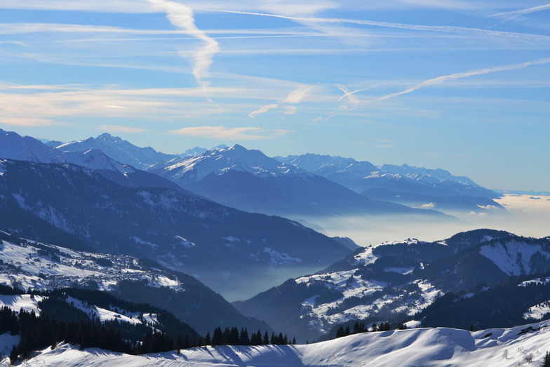
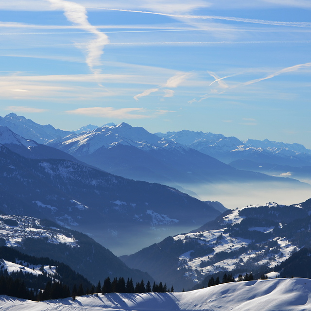
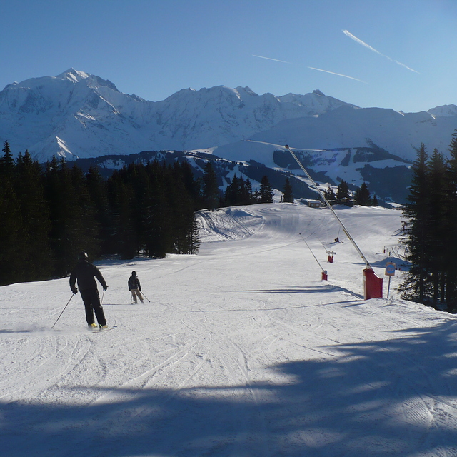
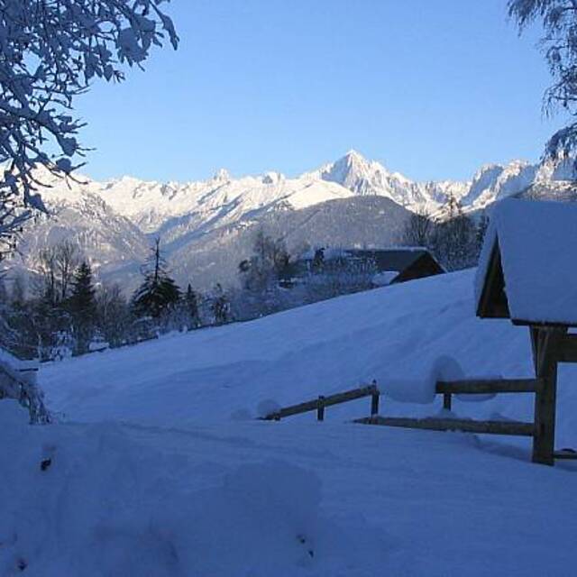
First went to Combloux in 2003 and went back every year since. Great French ski area with mostly French people, who enjoy great views, great food, and a well kept secret. Access to bigger slopes and more skiing is easy by car. It's even possible to touch down in Geneva and be on the slopes in the hour.
Phill from United Kingdom writes:
First went to Combloux in 2003 and went back every year since.
Great French ski area with mostly French people, who enjoy great views, great food, and a well kept secret.
Access to bigger slopes and more skiing is easy by car.
It's even possible to touch down in Geneva and be on the slopes in the hour.


 Nearest