


Portillo Re-Opens To Guests Arriving By Helicopter
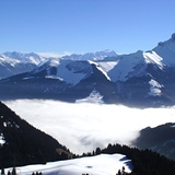
Chile’s famous Portillo ski resort is reported to have re-opened to guests arriving by helicopter after being cut off by road for more than two weeks by over 6m/20 feet of snowfall.

Next 3 days weather summary:Heavy rain (total 44.0mm), heaviest during Mon night. Very mild (max 19°C on Mon afternoon, min 13°C on Tue afternoon). Wind will be generally light. | Days 4-6 weather summary:Light rain (total 9.0mm), mostly falling on Thu afternoon. Very mild (max 15°C on Thu morning, min 10°C on Thu night). Wind will be generally light. | |||||||||||||||||
Monday 3 | Tuesday 4 | Wednesday 5 | Thursday 6 | Friday 7 | Saturday 8 | |||||||||||||
AM | PM | night | AM | PM | night | AM | PM | night | AM | PM | night | AM | PM | night | AM | PM | night | |
clear | t-storm risk | rain shwrs | clear | t-storm risk | rain shwrs | clear | rain shwrs | rain shwrs | clear | mod. rain | rain shwrs | clear | some clouds | clear | clear | clear | clear | |
km/h | ||||||||||||||||||
Snow map |  |  |  |  |  |  | ||||||||||||
— | — | — | — | — | — | — | — | — | — | — | — | — | — | — | — | — | — | |
mm | — | 3 | 16 | — | 13 | 10 | — | 1 | 1 | — | 8 | 1 | — | — | — | — | — | — |
max °C | 17 | 19 | 14 | 15 | 16 | 13 | 14 | 16 | 15 | 15 | 13 | 11 | 11 | 13 | 12 | 13 | 15 | 14 |
min °C | 15 | 15 | 14 | 14 | 13 | 13 | 13 | 16 | 14 | 13 | 11 | 10 | 10 | 12 | 11 | 11 | 14 | 13 |
chill °C | 15 | 14 | 14 | 14 | 13 | 13 | 13 | 16 | 14 | 13 | 10 | 10 | 10 | 12 | 11 | 11 | 14 | 12 |
Humid % | 44 | 71 | 65 | 57 | 83 | 66 | 61 | 63 | 60 | 60 | 88 | 81 | 70 | 60 | 50 | 40 | 45 | 45 |
Freeze m | 4550 | 4400 | 4500 | 4500 | 4350 | 4400 | 4300 | 4350 | 4400 | 4300 | 4300 | 4150 | 4150 | 4250 | 4300 | 4300 | 4200 | 4250 |
6:15 | — | — | 6:16 | — | — | 6:18 | — | — | 6:18 | — | — | 6:20 | — | — | 6:20 | — | — | |
— | — | 9:00 | — | — | 8:59 | — | — | 8:58 | — | — | 8:55 | — | — | 8:54 | — | — | 8:52 | |
Go pro and carve into:
Avalanche information: European Avalanche Warning Services (EAWS)
Latest snow reports near Chatel:
| Top snow depth: | — |
|---|---|
| Bottom snow depth: | — |
| Fresh snowfall depth: | — |
| Last snowfall: | 16 May 2026 |
| Snow Alerts | Create Alert |
0.0 | Bluebird Powder days Fresh snow, mostly sunny, light wind. |
|---|---|
0.0 | Powder days Fresh snow, limited sun, any wind. |
0.0 | Bluebird days Average snow, mostly sunny, light wind. |

The above table gives the weather forecast for Chatel at the specific elevation of 2201 m. Our sophisticated weather models allow us to provide snow forecasts for the top, middle and bottom ski stations of Chatel. To access the weather forecasts for the other elevations, use the tab navigation above the table. For a wider view of the weather, check out the Weather Map of France.
Click here to read further information on freezing levels and how we forecast our temperatures.
Overall 4.4 Based on 59 votes and 66 reviews
Spent a day in Chatel. What a lovely place. The skiing was incredibly varied, superb views onto the Dente de Midi(at the top), really well groomed runs and we had lunch in town at a place that was very close to Michelin star quality. Highly recommend this place. Easy access from the Swiss autoroute and a quick drive up.
walter from Italy writes:
Spent a day in Chatel. What a lovely place. The skiing was incredibly varied, superb views onto the Dente de Midi(at the top), really well groomed runs and we had lunch in town at a place that was very close to Michelin star quality. Highly recommend this place. Easy access from the Swiss autoroute and a quick drive up.


 Nearest