

Portillo Storm Snowfall Total Passes 5m / 17 Feet
A snow storm that has now continued for nine days has taken Chilean ski resort Portillo to a snowfall total of 5.2 metres (17 feet) so far, with more snow forecast.

Next 4 days weather summary:Light rain (total 5.0mm), mostly falling on Sun night. Very mild (max 16°C on Wed afternoon, min 10°C on Mon morning). Winds decreasing (near gales from the W on Sun night, calm by Tue afternoon). | Days 5-7 weather summary:Mostly dry. Very mild (max 17°C on Thu afternoon, min 13°C on Fri morning). Wind will be generally light. | |||||||||||||||
Monday 27 | Tuesday 28 | Wednesday 29 | Thursday 30 | Friday 31 | ||||||||||||
night | AM | PM | night | AM | PM | night | AM | PM | night | AM | PM | night | AM | PM | night | |
rain shwrs | t-storm risk | rain shwrs | clear | clear | some clouds | clear | clear | clear | clear | clear | clear | clear | clear | clear | clear | |
km/h | ||||||||||||||||
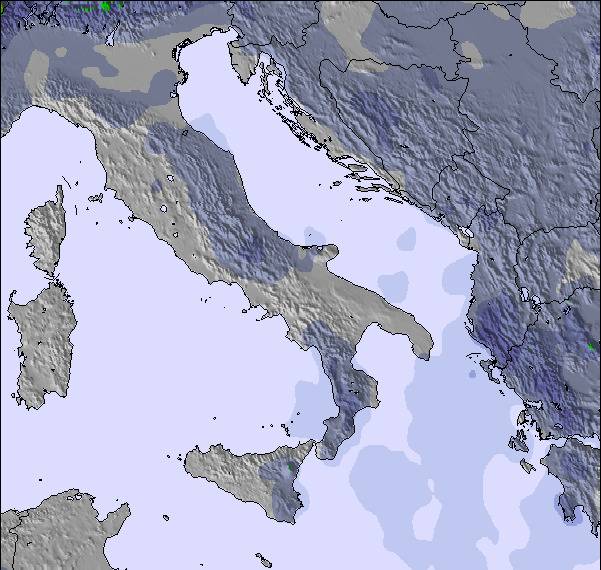
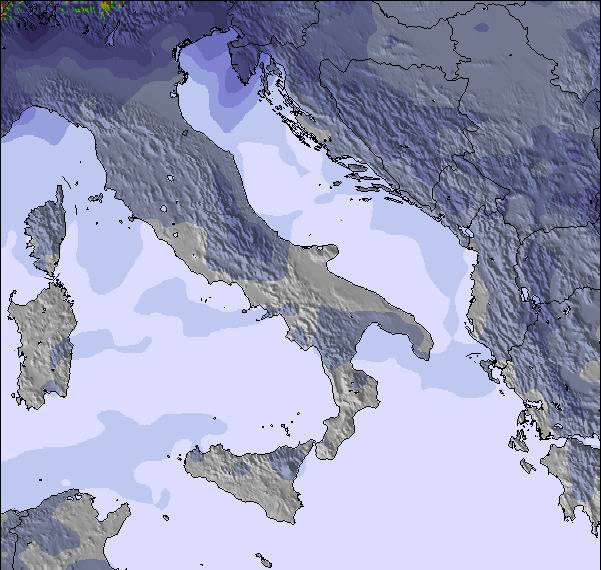
Snow map | 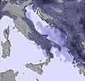 | 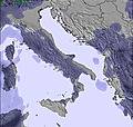 | 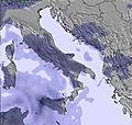 | 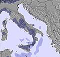 | 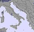 | 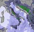 | ||||||||||
— | — | — | — | — | — | — | — | — | — | — | — | — | — | — | — | |
mm | 3 | 1 | 1 | — | — | — | — | — | — | — | — | — | — | — | — | — |
max °C | 14 | 11 | 12 | 12 | 11 | 14 | 14 | 14 | 16 | 16 | 15 | 17 | 16 | 14 | 16 | 16 |
min °C | 12 | 10 | 11 | 11 | 11 | 13 | 13 | 13 | 15 | 14 | 14 | 16 | 14 | 13 | 16 | 13 |
chill °C | 8 | 6 | 7 | 11 | 11 | 13 | 13 | 13 | 15 | 14 | 14 | 16 | 13 | 12 | 15 | 12 |
Humid % | 48 | 64 | 60 | 64 | 64 | 63 | 55 | 46 | 50 | 48 | 33 | 37 | 44 | 47 | 34 | 26 |
Freeze m | 4300 | 4000 | 4150 | 4150 | 4200 | 4450 | 4550 | 4600 | 4700 | 4650 | 4600 | 4700 | 4500 | 4300 | 4500 | 4450 |
— | 5:22 | — | — | 5:24 | — | — | 5:24 | — | — | 5:26 | — | — | 5:26 | — | — | |
— | — | — | 8:00 | — | — | 8:00 | — | 7:59 | — | — | 7:58 | — | — | 7:57 | — | |
Go pro and carve into:
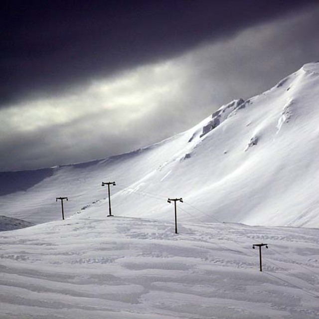
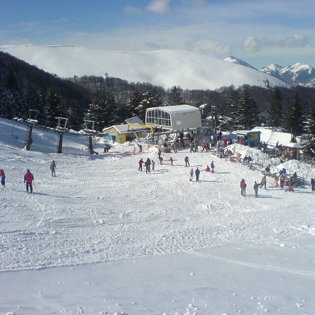
Latest snow reports near Brezovica:
| Top snow depth: | — |
|---|---|
| Bottom snow depth: | — |
| Fresh snowfall depth: | — |
| Last snowfall: | 19 May 2026 |
| Snow Alerts | Create Alert |
0.0 | Bluebird Powder days Fresh snow, mostly sunny, light wind. |
|---|---|
0.0 | Powder days Fresh snow, limited sun, any wind. |
0.0 | Bluebird days Average snow, mostly sunny, light wind. |
The above table gives the weather forecast for Brezovica at the specific elevation of 2499 m. Our sophisticated weather models allow us to provide snow forecasts for the top, middle and bottom ski stations of Brezovica. To access the weather forecasts for the other elevations, use the tab navigation above the table. For a wider view of the weather, check out the Weather Map of Kosovo.
Click here to read further information on freezing levels and how we forecast our temperatures.
Overall 3.8 Based on 39 votes and 28 reviews
Brezovica, in terms of the raw material (the mountains themselves), is awesome. As all have mentioned, the infrastructure is not like anything I have ever seen. It is impossible to know if/when the lift will run. I have gone four days this year, and one lift plus the rope tow have worked each of those times, but unpredictably. Sometimes, only for 2-3 hours. This last Friday, it was running for at least six hours straight which was amazing! You can always hike up. You can sometimes pay someone at the base for a snow mobile ride up and I am told there are cat services for free skiing. The terrain is really special-there are so many nooks and crannies in an around the pistes that you can get to without hiking-some really steep stuff, wide open stuff, thick glades at the bottom, spread out trees towards the top. Plus there are huge mountains with bowls, couloirs, glades, etc. in all directions, if you are willing to hike. Avalanches are a possibility, so be aware of this risk if you do start exploring. The parking area is tiny. There is an open garbage heap next to it with feral dogs. There are a bunch of bars/cafes at the base with hip-hop and techno. If you go, don't expect the lifts to work and if they do, bonus! The place is awful and awesome all at once!
Brian from United States writes:
Brezovica, in terms of the raw material (the mountains themselves), is awesome. As all have mentioned, the infrastructure is not like anything I have ever seen. It is impossible to know if/when the lift will run. I have gone four days this year, and one lift plus the rope tow have worked each of those times, but unpredictably. Sometimes, only for 2-3 hours. This last Friday, it was running for at least six hours straight which was amazing! You can always hike up. You can sometimes pay someone at the base for a snow mobile ride up and I am told there are cat services for free skiing. The terrain is really special-there are so many nooks and crannies in an around the pistes that you can get to without hiking-some really steep stuff, wide open stuff, thick glades at the bottom, spread out trees towards the top. Plus there are huge mountains with bowls, couloirs, glades, etc. in all directions, if you are willing to hike. Avalanches are a possibility, so be aware of this risk if you do start exploring. The parking area is tiny. There is an open garbage heap next to it with feral dogs. There are a bunch of bars/cafes at the base with hip-hop and techno. If you go, don't expect the lifts to work and if they do, bonus! The place is awful and awesome all at once!

 Nearest