


Global Weekly Snow Roundup #320
Weekly Snow News for the world, updated 25 June 2026: Chile and New Zealand's seasons proper set to begin, Tignes and Sunshine reopen for summer skiing. weekend as Riksgransen ends its 2026 season.

Next 3 days weather summary:Heavy rain (total 30.0mm), heaviest during Sun night. Warm (max 27°C on Sun afternoon, min 17°C on Mon night). Wind will be generally light. | Days 4-6 weather summary:Heavy rain (total 20.0mm), heaviest during Wed night. Warm (max 21°C on Thu afternoon, min 11°C on Fri night). Wind will be generally light. | ||||||||||||||||
Sun 28 | Monday 29 | Tuesday 30 | Wednesday 1 | Thursday 2 | Friday 3 | ||||||||||||
PM | night | AM | PM | night | AM | PM | night | AM | PM | night | AM | PM | night | AM | PM | night | |
t-storm risk | rain shwrs | clear | t-storm risk | rain shwrs | some clouds | t-storm risk | rain shwrs | t-storm risk | mod. rain | rain shwrs | clear | clear | some clouds | light rain | light rain | rain shwrs | |
km/h | |||||||||||||||||
Snow map | 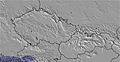 | 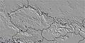 | 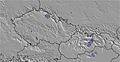 |  |  |  | |||||||||||
— | — | — | — | — | — | — | — | — | — | — | — | — | — | — | — | — | |
mm | 2 | 6 | — | 5 | 2 | — | 1 | 9 | 5 | 6 | 7 | — | — | — | 2 | 3 | 2 |
max °C | 27 | 19 | 24 | 24 | 18 | 21 | 23 | 21 | 18 | 17 | 14 | 19 | 21 | 19 | 17 | 14 | 13 |
min °C | 23 | 18 | 20 | 21 | 17 | 19 | 22 | 18 | 17 | 14 | 14 | 16 | 20 | 16 | 13 | 13 | 11 |
chill °C | 23 | 18 | 20 | 21 | 17 | 19 | 22 | 18 | 17 | 13 | 14 | 16 | 20 | 15 | 12 | 11 | 10 |
Humid % | 69 | 68 | 53 | 75 | 68 | 59 | 70 | 78 | 93 | 94 | 71 | 41 | 42 | 67 | 90 | 74 | 73 |
Freeze m | 4550 | 4500 | 4350 | 4300 | 4350 | 4250 | 4350 | 4300 | 4100 | 3850 | 3300 | 3300 | 3650 | 3550 | 3200 | 2950 | 2800 |
— | — | 5:11 | — | — | 5:13 | — | — | 5:13 | — | — | 5:13 | — | — | 5:15 | — | — | |
— | 9:09 | — | — | 9:09 | — | — | 9:08 | — | — | 9:08 | — | — | 9:08 | — | — | 9:08 | |
Go pro and carve into:
Avalanche information: European Avalanche Warning Services (EAWS)
Latest snow reports near Bischofswiesen/Götschen:
| Top snow depth: | 0 cm |
|---|---|
| Bottom snow depth: | 0 cm |
| Fresh snowfall depth: | — |
| Last snowfall: | 16 May 2026 |
| Snow Alerts | Create Alert |
0.0 | Bluebird Powder days Fresh snow, mostly sunny, light wind. |
|---|---|
0.0 | Powder days Fresh snow, limited sun, any wind. |
0.0 | Bluebird days Average snow, mostly sunny, light wind. |
The above table gives the weather forecast for Bischofswiesen/Götschen at the specific elevation of 1094 m. Our sophisticated weather models allow us to provide snow forecasts for the top, middle and bottom ski stations of Bischofswiesen/Götschen. To access the weather forecasts for the other elevations, use the tab navigation above the table. For a wider view of the weather, check out the Weather Map of Germany.
Click here to read further information on freezing levels and how we forecast our temperatures.
Resort name is also written as Bischofswiesen-Goetschen.
Overall 3.0 Based on 10 votes and 1 review
Pretty area but small and when half of it is closed for sports events it becomes simply much too small. Sadly, they often close it and tend to forget to inform about it on their website. You learn when you come and then the day is wasted.
Andy from Russia writes:
Pretty area but small and when half of it is closed for sports events it becomes simply much too small. Sadly, they often close it and tend to forget to inform about it on their website. You learn when you come and then the day is wasted.
Click here to submit your own review of Bischofswiesen/Götschen


 Nearest