


A New Largest Ski Area in New Zealand?
The Remarkables is hoping to overtake Cardrona as New Zealand’s largest ski area under a major NZD 150 million‑plus expansion proposal lodged by owner NZSki.

Next 4 days weather summary:Heavy rain (total 26.0mm), heaviest during Thu night. Warm (max 23°C on Thu afternoon, min 14°C on Wed night). Wind will be generally light. | Days 5-7 weather summary:Light rain (total 8.0mm), mostly falling on Sun afternoon. Warm (max 24°C on Tue afternoon, min 15°C on Sat night). Wind will be generally light. | |||||||||||||||
Thursday 25 | Friday 26 | Saturday 27 | Sunday 28 | Monday 29 | ||||||||||||
night | AM | PM | night | AM | PM | night | AM | PM | night | AM | PM | night | AM | PM | night | |
cloudy | some clouds | some clouds | heavy rain | light rain | t-storm risk | rain shwrs | cloudy | t-storm risk | rain shwrs | t-storm risk | t-storm risk | rain shwrs | clear | cloudy | some clouds | |
km/h | ||||||||||||||||
Snow map |  |  |  |  |  |  | ||||||||||
— | — | — | — | — | — | — | — | — | — | — | — | — | — | — | — | |
mm | — | — | — | 18 | 2 | 2 | 1 | — | 3 | 2 | 1 | 4 | 1 | — | — | — |
max °C | 17 | 21 | 23 | 17 | 16 | 21 | 18 | 20 | 20 | 18 | 20 | 21 | 19 | 22 | 23 | 21 |
min °C | 14 | 17 | 20 | 14 | 15 | 20 | 15 | 17 | 20 | 15 | 17 | 20 | 15 | 19 | 22 | 16 |
chill °C | 13 | 17 | 20 | 14 | 15 | 20 | 15 | 17 | 20 | 15 | 17 | 20 | 15 | 19 | 22 | 16 |
Humid % | 81 | 44 | 61 | 99 | 93 | 63 | 84 | 65 | 79 | 94 | 66 | 65 | 80 | 47 | 59 | 68 |
Freeze m | 3450 | 3050 | 3000 | 3150 | 3400 | 3300 | 3650 | 3600 | 3600 | 3400 | 3400 | 3250 | 3350 | 3350 | 3250 | 3350 |
— | 5:01 | — | — | 5:03 | — | — | 5:03 | — | — | 5:03 | — | — | 5:03 | — | — | |
— | — | — | 8:31 | — | — | 8:31 | — | — | 8:31 | — | — | 8:31 | — | — | 8:31 | |
Go pro and carve into:
Avalanche information: National Avalanche Center
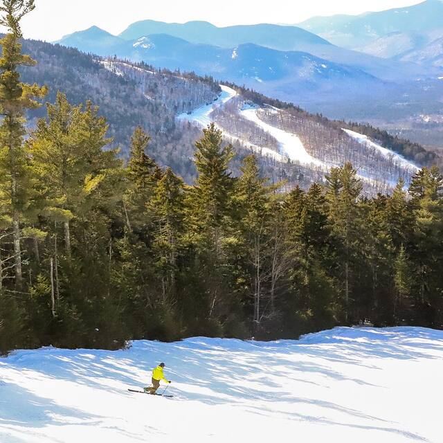
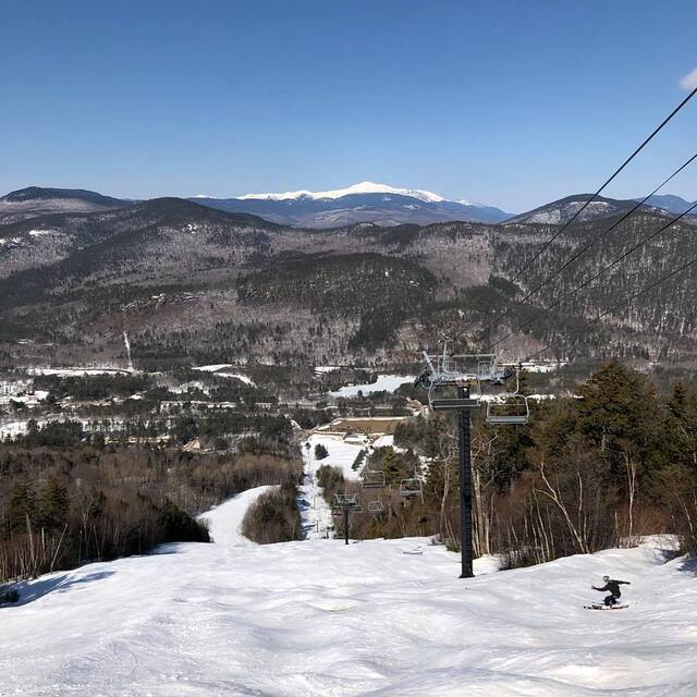
Latest snow reports near Attitash Mountain Resort:
| Top snow depth: | 0 cm |
|---|---|
| Bottom snow depth: | 0 cm |
| Fresh snowfall depth: | — |
| Last snowfall: | 30 May 2026 |
| Snow Alerts | Create Alert |
0.0 | Bluebird Powder days Fresh snow, mostly sunny, light wind. |
|---|---|
0.0 | Powder days Fresh snow, limited sun, any wind. |
0.0 | Bluebird days Average snow, mostly sunny, light wind. |
The above table gives the weather forecast for Attitash Mountain Resort at the specific elevation of 450 m. Our sophisticated weather models allow us to provide snow forecasts for the top, middle and bottom ski stations of Attitash Mountain Resort. To access the weather forecasts for the other elevations, use the tab navigation above the table. For a wider view of the weather, check out the Weather Map of United States.
Click here to read further information on freezing levels and how we forecast our temperatures.
Overall 2.9 Based on 12 votes and 1 review
Amazing, with the amount of money this ski area takes in, that the triple chair that brings you to the summit is actually older than the Attitash ski area itself. How, you might ask, was it purchased from another ski area? This chair breaks down quite often. Attitash has a low base elevation 600 feet; more likely to get rain than some nearby ski areas with higher base elevation on borderline snow/rain events. This ski area gets extremely crowded on weekends; its best to avoid on a saturday. On the positive side, it does have overpriced slope-side lodging available.
old school from United States writes:
Amazing, with the amount of money this ski area takes in, that the triple chair that brings you to the summit is actually older than the Attitash ski area itself. How, you might ask, was it purchased from another ski area? This chair breaks down quite often. Attitash has a low base elevation 600 feet; more likely to get rain than some nearby ski areas with higher base elevation on borderline snow/rain events. This ski area gets extremely crowded on weekends; its best to avoid on a saturday. On the positive side, it does have overpriced slope-side lodging available.
Click here to submit your own review of Attitash Mountain Resort


 Nearest