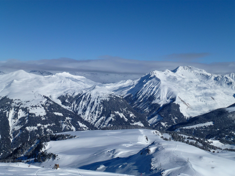


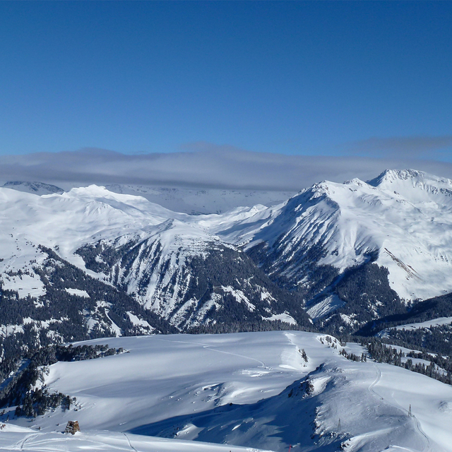
Portillo Storm Snowfall Total Passes 5m / 17 Feet
A snow storm that has now continued for nine days has taken Chilean ski resort Portillo to a snowfall total of 5.2 metres (17 feet) so far, with more snow forecast.

Next 4 days weather summary:Light rain (total 8.0mm), mostly falling on Wed afternoon. Warm (max 27°C on Thu afternoon, min 14°C on Tue night). Wind will be generally light. | Days 5-7 weather summary:Heavy rain (total 46.0mm), heaviest during Sat afternoon. Warm (max 25°C on Sat afternoon, min 13°C on Fri night). Wind will be generally light. | |||||||||||||||
Wednesday 29 | Thursday 30 | Friday 31 | Saturday 1 | Sunday 2 | ||||||||||||
night | AM | PM | night | AM | PM | night | AM | PM | night | AM | PM | night | AM | PM | night | |
clear | t-storm risk | t-storm risk | rain shwrs | clear | clear | rain shwrs | clear | cloudy | mod. rain | t-storm risk | heavy rain | rain shwrs | rain shwrs | t-storm risk | rain shwrs | |
km/h | ||||||||||||||||
Snow map |  |  |  |  |  |  | ||||||||||
— | — | — | — | — | — | — | — | — | — | — | — | — | — | — | — | |
mm | — | 1 | 3 | 3 | — | — | 1 | — | — | 10 | 1 | 21 | 4 | 1 | 3 | 5 |
max °C | 21 | 22 | 24 | 20 | 25 | 27 | 23 | 25 | 27 | 15 | 21 | 25 | 16 | 23 | 22 | 16 |
min °C | 14 | 18 | 23 | 16 | 19 | 26 | 15 | 20 | 27 | 13 | 18 | 16 | 14 | 18 | 22 | 15 |
chill °C | 14 | 18 | 23 | 16 | 19 | 26 | 15 | 20 | 27 | 13 | 18 | 16 | 14 | 18 | 22 | 15 |
Humid % | 76 | 53 | 51 | 59 | 27 | 22 | 58 | 40 | 31 | 78 | 55 | 89 | 63 | 45 | 52 | 70 |
Freeze m | 4450 | 4350 | 4500 | 4400 | 4550 | 4700 | 4650 | 4650 | 4800 | 4600 | 4500 | 4100 | 4600 | 4500 | 4600 | 4450 |
— | 5:56 | — | — | 5:58 | — | — | 5:58 | — | — | 6:00 | — | — | 6:01 | — | — | |
— | — | — | 8:57 | — | — | 8:55 | — | — | 8:54 | — | — | 8:53 | — | — | 8:52 | |
Go pro and carve into:
Avalanche information: European Avalanche Warning Services (EAWS)
Latest snow reports near Arosa:
| Top snow depth: | 0 cm |
|---|---|
| Bottom snow depth: | 0 cm |
| Fresh snowfall depth: | — |
| Last snowfall: | 10 Jun 2026 |
| Snow Alerts | Create Alert |
0.0 | Bluebird Powder days Fresh snow, mostly sunny, light wind. |
|---|---|
0.0 | Powder days Fresh snow, limited sun, any wind. |
0.0 | Bluebird days Average snow, mostly sunny, light wind. |

The above table gives the weather forecast for Arosa at the specific elevation of 1493 m. Our sophisticated weather models allow us to provide snow forecasts for the top, middle and bottom ski stations of Arosa. To access the weather forecasts for the other elevations, use the tab navigation above the table. For a wider view of the weather, check out the Weather Map of Switzerland.
Click here to read further information on freezing levels and how we forecast our temperatures.
Overall 4.4 Based on 20 votes and 12 reviews
I'm a boarder from Cape Town and been to the Weishorn (Arosa) for close on thirty years in a row. It's close to the sky and surely the most beautiful spot on earth. Oh and it gets cold, ie good powder to be found....
hans Kamhoot from South Africa writes:
I'm a boarder from Cape Town and been to the Weishorn (Arosa) for close on thirty years in a row. It's close to the sky and surely the most beautiful spot on earth. Oh and it gets cold, ie good powder to be found....


 Nearest