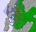
Next snow in Antillanca: 0.4cm on Fri 17th (after 6 AM local time)
View forecast
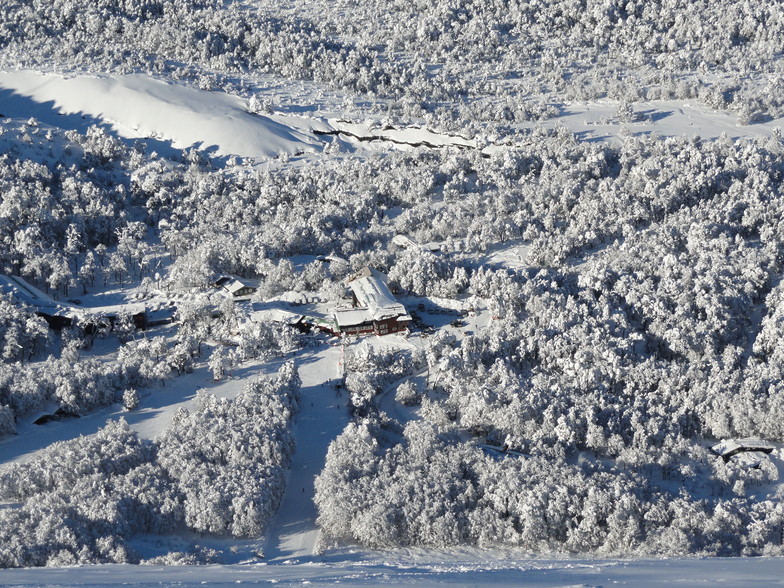
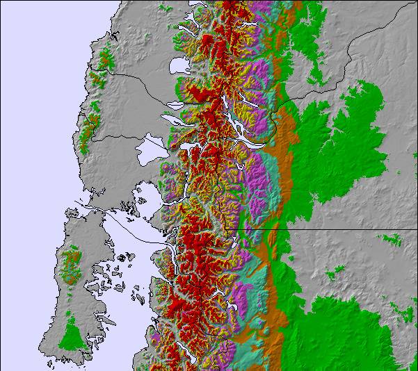
Antillancaat 1040 m altitude
Issued by Snow-Forecast.com at:2 am (local time) / 17 Jul 2026
Last 6 daysScroll left for last 6 daysNow
Next 3 days weather summary:
A dusting of snow turning to light rain (total 3.0mm) on Fri afternoon. Freeze-thaw conditions (max 2°C on Fri morning, min -4°C on Sun night). Wind will be generally light.
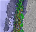
Days 4-6 weather summary:
A moderate fall of snow, heaviest on Wed night. Turning milder with moderate rain (total 10.0mm), heaviest on Wed night. Freeze-thaw conditions (max 5°C on Mon afternoon, min -3°C on Mon morning). Wind will be generally light.
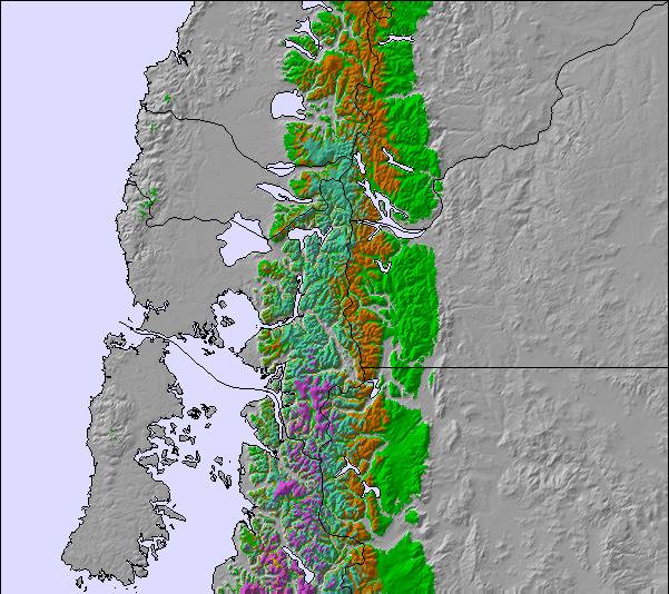
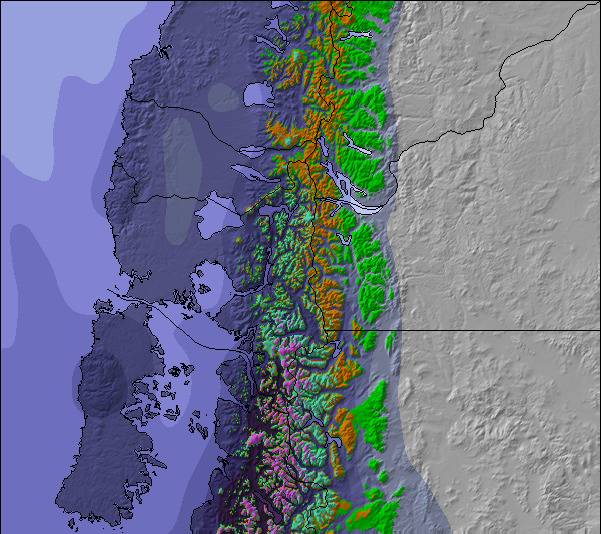
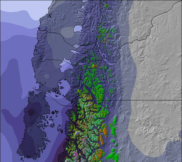
The above table gives the weather forecast for Antillanca at the specific elevation of 1040 m. Our sophisticated weather models allow us to provide snow forecasts for the top, middle and bottom ski stations of Antillanca. To access the weather forecasts for the other elevations, use the tab navigation above the table. For a wider view of the weather, check out the Weather Map of Chile.
Click here to read further information on freezing levels and how we forecast our temperatures.
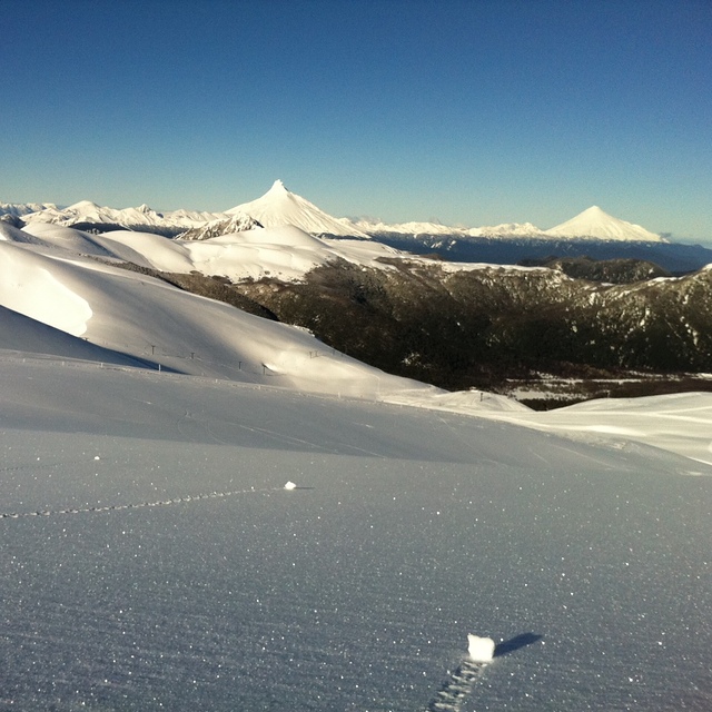
I work in Antillanca as a ski/snb instructor all the 2015 season. I had all the best and worst things from Chilean Patagonia. Center is not very big but it has nice pistes of difficulties between green and red level. Haique is a nice FIS certified red slope; races are organized here very often. Cerro Haique is also a nice start point for slack-country slopes called El Lobo and Araucano. Both are nice; fast and long but not very steep runs with plenty of space. From the top of Don Pedro lift you can enjoy a great view of Volcan Osorno, Volcan Puntiagudo and Volcan Puyehue. It's also a gaze to Antillanca backcountry: Cerro Mirador (30 minutes ski-touring) and Crater of Casablanca (about two hours skinning). Great views with mostly good snow; Casblanca run is great fun but backcountry is much bigger. As almost everywhere in Chile, you can spend a couple of days camping and ski-touring. I love this place! Bad things? Only one: difficult and unstable weather. It rains very often during the season. Sometimes rains a couple of days with no skiable window. Puelche Wind can be pretty strong too. Yes, this is Patagonia and when Pachamama enters the game, everybody just waits (and write internet comment like me now). Highly recommended but always check weather forecast first! Chilenos disculpen por favor, Español es mi lengua preferida,pero la idea es a ayudar a viajeros de otros países,ustedes saben que pasa aquí!
I work in Antillanca as a ski/snb instructor all the 2015 season. I had all the best and worst things from Chilean Patagonia. Center is not very big but it has nice pistes of difficulties between green and red level. Haique is a nice FIS certified red slope; races are organized here very often. Cerro Haique is also a nice start point for slack-country slopes called El Lobo and Araucano. Both are nice; fast and long but not very steep runs with plenty of space. From the top of Don Pedro lift you can enjoy a great view of Volcan Osorno, Volcan Puntiagudo and Volcan Puyehue. It's also a gaze to Antillanca backcountry: Cerro Mirador (30 minutes ski-touring) and Crater of Casablanca (about two hours skinning). Great views with mostly good snow; Casblanca run is great fun but backcountry is much bigger. As almost everywhere in Chile, you can spend a couple of days camping and ski-touring. I love this place! Bad things? Only one: difficult and unstable weather. It rains very often during the season. Sometimes rains a couple of days with no skiable window. Puelche Wind can be pretty strong too. Yes, this is Patagonia and when Pachamama enters the game, everybody just waits (and write internet comment like me now). Highly recommended but always check weather forecast first! Chilenos disculpen por favor, Español es mi lengua preferida,pero la idea es a ayudar a viajeros de otros países,ustedes saben que pasa aquí!
Free Snow-Forecast.com weather widget for your website
Embed the Antillanca weather widget on your site for free. It provides a weekly snapshot of snow and rain conditions across all elevations. Follow the two quick steps to grab your custom code and paste it into your site. Choose between metric or imperial units. Click here to get the code.


 Nearest