

Global Weekly Snow Roundup #320
Weekly Snow News for the world, updated 25 June 2026: Chile and New Zealand's seasons proper set to begin, Tignes and Sunshine reopen for summer skiing. weekend as Riksgransen ends its 2026 season.

Next 3 days weather summary:Light rain (total 3.0mm), mostly falling on Sat morning. Very mild (max 18°C on Sat afternoon, min 14°C on Sun morning). Mainly fresh winds. | Days 4-6 weather summary:Moderate rain (total 10.0mm), heaviest on Wed night. Very mild (max 19°C on Tue afternoon, min 15°C on Wed afternoon). Wind will be generally light. | |||||||||||||||||
Saturday 27 | Sunday 28 | Monday 29 | Tuesday 30 | Wednesday 1 | Thursday 2 | |||||||||||||
AM | PM | night | AM | PM | night | AM | PM | night | AM | PM | night | AM | PM | night | AM | PM | night | |
t-storm risk | t-storm risk | clear | clear | some clouds | clear | clear | clear | some clouds | t-storm risk | some clouds | clear | some clouds | t-storm risk | rain shwrs | clear | t-storm risk | rain shwrs | |
km/h | ||||||||||||||||||
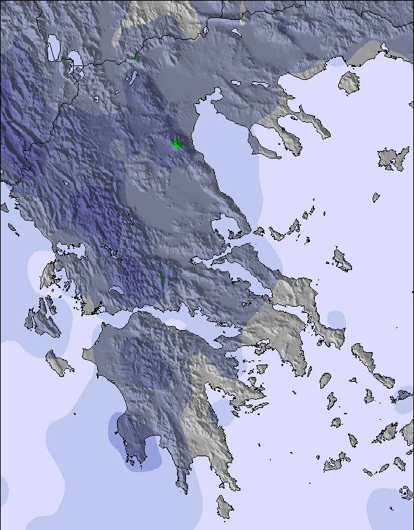
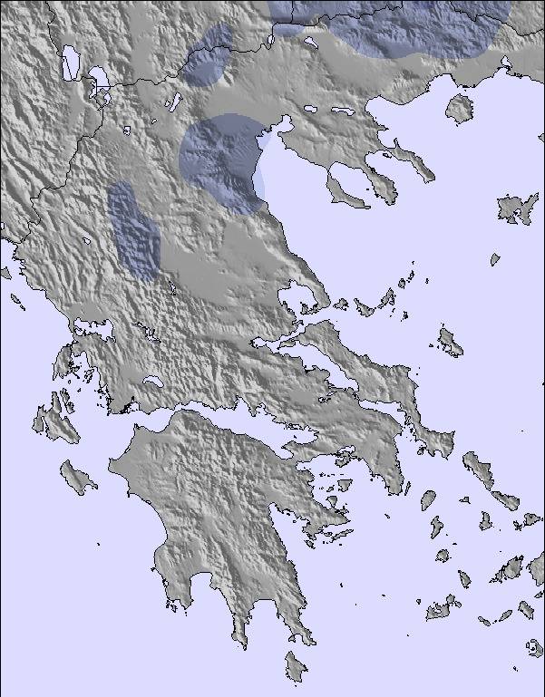
Snow map | 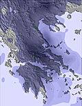 | 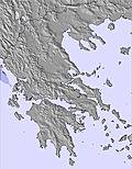 | 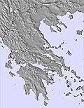 | 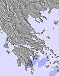 | 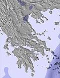 | 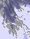 | ||||||||||||
— | — | — | — | — | — | — | — | — | — | — | — | — | — | — | — | — | — | |
mm | 1 | 2 | — | — | — | — | — | — | — | 1 | — | — | — | 2 | 3 | — | 2 | 2 |
max °C | 16 | 18 | 17 | 16 | 17 | 16 | 15 | 17 | 17 | 17 | 19 | 18 | 18 | 17 | 16 | 18 | 18 | 18 |
min °C | 15 | 17 | 15 | 14 | 17 | 14 | 14 | 17 | 16 | 16 | 18 | 16 | 17 | 15 | 15 | 15 | 18 | 16 |
chill °C | 14 | 16 | 14 | 13 | 16 | 13 | 12 | 16 | 15 | 15 | 18 | 16 | 17 | 15 | 15 | 15 | 18 | 16 |
Humid % | 77 | 67 | 60 | 75 | 64 | 68 | 64 | 52 | 58 | 65 | 56 | 47 | 47 | 68 | 61 | 66 | 60 | 63 |
Freeze m | 4000 | 4100 | 4200 | 4450 | 4400 | 4200 | 4050 | 3950 | 3950 | 4000 | 3950 | 3900 | 3950 | 3950 | 4200 | 4100 | 4150 | 4250 |
6:07 | — | — | 6:09 | — | — | 6:09 | — | — | 6:09 | — | — | 6:09 | — | — | 6:09 | — | — | |
— | — | 9:07 | — | — | 9:07 | — | — | 9:07 | — | — | 9:07 | — | — | 9:07 | — | — | 9:06 | |
Go pro and carve into:
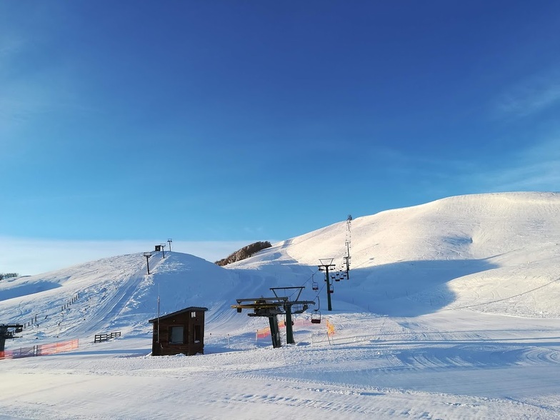
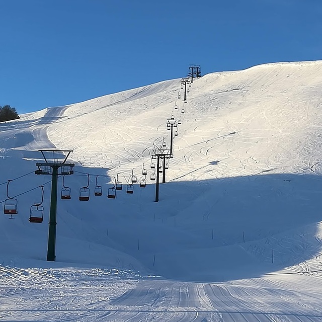
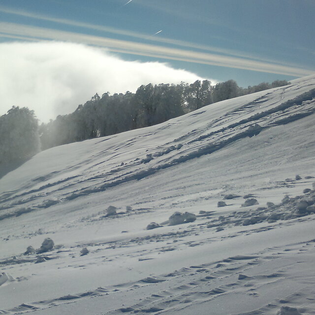
Latest snow reports near Anilio Ski Resort:
| Top snow depth: | — |
|---|---|
| Bottom snow depth: | — |
| Fresh snowfall depth: | — |
| Last snowfall: | 2 May 2026 |
| Snow Alerts | Create Alert |
0.0 | Bluebird Powder days Fresh snow, mostly sunny, light wind. |
|---|---|
0.0 | Powder days Fresh snow, limited sun, any wind. |
0.0 | Bluebird days Average snow, mostly sunny, light wind. |
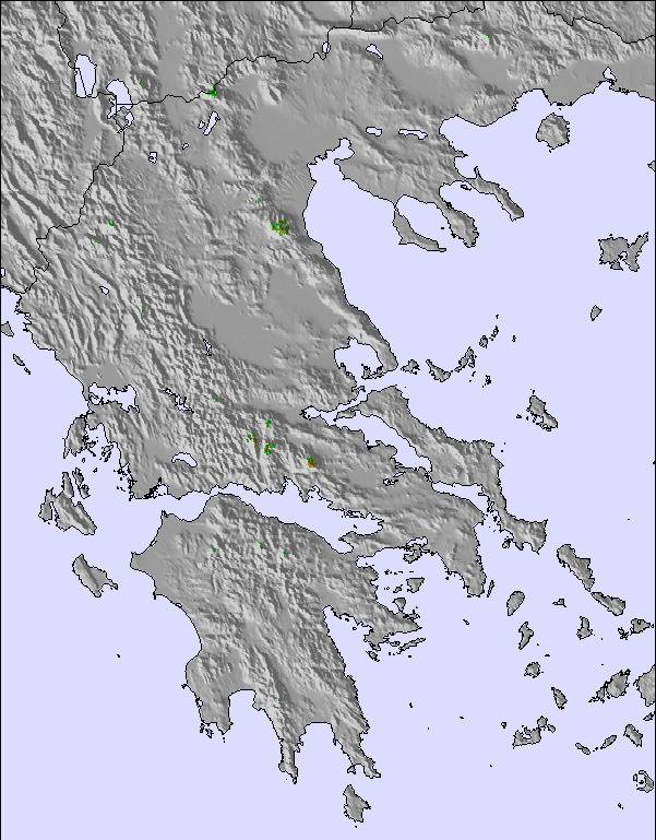
The above table gives the weather forecast for Anilio Ski Resort at the specific elevation of 1750 m. Our sophisticated weather models allow us to provide snow forecasts for the top, middle and bottom ski stations of Anilio Ski Resort. To access the weather forecasts for the other elevations, use the tab navigation above the table. For a wider view of the weather, check out the Weather Map of Greece.
Click here to read further information on freezing levels and how we forecast our temperatures.
Overall 4.4 Based on 4 votes and 1 review
ΛΟΙΠΟΝ! ΦΤΑΣΑΜΕ ΣΤΟ ΧΙΟΝΟΔΡΟΜΙΚΟ ΚΑΙ ΜΠΗΚΑΜΕ ΣΤΗΝ ΟΥΡΑ 10.30 ΚΑΙ ΠΑΡΑΛΆΒΑΜΕ ΕΞΟΠΛΙΣΜΟ ΣΤΙΣ 12. ΚΑΙ ΔΕΝ ΕΙΧΕ ΚΑΝ ΝΟΥΜΕΡΑ ΓΙΑ ΣΝΟΟΥΜΠΟΡΝΤ. ΚΑΙ ΑΝΑΓΚΑΣΤΗΚΑ ΝΑ ΠΑΡΩ ΠΕΔΙΛΑ ΤΟΥ ΣΚΙ ΚΑΙ ΔΕΝ ΜΠΟΡΟΥΣΑ ΝΑ ΚΑΤΕΒΩ , ΓΙΑΤΙ ΔΕΝ ΞΕΡΩ ΣΚΙ ΕΓΩ ΓΙΑ ΣΝΟΟΥΜΠΟΡΝΤ ΗΡΘΑ! ΓΙΑ ΝΑ ΜΗΝ ΣΧΟΛΙΑΣΩ ΚΑΝ ΠΟΣΟ ΒΑΡΕΤΕΣ ΗΤΑΝ ΟΙ ΠΙΣΤΕΣ. ΗΤΑΝ ΠΟΛΥ ΒΑΡΕΤΟ ΝΑ ΠΕΦΤΩ ΣΥΝΕΧΕΙΑ ΓΙΑΤΙ ΔΕΝ ΗΞΕΡΑ ΝΑ ΚΑΝΩ ΣΚΙ. ΔΕΝ ΕΙΧΑ ΠΡΟΛΑΒΕΙ ΚΑΝ ΝΑ ΔΩ ΚΑΠΟΙΟ ΤΟΥΤΟΡΙΑΛ. ΑΠΑΡΑΔΕΚΤΟΙ ΣΙΓΑ ΜΗΝ ΞΑΝΑΠΑΩ. ΤΗΝ ΕΠΟΜΕΝΗ ΜΟΝΟ ΕΛΚΥΘΡΟ!
ΜΑΡΚΕΛΑ ΖΟΤΑΙ from Greece writes:
ΛΟΙΠΟΝ! ΦΤΑΣΑΜΕ ΣΤΟ ΧΙΟΝΟΔΡΟΜΙΚΟ ΚΑΙ ΜΠΗΚΑΜΕ ΣΤΗΝ ΟΥΡΑ 10.30 ΚΑΙ ΠΑΡΑΛΆΒΑΜΕ ΕΞΟΠΛΙΣΜΟ ΣΤΙΣ 12. ΚΑΙ ΔΕΝ ΕΙΧΕ ΚΑΝ ΝΟΥΜΕΡΑ ΓΙΑ ΣΝΟΟΥΜΠΟΡΝΤ. ΚΑΙ ΑΝΑΓΚΑΣΤΗΚΑ ΝΑ ΠΑΡΩ ΠΕΔΙΛΑ ΤΟΥ ΣΚΙ ΚΑΙ ΔΕΝ ΜΠΟΡΟΥΣΑ ΝΑ ΚΑΤΕΒΩ , ΓΙΑΤΙ ΔΕΝ ΞΕΡΩ ΣΚΙ ΕΓΩ ΓΙΑ ΣΝΟΟΥΜΠΟΡΝΤ ΗΡΘΑ! ΓΙΑ ΝΑ ΜΗΝ ΣΧΟΛΙΑΣΩ ΚΑΝ ΠΟΣΟ ΒΑΡΕΤΕΣ ΗΤΑΝ ΟΙ ΠΙΣΤΕΣ. ΗΤΑΝ ΠΟΛΥ ΒΑΡΕΤΟ ΝΑ ΠΕΦΤΩ ΣΥΝΕΧΕΙΑ ΓΙΑΤΙ ΔΕΝ ΗΞΕΡΑ ΝΑ ΚΑΝΩ ΣΚΙ. ΔΕΝ ΕΙΧΑ ΠΡΟΛΑΒΕΙ ΚΑΝ ΝΑ ΔΩ ΚΑΠΟΙΟ ΤΟΥΤΟΡΙΑΛ. ΑΠΑΡΑΔΕΚΤΟΙ ΣΙΓΑ ΜΗΝ ΞΑΝΑΠΑΩ. ΤΗΝ ΕΠΟΜΕΝΗ ΜΟΝΟ ΕΛΚΥΘΡΟ!

 Nearest